10 Powerful Experiential Learning Activities to Transform Education in 2025
Discover 10 engaging experiential learning activities for K-12 and higher ed. Elevate learning with our actionable guide and immersive tools.
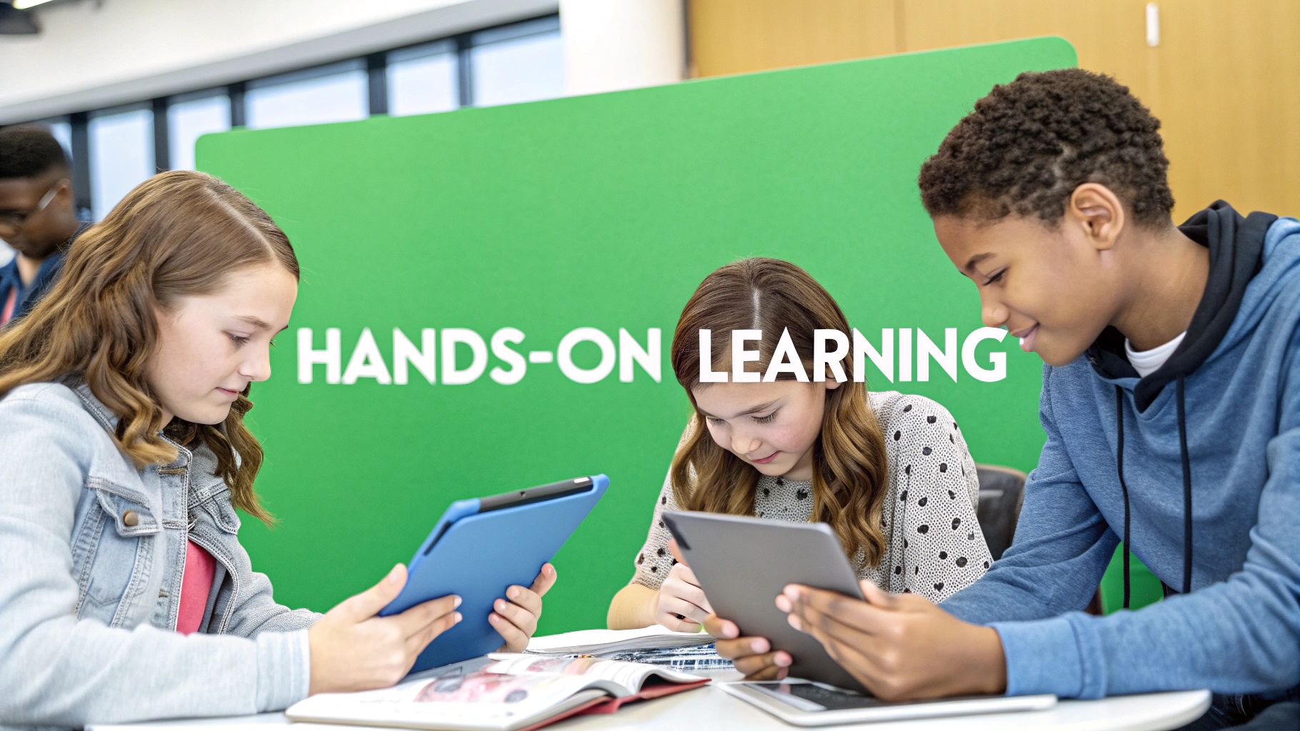
Forget dusty textbooks and rote memorization. The most effective learning happens when we roll up our sleeves and dive in. This is the core of experiential learning, a powerful approach that transforms students from passive recipients of information into active creators of knowledge. It’s a dynamic, hands-on process grounded in a proven framework: David Kolb's four-stage learning cycle. This model emphasizes a continuous loop of experiencing, reflecting, thinking, and acting, ensuring that learning is not just absorbed but deeply integrated.
This shift from passive to active learning is crucial for developing essential 21st-century skills. When students engage in well-designed experiential learning activities, they aren't just memorizing facts; they are building resilience, honing critical thinking, and mastering collaborative problem-solving. These are the adaptable skills required to navigate a complex, ever-changing world. To further explore the depth of this approach, consider examples of immersive travel experiences that go beyond the guidebook, which demonstrate how direct engagement can create profound understanding.
Fortunately, technology now makes these powerful learning methods more accessible than ever. Platforms like EarthChasers amplify the principles of experiential learning, allowing educators to create everything from virtual field trips and gamified geography quests to complex, data-driven problem scenarios. This article provides a curated collection of ten actionable experiential learning activities you can implement immediately. Each example includes learning objectives, step-by-step instructions, and specific ways to leverage technology to create unforgettable, high-impact educational experiences for any age group.
1. Gamified Geography Exploration
Gamified geography exploration transforms traditional map-based learning into an interactive, competitive experience. This method uses game mechanics like points, badges, and leaderboards to motivate learners as they discover real-world locations. Instead of passively studying maps, participants actively engage in challenges, making it one of the most dynamic experiential learning activities for knowledge retention.
This approach leverages the brain's natural reward system. By framing learning as a game, it increases engagement, encourages persistence through challenges, and provides immediate feedback on performance.
How It Works: A Strategic Breakdown
The core strategy is to apply game-like elements to educational content. For example, a platform might present a satellite image and challenge users to identify the city or landmark. Correct answers earn points, contributing to a daily or weekly leaderboard ranking. This competitive aspect, seen in apps like Duolingo or EarthChasers' Daily Hunt feature, fosters a desire to improve and return daily.
Key Insight: The power of gamification lies in its ability to create intrinsic motivation. Leaderboards provide social proof and competition, while badges and point systems offer a clear sense of progression and achievement.
Actionable Tips for Implementation
To successfully implement gamified exploration, consider the following tactics:
- Balance Competition and Cooperation: While leaderboards motivate many, they can discourage others. Introduce team-based challenges or collaborative goals to engage different learning styles.
- Vary the Challenges: Keep the content fresh by creating themed weeks (e.g., "National Parks Week" or "World Capitals Tour"). This prevents gameplay from becoming repetitive.
- Celebrate All Milestones: Publicly recognize more than just the top players. Acknowledge personal bests, improvement streaks, or participation milestones to keep everyone feeling valued and motivated.
- Use Data to Support Learners: Analyze leaderboard data to identify users who may be struggling. You can then provide them with targeted hints, resources, or easier challenges to help them build confidence and skills.
2. 3D Immersive Map Exploration
3D immersive map exploration transports learners from flat, two-dimensional maps into dynamic, photorealistic digital environments. This method allows users to virtually navigate and interact with 3D representations of real-world locations, providing crucial spatial context that static images cannot. By exploring terrain, cityscapes, and natural wonders from any angle, participants develop superior spatial reasoning and a deeper appreciation for geographical scale, making it one of the most powerful experiential learning activities available today.
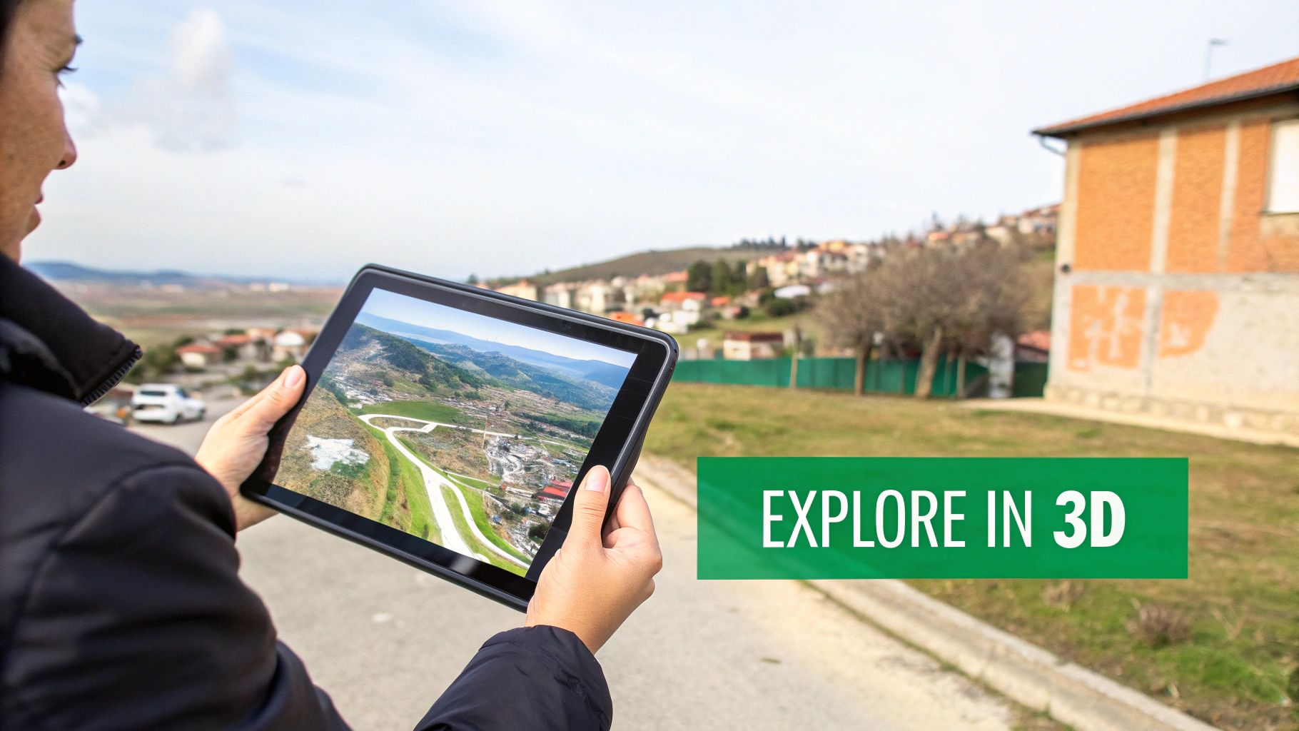
This approach bridges the gap between abstract concepts and tangible reality. Viewing a mountain range in 3D, for example, makes concepts like elevation, watersheds, and rain shadows intuitive and memorable. It transforms passive observation into active discovery.
How It Works: A Strategic Breakdown
The core strategy is to use high-fidelity 3D models to create a sense of presence and scale. Platforms like EarthChasers, which utilize Google's Photorealistic 3D Tiles, allow learners to "fly" through canyons, inspect architectural details on historic buildings, or trace a river from its source to the sea. This firsthand perspective fosters curiosity and allows for self-directed learning in a way that traditional atlases cannot.
Key Insight: The value of 3D exploration lies in its ability to make the abstract concrete. When learners can virtually "stand" at the base of a skyscraper or on a mountain peak, they gain an intuitive understanding of scale, perspective, and environmental context.
Actionable Tips for Implementation
To successfully integrate 3D immersive exploration, consider the following tactics:
- Provide Navigation Scaffolding: Begin with a brief tutorial on 3D controls (pan, zoom, tilt, street-level view). This ensures learners feel confident and can focus on the content rather than the interface.
- Connect Virtual to Reality: Start explorations in a familiar location, like the learner's own town or school. This creates an immediate connection before venturing to more remote or complex environments.
- Create Thematic Scavenger Hunts: Design goal-oriented tasks. For example, ask learners to find specific geological features in a national park or trace the historic path of an urban development project.
- Compare and Contrast Views: Encourage learners to toggle between 3D, 2D satellite, and street-level imagery. This helps them build a comprehensive mental model of a location by cross-referencing different data types.
3. Community-Created Custom Learning Modules
Community-created custom learning modules empower educators and enthusiasts to design personalized geography challenges and educational content. This method shifts the focus from passive consumption to active creation, allowing users to build lessons tailored to specific topics, regions, or skill levels. By enabling peer-to-peer content generation, it fosters a dynamic and collaborative learning ecosystem.
This approach is rooted in constructivist theory, where learners construct knowledge through experience. Creating a module requires deep understanding, turning learners into teachers and solidifying their own expertise in the process.
How It Works: A Strategic Breakdown
The core strategy is to provide users with tools to build and share their own learning experiences. Platforms like EarthChasers can offer a custom map functionality where a user can select a series of locations, write custom clues, and bundle them into a shareable challenge. This user-generated content model is also seen in Minecraft Education's custom worlds or Roblox Studio's developer-created experiences, where the community drives content diversity.
Key Insight: The power of user-generated content lies in its relevance and specificity. A local history teacher can create a module on the Civil War battlefields of their state, offering a level of niche detail that a one-size-fits-all curriculum cannot match.
Actionable Tips for Implementation
To successfully foster a community of creators, consider the following tactics:
- Provide Creator Templates: Offer pre-built templates for common learning scenarios, such as "Historical Landmark Tour" or "Biomes of a Continent," to lower the barrier to entry for new creators.
- Implement a Peer Review System: Allow users to rate and comment on custom modules. This provides valuable feedback for creators and helps other users identify high-quality content.
- Feature Outstanding Modules: Showcase the best community creations on a platform homepage or in a newsletter. This recognition motivates creators and highlights what is possible with the tools.
- Offer Creator Recognition: Award special badges, titles, or contributor status to users who consistently produce popular and effective learning modules. This builds a sense of community and rewards valuable contributions.
4. Real-World Problem-Based Learning Scenarios
Real-world problem-based learning (PBL) scenarios immerse participants in authentic geographical challenges that demand critical analysis, research, and innovative solutions. This method moves learning from theoretical concepts to practical application, showing learners how geographic information systems and spatial thinking are used to address pressing global issues. By tackling complex problems, participants engage in one of the most impactful experiential learning activities for developing higher-order thinking skills.
This approach grounds abstract knowledge in tangible contexts, fostering a deeper understanding of interconnected systems. Learners must synthesize data, consider multiple stakeholder perspectives, and justify their conclusions, mirroring the work of professionals in fields like urban planning, disaster management, and environmental science.
How It Works: A Strategic Breakdown
The core strategy is to present an open-ended, real-world problem that lacks a single correct answer. For example, a scenario in EarthChasers might task users with selecting an optimal location for a new wind farm, requiring them to analyze wind patterns, elevation data, proximity to infrastructure, and potential environmental impact. This contrasts with traditional learning by emphasizing the process of inquiry and solution-building over rote memorization of facts.
Key Insight: The effectiveness of PBL lies in its ability to cultivate agency and critical thinking. By removing the comfort of a single right answer, it forces learners to weigh trade-offs, defend their reasoning, and appreciate the complexity of real-world decision-making.
Actionable Tips for Implementation
To successfully implement problem-based learning scenarios, consider the following tactics:
- Ground Scenarios in Current Events: Connect challenges to relevant issues like climate change adaptation, supply chain disruptions, or humanitarian aid logistics to increase engagement and perceived relevance.
- Provide Scaffolding Resources: Equip learners with curated data sets, expert articles, and tools like an elevation finder or line of sight calculator to support their analysis without overwhelming them.
- Introduce Stakeholder Perspectives: Increase the complexity and realism by requiring learners to consider the conflicting needs of different groups, such as local communities, corporations, and government agencies.
- Allow for Multiple Valid Solutions: Encourage creativity and divergent thinking by designing problems where various well-reasoned solutions are possible. The focus should be on the quality of the analysis and justification, not a predetermined outcome.
5. Competitive Location-Based Trivia Challenges
Competitive location-based trivia challenges merge the thrill of a quiz show with the intellectual rigor of geography. This method uses timed questions and specific geographical contexts to transform passive fact memorization into an active, high-stakes recall experience. Participants don't just answer questions; they must do so quickly and accurately about specific places, making this one of the most exciting experiential learning activities for reinforcing geographic knowledge.
This dynamic format capitalizes on the power of friendly competition and time pressure to boost focus and memory. By connecting abstract trivia to real-world satellite imagery or maps, it creates stronger cognitive links between a place and its associated facts.
How It Works: A Strategic Breakdown
The core strategy is to anchor trivia questions to visual, geographic locations. For instance, a challenge might display a 3D view of the Eiffel Tower and ask, "What year was this landmark completed?" This format, seen in platforms like GeoGuessr, Sporcle, or the trivia rounds within EarthChasers’ Daily Hunt, requires players to synthesize visual data with stored knowledge under pressure.
Key Insight: The power of this format lies in its use of spatial context to make trivia more memorable. Answering a question about a place you are virtually "looking at" creates a much deeper learning impression than reading a plain text question.
Actionable Tips for Implementation
To successfully implement competitive location-based trivia, consider the following tactics:
- Balance Speed and Reflection: Mix rapid-fire identification questions with more complex, multi-step trivia that requires thought. This caters to both quick thinkers and deep processors.
- Provide Answer Explanations: After a question is answered, reveal not only the correct response but also a brief, interesting fact. This reinforces learning even when a player gets an answer wrong.
- Rotate Question Difficulty: Organize challenges with a mix of easy, medium, and hard questions. This prevents novices from becoming discouraged and keeps experts engaged.
- Use 3D Views for Reinforcement: After a correct answer, transition the map to a 3D or street-level view of the location. This visual reward provides powerful context and makes the learning more concrete.
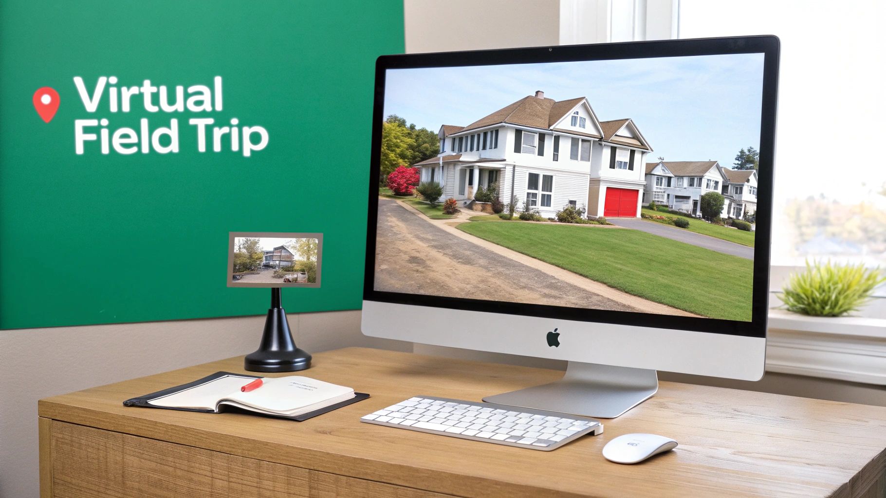
6. Virtual Field Trips and Guided Location Tours
Virtual field trips and guided location tours use immersive 3D environments to simulate the experience of traveling to geographical locations without physical travel. Expert guides or curated pathways direct learners through significant sites, providing historical context, geographical facts, and cultural insights. This democratizes access to remote and inaccessible locations, making it one of the most inclusive experiential learning activities available.
This approach leverages technology to break down physical and financial barriers to exploration. Instead of simply reading about the Amazon rainforest or the Louvre, participants can "walk" through these spaces, engage with multimedia content, and gain a spatial understanding that text alone cannot provide.
How It Works: A Strategic Breakdown
The core strategy is to create a guided, narrative-driven experience within a virtual space. Platforms like Google Arts & Culture and the Smithsonian Institution use high-resolution imagery and interactive hotspots to guide users through museums or historical sites. The guided nature ensures learners focus on key educational objectives rather than wandering aimlessly. For effective implementation, exploring the best tools for distance learning can provide educators with the right platforms to build or host these tours.
Key Insight: The power of virtual tours lies in their ability to provide contextualized learning. By embedding information directly into the environment, they connect abstract facts to a tangible place, significantly improving comprehension and retention.
Actionable Tips for Implementation
To successfully implement virtual field trips, consider the following tactics:
- Define Clear Learning Objectives: Before the tour, establish what students should learn. Create a worksheet or a set of questions that guide their exploration and focus their attention on specific details.
- Pair with Pre- and Post-Visit Activities: Build context before the virtual trip with readings or videos. Afterward, facilitate a discussion, debate, or creative project to help learners process and apply what they experienced.
- Incorporate Interactive Elements: Use platform features to embed quizzes, information hotspots, or short video clips at key locations. This transforms passive viewing into active engagement.
- Empower Student Creation: Challenge students to create their own guided tours of a location they have researched. This deepens their learning and develops presentation, research, and narrative design skills.
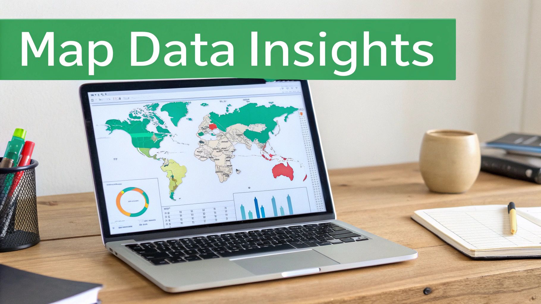
7. Data Analysis and Mapping Visualization Exercises
Data analysis and mapping visualization exercises teach learners to interpret geographical data, create meaningful visualizations, and communicate spatial relationships. Participants work with real datasets like climate, population, or economic figures and use mapping tools to uncover patterns, correlations, and anomalies. This process transforms abstract numbers into visual stories, making it one of the most powerful experiential learning activities for developing analytical and critical thinking skills.
This method moves beyond memorization by asking learners to become data detectives. By actively manipulating, mapping, and questioning datasets, they develop statistical literacy and a deeper, more nuanced understanding of how different variables interact across geographical spaces.
How It Works: A Strategic Breakdown
The core strategy is to connect raw data with its real-world geographical context through visualization. Learners might use tools like NOAA's Climate Visualizations or GIS software to map temperature anomalies over time, revealing global warming trends. Similarly, using EarthChasers’ Elevation Finder alongside population data can help students explore how topography influences settlement patterns.
The learning happens when students formulate a hypothesis, map the relevant data, and then analyze the resulting visualization to confirm or challenge their initial assumptions. This iterative process of questioning and discovery is what builds deep, lasting comprehension.
Key Insight: The power of this approach is in making data tangible. When learners see a cluster of high-poverty indicators on a map, it's no longer just a statistic; it's a real place with a story that demands investigation and understanding.
Actionable Tips for Implementation
To successfully implement data visualization exercises, consider the following tactics:
- Start with Single Variables: Begin with simple, single-variable datasets (e.g., mapping population density) before introducing more complex multivariate analysis, such as comparing density with elevation and access to water.
- Provide Real-World Context: Always connect data to relevant, real-world scenarios. Analyzing economic data is more meaningful when framed as a tool for understanding global trade or local development policies.
- Encourage Hypothesis Formation: Ask learners to predict what they think the data will show before they begin mapping. This encourages them to think critically and engages them more deeply in the discovery process.
- Teach Critical Evaluation: Guide students to question their data sources. Discuss potential biases, collection methods, and limitations to foster a sophisticated approach to data-driven arguments.
8. Peer-to-Peer Guided Exploration and Knowledge Sharing
Peer-to-peer guided exploration shifts the role of educator to the learners themselves, transforming them into experts who teach others. Students create guided tours, location guides, or challenge explanations for their peers, building confidence and deepening their own understanding through the act of teaching. This method creates an authentic audience and purpose for learning, making it one of the most empowering experiential learning activities.
This approach is rooted in the "protégé effect," where teaching information to others helps a person learn that information more thoroughly. By organizing and articulating knowledge for an audience, students reinforce their own learning and identify gaps in their understanding.
How It Works: A Strategic Breakdown
The core strategy is to structure opportunities for students to become creators and guides. For instance, a student who has mastered identifying geological features in a satellite imagery game might create a short video tutorial explaining their process. This content is then shared with the community, serving as a resource for others who are struggling with the same concept, much like community-created gaming guides or student-created Wikipedia entries.
Key Insight: The power of peer-to-peer teaching lies in its authenticity. Learners often connect more deeply with content created by a peer who speaks their language and has recently navigated the same challenges.
Actionable Tips for Implementation
To successfully implement peer-to-peer exploration, consider the following tactics:
- Establish Clear Guidelines: Provide rubrics or checklists defining what a high-quality guide or explanation looks like. This ensures consistency and sets a standard for all contributions.
- Structure Peer Review: Implement a formal peer-review process where students give and receive specific, criteria-based feedback on their guides before they are published for the wider group.
- Recognize Top Contributors: Create a system to celebrate helpful contributions. This could be a "Guide of the Week" feature, special badges, or a leaderboard for the most-viewed tutorials.
- Pair Mentors and Mentees: Intentionally pair experienced learners with novices. This creates a supportive learning relationship and ensures that new participants have a direct resource for help.
9. Route Planning and Logistics Problem-Solving
Route planning and logistics problem-solving challenges learners to find optimal paths by considering real-world geographical constraints like terrain, weather, and accessibility. Participants use digital mapping tools and data to navigate complex scenarios, transforming abstract concepts into practical exercises. This makes it one of the most effective experiential learning activities for developing critical thinking, spatial reasoning, and strategic planning skills.
This method forces a synthesis of data analysis and creative problem-solving. By grappling with variables like elevation, transportation networks, and time constraints, learners move beyond simple memorization and engage in higher-order thinking essential for real-world applications.
How It Works: A Strategic Breakdown
The core strategy involves presenting learners with a logistics-based problem that requires an optimized route as the solution. For instance, a challenge might involve planning a multi-day hiking expedition through a national park or designing a supply chain route for disaster relief. Using tools like EarthChasers' Elevation Finder and Line of Sight Calculator, students analyze terrain for viability, assess visibility between points, and justify their chosen path based on data.
Key Insight: The power of this activity lies in its ambiguity and trade-offs. There is often no single "correct" answer, forcing learners to weigh competing factors like speed, safety, cost, and efficiency, thereby mirroring real-world decision-making.
Actionable Tips for Implementation
To successfully implement route planning challenges, consider the following tactics:
- Introduce Constraints Gradually: Start with a simple point-to-point routing task before adding complexities like weather patterns, budget limits, or regulatory restrictions.
- Use Real-World Scenarios: Frame problems around relevant contexts, such as planning a humanitarian aid delivery, a scientific expedition, or a commercial transport route to enhance engagement.
- Compare and Contrast Solutions: Have teams present their final routes and justify their decisions. This fosters collaborative learning as groups discuss the various trade-offs each solution made.
- Incorporate Cost-Benefit Analysis: Require learners to include a budget or resource analysis in their final proposal. This adds a crucial layer of practical, real-world constraint to the problem-solving process.
10. Cross-Boundary Cultural and Environmental Comparison Studies
Cross-boundary comparison studies move learners beyond memorizing isolated facts by challenging them to analyze and synthesize information across different regions. Participants investigate geographical, cultural, and environmental characteristics side-by-side, uncovering deep connections and stark contrasts. This method transforms learners into global analysts, making it one of the most intellectually rigorous experiential learning activities for developing critical thinking and a nuanced worldview.
This approach builds empathy and systems thinking by forcing learners to ask why differences and similarities exist. It pushes them to connect factors like climate, economic development, and cultural practices into a cohesive, interconnected understanding of the world.
How It Works: A Strategic Breakdown
The core strategy is to use a comparative framework to reveal underlying patterns and relationships between places. Instead of studying a single country, learners might compare the environmental challenges of coastal cities like Venice, Italy, and Dhaka, Bangladesh. This requires them to analyze data from sources like Our World in Data or National Geographic to understand how factors like geography, economic status, and policy lead to different outcomes.
Key Insight: The power of comparative analysis lies in its ability to de-center a learner's perspective. By juxtaposing a familiar region with an unfamiliar one, it dismantles assumptions and builds a more sophisticated, evidence-based understanding of global dynamics.
Actionable Tips for Implementation
To successfully implement cross-boundary comparison studies, consider the following tactics:
- Provide Structured Templates: Guide the analysis using tools like Venn diagrams or comparison matrices. This helps learners organize complex information and focus on specific variables like population density, climate, and GDP per capita.
- Select Strategic Pairings: Choose locations that share some traits but differ in others (e.g., two rainforest regions, one in a developed nation and one in a developing one). This highlights the impact of specific variables like policy or economic resources.
- Encourage Deeper Inquiry: Push learners beyond simply identifying differences. Prompt them to investigate the historical, political, and social reasons behind those differences, encouraging them to find local perspectives.
- Incorporate Blind Spot Analysis: Conclude by asking what information is missing from the data. This teaches critical data literacy and helps students recognize that datasets from sources like the World Bank don't always capture the full human experience.
Experiential Learning Activities — 10-Point Comparison
| Approach | Implementation Complexity 🔄 | Resource Requirements ⚡ | Expected Outcomes 📊⭐ | Ideal Use Cases 💡 | Key Advantages ⭐ |
|---|---|---|---|---|---|
| Gamified Geography Exploration | Moderate — game design, balancing mechanics | Moderate — backend leaderboards, content updates | Increased engagement and retention; measurable participation gains | Daily micro-learning, motivation-driven classrooms, community events | Boosts motivation; instant feedback; scalable competitions |
| 3D Immersive Map Exploration | High — 3D rendering, optimization, UX for navigation | High — photorealistic data, bandwidth, device performance | Strong spatial reasoning and contextual understanding; deep visual learning | Virtual fieldwork, advanced spatial lessons, visual learners | Authentic context; rich terrain detail; immersive exploration |
| Community-Created Custom Learning Modules | Moderate — authoring tools + moderation workflows | Low–Moderate — content tools, community management | Diverse, localized content; higher platform engagement and relevance | Curriculum alignment, localized topics, teacher-created resources | Scalable content creation; cultural relevance; educator ownership |
| Real-World Problem-Based Learning Scenarios | High — scenario design, scaffolding, assessment design | High — expert input, data access, development time | Improved critical thinking, applied skills, intrinsic motivation | Project-based courses, interdisciplinary modules, higher education | Deep learning; real-world relevance; transferable problem-solving |
| Competitive Location-Based Trivia Challenges | Low–Moderate — Q&A systems, timing, fairness mechanics | Low — question DB, real-time scoring, leaderboards | Fast engagement and recall gains; high short-term participation | Warm-ups, large-scale events, casual learners | Highly engaging; easy to scale; quick measurable outcomes |
| Virtual Field Trips and Guided Location Tours | Moderate — curated pathways, narration, interactivity | Moderate–High — high-quality media, 3D assets, scripts | Increased access to remote sites; contextual and repeatable learning | Accessibility-focused lessons, cultural studies, trip prep | Democratizes access; curated learning journeys; repeat visits |
| Data Analysis and Mapping Visualization Exercises | High — data integration, analysis tools, pedagogy | High — datasets, GIS/tools, instructor expertise | Enhanced data literacy, analytical skills, pattern discovery | Upper-level courses, STEM integration, research projects | Teaches quantitative skills; meaningful visual insights |
| Peer-to-Peer Guided Exploration & Knowledge Sharing | Moderate — content tools, peer review systems | Low–Moderate — community features, moderation, recognition | Deeper understanding through teaching; improved communication | Mixed-skill classrooms, mentorship programs, collaborative projects | Builds agency; scalable peer teaching; diverse perspectives |
| Route Planning and Logistics Problem-Solving | High — constraint modeling, optimization scenarios | Moderate–High — routing tools, elevation and constraint data | Strong planning and optimization skills; applied decision-making | Transportation planning, disaster response drills, expeditions | Real-world decision practice; cross-disciplinary relevance |
| Cross-Boundary Cultural & Environmental Comparison Studies | High — multi-region data synthesis, careful framing | Moderate — diverse datasets, templates, facilitation | Systems thinking, empathy, comparative insights | Global studies, policy education, comparative geography | Reveals patterns across regions; fosters critical perspective |
Putting Learning on the Map: Your Next Steps
Throughout this guide, we have journeyed through a diverse landscape of ten powerful experiential learning activities. We've moved beyond theoretical discussions and into the practical, actionable steps that transform passive observation into active participation. The central theme connecting each example, from Gamified Geography Exploration to Cross-Boundary Cultural Studies, is a fundamental shift in how we approach education. Learning is not something to be merely consumed; it is an experience to be lived, a problem to be solved, and a world to be discovered.
The activities detailed, such as crafting Real-World Problem-Based Learning Scenarios and launching Competitive Location-Based Trivia Challenges, demonstrate that engagement is the key that unlocks deeper comprehension. When learners are placed in the driver's seat, tasked with navigating complex data, planning logistical routes, or collaborating on virtual field trips, the knowledge they gain becomes intrinsically linked to the actions they perform. This process forges stronger, more resilient neural pathways, ensuring that lessons are not just memorized for a test but are truly understood and retained for a lifetime.
Technology, particularly platforms like EarthChasers, acts as a powerful catalyst in this process. These tools are not simply digital novelties; they are sophisticated engines for inquiry. They provide the immersive 3D environments, the robust data sets, and the collaborative frameworks necessary to execute these dynamic experiential learning activities at scale, whether in a classroom, a corporate training session, or a home-schooling environment.
Key Takeaways for Implementing Experiential Learning
As you prepare to integrate these strategies, keep these core principles at the forefront of your planning. They represent the strategic foundation upon which the most effective learning experiences are built.
- Gamify for Engagement and Motivation: Integrating game mechanics like points, leaderboards, and challenges, as seen in the location-based trivia, taps into intrinsic human motivation. It transforms the learning process from a mandatory task into a compelling and enjoyable quest, boosting participation and knowledge retention.
- Use 3D Immersion for Unmatched Context: Abstract concepts become tangible when explored in a three-dimensional space. The ability to virtually "stand" in the Amazon rainforest or navigate the streets of Tokyo provides a level of spatial and contextual understanding that flat maps and textbooks can never replicate.
- Solve Real Problems for Authentic Application: The most profound learning occurs when knowledge is applied to solve authentic, real-world challenges. Activities like the data analysis and route planning exercises push learners beyond memorization, forcing them to think critically, strategize, and see the direct impact of their skills.
- Empower through Creation and Collaboration: Shifting learners from consumers to creators, as demonstrated in the Community-Created Learning Modules and Peer-to-Peer Guided Tours, fosters a deeper sense of ownership and mastery. This collaborative approach also builds essential soft skills like communication, teamwork, and leadership.
Ultimately, the power of these experiential learning activities lies in their ability to make learning personal, relevant, and memorable. They answer the age-old student question, "When will I ever use this?" by placing learners in scenarios where the application of knowledge is immediate and meaningful. By embracing this hands-on, inquiry-based approach, you are not just teaching facts; you are cultivating a new generation of curious explorers, critical thinkers, and lifelong problem-solvers. The journey of a thousand miles begins with a single step, and your journey into transformative education can begin today with one of these activities.
Ready to stop just reading about the world and start exploring it? EarthChasers provides the ultimate sandbox for implementing the very experiential learning activities discussed in this article. Launch your first virtual field trip or create a custom geography challenge today by visiting EarthChasers and discover a new dimension of interactive learning.