A Guide to Interactive 3D Maps and Digital Exploration
Explore the world of interactive 3D maps. This guide demystifies the technology, reveals real-world uses, and shows you how to get started.
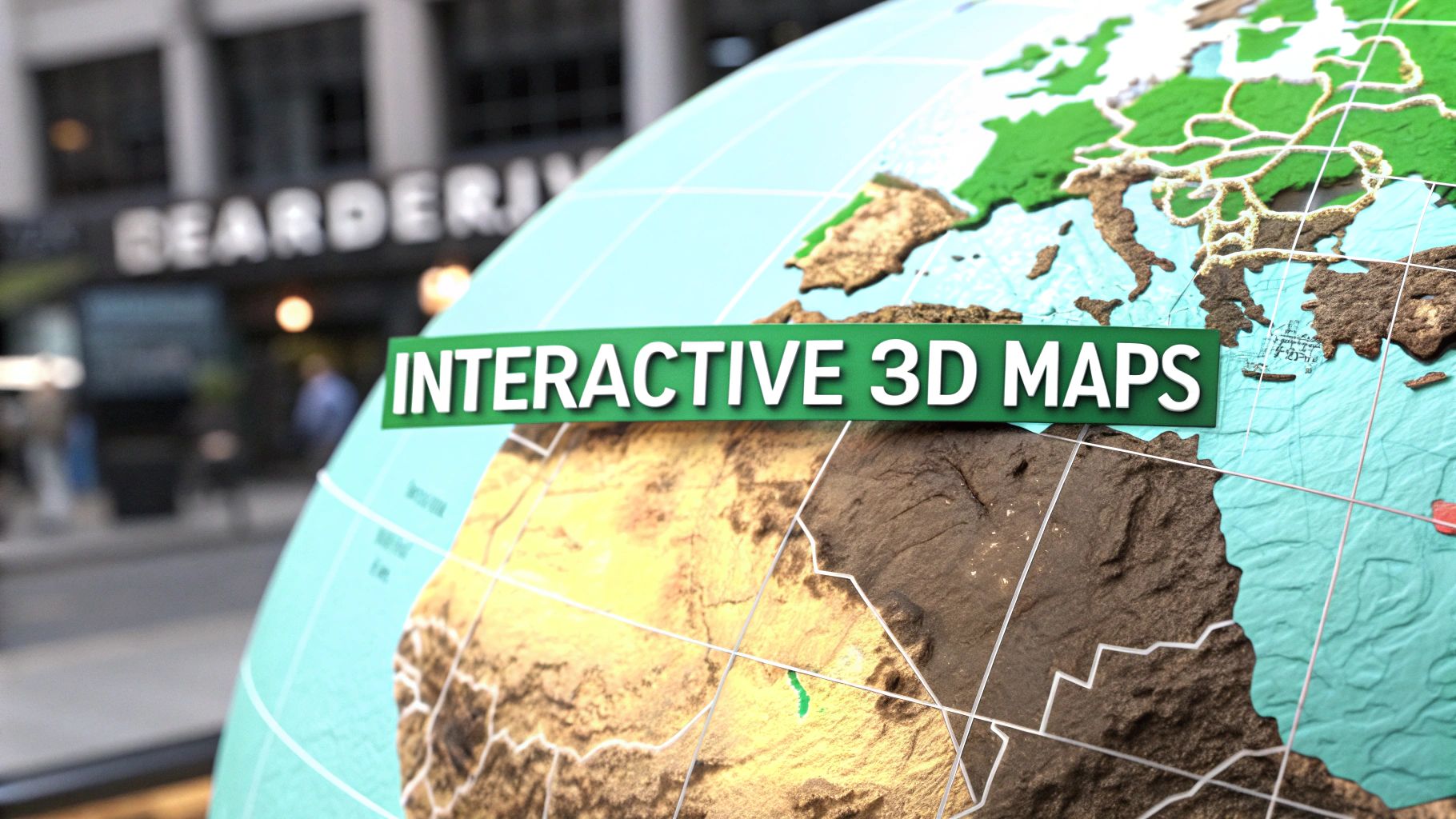
Tired of the flat, lifeless maps we tap at every day? Interactive 3D maps are the next step, turning digital navigation into a rich, three-dimensional world you can actually explore from your screen. It's the difference between looking at a blueprint and walking through the finished building.
Welcome to a New Dimension of Digital Maps
Think about the leap from a classic 2D cartoon to a modern animated film—that’s the kind of jump we're talking about. It’s a massive upgrade in depth, realism, and the power to tell a story. Interactive 3D maps are a similar evolution, moving past simple lines and labels to give us a digital twin of our world. They let you feel a location’s scale, see its terrain, and get a sense of its atmosphere in a way flat images just can't match.
This guide will walk you through this exciting shift, showing how it blends artistry with powerful tools to change everything from urban planning to how we play games. We’re no longer just looking at a map; we’re stepping inside it. This opens up a whole new world of engagement and understanding.
So, What Makes Them Different?
Unlike the static maps we’re used to, interactive 3D maps are living, breathing environments. This means you can:
- Change your perspective: Pan, zoom, and tilt your view to see a city skyline from a helicopter or explore a mountain trail from the ground.
- Interact with data layers: Click on buildings to pull up information, highlight specific routes, or see real-time data like traffic flow.
- Experience realistic environments: See the true height of mountains, the actual layout of city streets, and the textures of buildings, all of which add crucial context.
Here’s a simple way to think about it: A 2D map tells you where something is. An interactive 3D map helps you understand what it’s like to be there. That extra layer of context and immersion is a game-changer.
Throughout this guide, we'll dive into how platforms like EarthChasers are making this once-specialized technology available to everyone. By turning the entire globe into an interactive playground, they’re giving curious minds the tools to not just see the world, but to experience it in a completely new way. We'll cover the core tech, show you some practical applications, and get you started on your own journey of digital exploration.
Understanding the Technology Behind 3D Worlds
To really get what makes interactive 3D maps tick, we need to peek under the hood at the tech that brings these digital worlds to life. Don't worry, it’s less about scary lines of code and more about a few smart ideas working together. Each one has a specific job to create a smooth, immersive experience right in your browser.
The starting point for any realistic 3D map is often advanced 3D modeling techniques. This is how developers build everything from a single building to an entire cityscape with incredible detail. It's a field that's growing like crazy for a reason.
The global 3D mapping market is set to hit USD 16.78 billion by 2030. That growth is being fueled by huge demand in city planning and immersive navigation. North America is leading the charge, holding a 54.21% revenue share in 2025.
The Building Blocks of a 3D Map
So, how do these massive, detailed models get from a server to your screen without melting your computer? It all comes down to some clever solutions that manage data and rendering power. Think of it as a well-organized crew where each member is a specialist.
Here's a quick look at the core technologies and how they work together, using some simple analogies to make sense of it all.
Core Technologies of Interactive 3D Maps
A quick look at the key technologies and the role they play in creating immersive 3D map experiences.
| Technology | Its Role Explained (Simple Analogy) |
|---|---|
| Photorealistic 3D | This is the artistry. It’s about creating a "digital twin" of the real world—capturing buildings, terrain, and textures in stunning detail. Like a high-res 3D photograph of an entire city. |
| WebGL | This is the universal translator. WebGL lets your browser render complex 3D graphics without needing special software or plugins. It makes 3D maps accessible to everyone. |
| 3D Tiles | These are the smart puzzle pieces. Instead of loading an entire city at once, the map is broken into thousands of tiles. Your browser only loads the ones you’re looking at, keeping things fast. |
| Digital Elevation Models (DEM) | This is the invisible skeleton. A DEM provides the underlying height data that gives mountains their peaks and valleys their depth, creating realistic and accurate terrain. |
Each of these technologies plays a critical part. Photorealistic models provide the beauty, WebGL provides the power, tiles manage the data, and DEMs give the world its shape.
For a deeper dive into how elevation data is used, check out our guide on how Geographic Information Systems (GIS) work.
This diagram pulls it all together, showing how artistry and technology combine to let you explore.
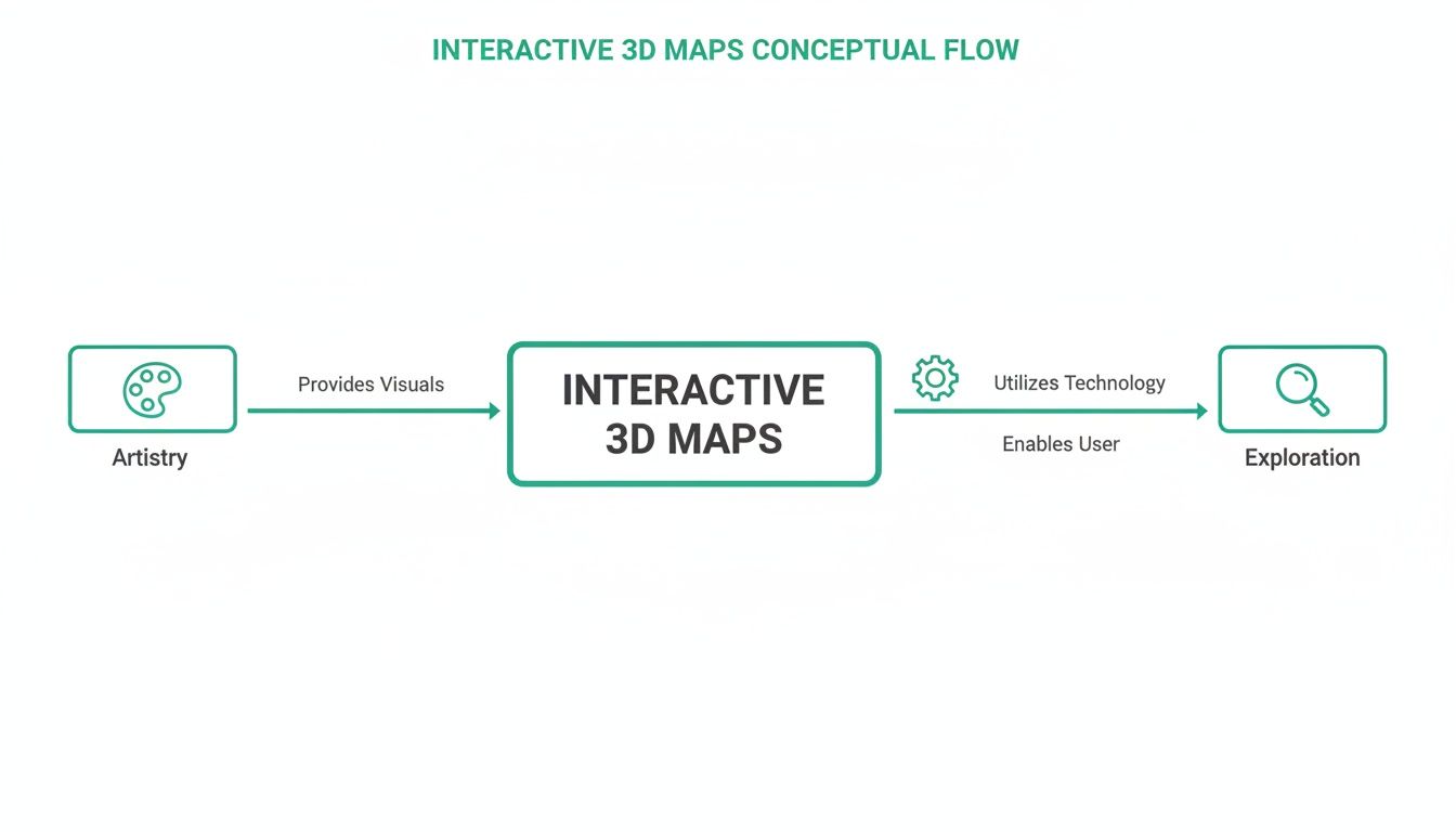
This flow—from creative modeling to your browser—is what makes it possible to explore these rich digital worlds without a hitch. It’s a seamless blend of art and engineering.
Where 3D Maps are Making a Real Difference
Interactive 3D maps are far more than just a cool way to look at the world—they're powerful, practical tools changing how entire industries operate. By adding true depth and context to geographic data, they solve stubborn problems and open up new possibilities in everything from city planning to education. It's a fundamental shift away from flat, static views toward immersive, functional digital environments.
And this isn't just a niche trend. The broader digital map market, which was valued at USD 31.7 billion in 2025, is on track to hit a staggering USD 84.5 billion by 2034. That explosive growth is being fueled by the real-world solutions these maps provide for industries that depend on geographic accuracy. You can dig into more of the data on this market growth at dimensionmarketresearch.com.
Let's break down where this transformation is happening.
Education and Virtual Exploration
In the classroom, interactive 3D maps are completely tearing down the walls. Imagine a history lesson where students can virtually walk through the Roman Colosseum, craning their necks to see the top arches and examining the architecture from any angle they choose. That kind of hands-on exploration makes learning stick in a way a picture in a textbook never could.
A geography class can suddenly come alive. Students can:
- Follow a river’s journey from a tiny mountain stream all the way to the sea, watching how the landscape changes.
- Fly over volcanic calderas or dive into deep ocean trenches to truly understand the scale of geological formations.
- Visualize historic battlefields in 3D to see why the high ground was so crucial for strategic advantage.
This flips the script from passive learning to an active journey of discovery.
Gaming and Entertainment
The gaming world was quick to see the potential of 3D maps for merging digital fun with the real world. Platforms like EarthChasers have turned the entire globe into a massive scavenger hunt, challenging players to pinpoint specific locations on photorealistic maps. It’s an experience that feels both like a game and a genuine exploration of our planet.
When you layer game mechanics over a realistic 3D model of Earth, something amazing happens. Players are motivated to explore, they learn about new places almost by accident, and they get rewarded for their geographic curiosity. The line between playing a game and exploring the world starts to blur.
This model also creates vibrant communities where players can build their own custom maps and quizzes, sharing their passion for geography with others.
Urban Planning and Outdoor Recreation
For professionals, interactive 3D maps are an analytical powerhouse. Urban planners can simulate the shadow a new skyscraper will cast throughout the year or model traffic patterns to spot future bottlenecks before a single brick is laid. This leads to smarter, more sustainable cities built on a foundation of accurate spatial data.
The benefits are just as tangible for outdoor enthusiasts. A hiker planning a trip can now use a 3D map to:
- Check the line of sight from a scenic viewpoint to see if the trail is worth the climb.
- Analyze a trail’s elevation profile to get a real feel for how strenuous it will be.
- Spot potential hazards like steep drop-offs or dense forests that aren't obvious on a flat map.
This level of detail makes planning safer, smarter, and way more effective. Whether you're building a city or just planning a weekend hike, interactive 3D maps provide the clarity needed to make much better decisions.
Bringing Global Exploration to Your Fingertips
All this tech is incredible, but the real magic happens when you can get your hands on it. That's where a platform like EarthChasers comes in, bridging the gap between powerful geospatial tools and our natural curiosity. It takes the idea of a 3D map from an abstract concept and turns it into a digital playground.
Instead of just showing you a static globe, EarthChasers invites you to jump into a global scavenger hunt, making geography feel less like a lecture and more like an adventure.
This isn't just a map; it's an invitation. The whole point is to dive right in and start exploring.
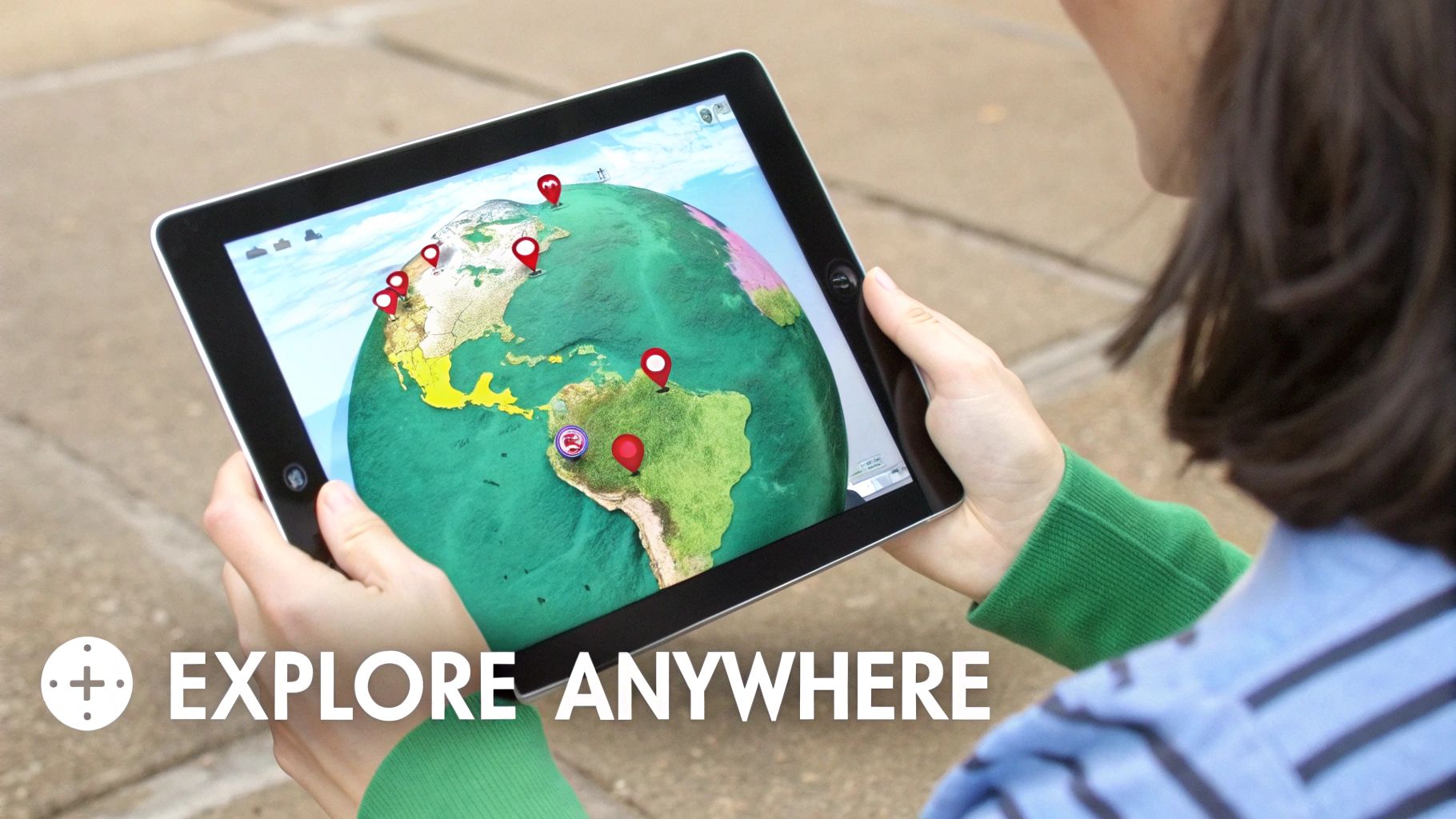
The image captures it perfectly—high-fidelity graphics with a clear, simple call to action: "EXPLORE ANYWHERE." It’s designed to be an easy entry point for anyone who wants to see the world differently.
Turning Discovery into a Game
Let's be honest, one of the best ways to get someone to explore is to make it a challenge. EarthChasers leans into this with a few game modes that transform geographical discovery into a fun, competitive experience.
- The Daily Hunt: Every day, there’s a new challenge. You get a few clues and have to race to find a specific spot on the 3D map.
- Weekly Leaderboards: A little friendly competition never hurt. You can see how your geography skills stack up against a global community.
- Community Maps: Users can build and share their own quizzes and location-based challenges, which fosters a pretty cool collaborative vibe among geography buffs.
This whole gamified approach is a genuinely smart way to learn. You can sharpen your geography knowledge and compete with friends—just check out the 3D geography game.
Professional Tools for Everyone
Beyond the games, what’s really compelling is the accessibility. Tools that were once locked away in expensive, professional software are now sitting right in your browser, totally free. You don't even need an account to get started.
The real breakthrough is democratizing access to powerful geospatial tools. When anyone can measure elevation for a hike or check a line of sight for a photography project, it empowers a new generation of creators, planners, and adventurers.
This has opened up a ton of uses. People are using these maps for everything from planning new hiking routes to spicing up trivia nights. In fact, by 2025, product marketing is expected to hold the largest revenue share in the 3D mapping market, as businesses use these interactive demos to showcase products. This trend connects directly to the rise of geography games, where things like leaderboards turn learning into a form of play.
For hobbyists, it’s a game-changer. Need to check an elevation for a school project or calculate sightlines for your next adventure? It's now just a few clicks away.
Some of the most practical free utilities include:
- Elevation Finder: Instantly find the elevation of any point on the globe. Perfect for hikers, cyclists, or just satisfying your curiosity.
- Line of Sight Calculator: See if two points have a clear, unobstructed view. It's invaluable for photographers, drone pilots, and even amateur radio operators.
- ZIP Code Radius Finder: Visualize a radius around a specific ZIP code. This is surprisingly handy for local marketing, event planning, or figuring out delivery zones.
These features transform a map from something you just look at into something you can actively use to solve real-world problems.
Getting Started with 3D Map Exploration
Ready to jump into the world of interactive 3D maps? The best part is, you don't need to be a GIS expert or a programmer anymore. This technology has moved out of the specialist's lab and into your web browser, inviting you to stop being a passive observer and start becoming an active explorer.
Let's break down how you can get started in a few simple, hands-on steps.
Embedded content
The first step? Just play. Seriously. Fire up a platform like EarthChasers and try one of the free game modes or mapping tools. A hands-on approach is the absolute fastest way to get a feel for navigation—panning around, zooming in, and tilting your view. You’ll quickly discover how intuitive it is to move through a digital twin of the real world.
Your First Steps into Exploration
Once you're comfortable zipping around the globe, you can start thinking about your own projects. Whether it's for a school assignment, planning the hike of a lifetime, or just satisfying your own curiosity, the process is surprisingly straightforward.
- Start with a Goal: What are you trying to figure out? Maybe you're looking for the most epic photo spot on a trail, creating a quiz for your friends, or visualizing a historical event. A clear goal is your compass.
- Use Free Tools: Start experimenting with utilities like an Elevation Finder or a Line of Sight Calculator. These tools offer instant, practical value and show you how 3D data can answer real-world questions you might have.
- Find Your Data: For a truly custom project, you might need specific information. Many government agencies and academic institutions, like the U.S. Geological Survey (USGS), offer incredible public datasets for free—everything from elevation models to geographic features.
The most important step is always the first one. Don't feel like you have to master everything at once. Just pick a place that sparks your curiosity—your hometown, a famous landmark, or a remote mountain range—and dive in. The insights will follow.
Bringing Your Own Map to Life
After you've spent some time exploring, you’ll probably get that creative itch to build something yourself. This is where the real fun begins. You can craft a map that tells a specific story, highlights your favorite points of interest, or challenges your friends with a custom game.
Modern platforms are making this easier than ever. For instance, you can use a custom map creator to build your own geographic quizzes and scavenger hunts in minutes. You don’t need to write a single line of code to start building engaging, interactive 3D experiences to share with the world.
This is the moment you transition from being a map user to a map maker, unlocking a whole new level of connection with the world around you.
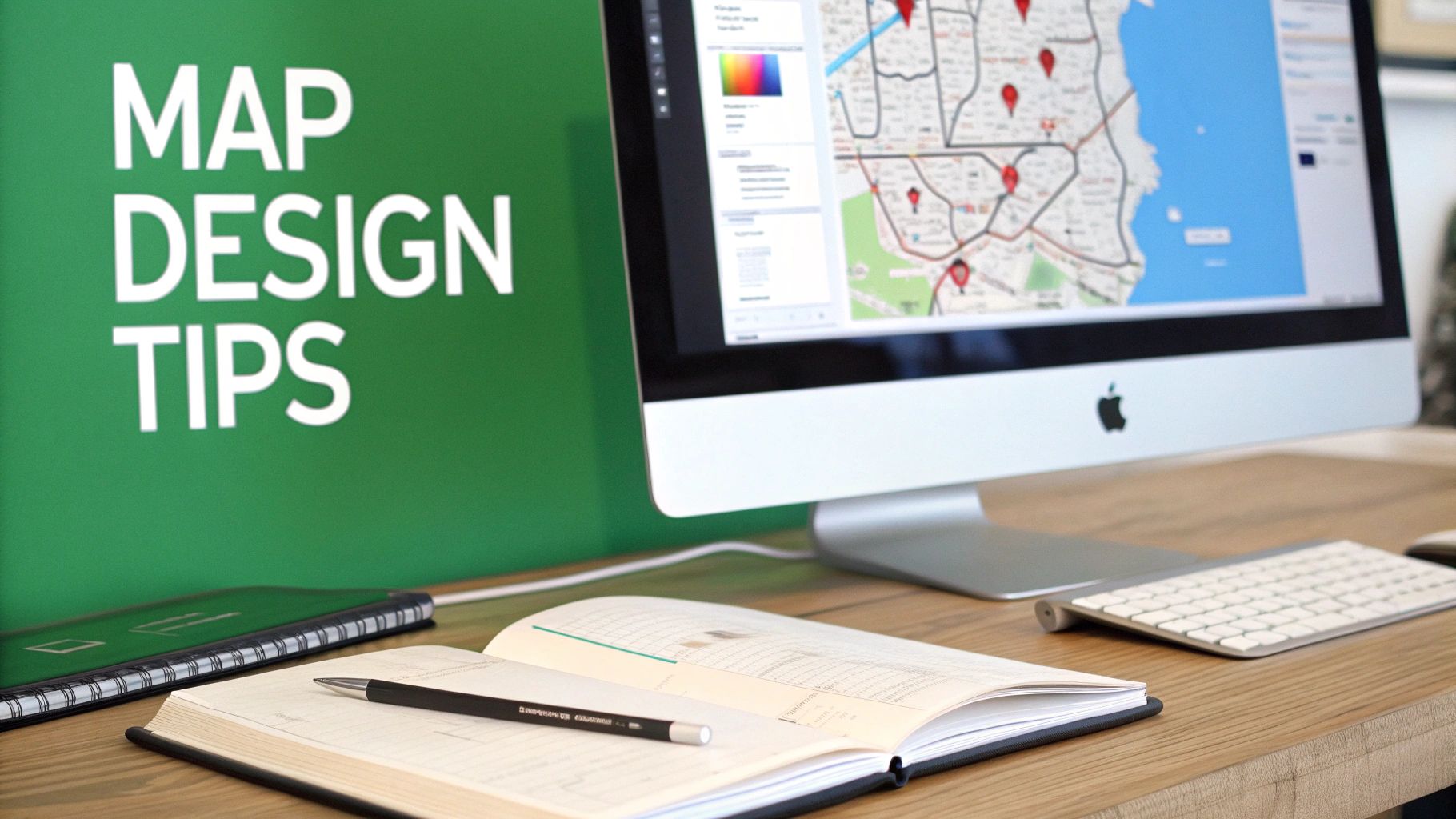
Best Practices for Engaging Map Design
Building a technically sound 3D map is just the first step. The real challenge? Creating an experience that actually pulls your audience in and keeps them there. A truly great map is more than just data—it’s a story, a tool, or an adventure waiting to unfold. The secret is to think about the user from the moment you start.
To craft an experience that people love, your design needs to feel both intuitive and purposeful. If you want to make sure your interactive 3D maps truly connect with users, exploring comprehensive UX design strategies is a must. This way of thinking shifts the focus away from just adding features and toward genuine, human-centered usability.
Core Principles for Better Maps
Every fantastic interactive 3D map shares a few common traits. Keep these four pillars in mind as you begin to build your own immersive worlds.
Tell a Clear Story: Every map needs a point. Guide your users along a clear path, whether you're showing a city's historical expansion or pointing out the key stops on a beautiful hiking trail.
Prioritize Performance: Nothing kills engagement faster than a laggy, slow-loading map. You absolutely have to optimize your 3D models and data to ensure a smooth ride, especially on mobile devices where over 60% of web traffic now happens.
Focus on Interactivity: Give people something to do! Add clickable points of interest, pop-up info boxes, and easy-to-use camera controls that invite them to explore, not just passively watch.
Provide Essential Context: Never assume your user already knows the area. Use clear labels for landmarks, a simple legend for your data layers, and a north arrow to help everyone get their bearings.
The ultimate goal is to remove friction. An effective interactive 3D map feels so natural to use that the technology becomes invisible, allowing the user to become fully immersed in the world you've built.
By sticking to these guidelines, you can create maps that are not only impressive to look at but are also genuinely useful and memorable.
Got Questions About 3D Maps? We’ve Got Answers.
Jumping into the world of 3D maps can spark a lot of questions. Even after covering the basics, a few things might still be on your mind. Let's tackle some of the most common ones to clear things up.
Do I Need Special Software to View Them?
Nope, not at all! The beauty of modern interactive 3D maps, including everything on EarthChasers, is that they are built with WebGL. This is just a fancy way of saying they run right inside your web browser—like Chrome, Firefox, or Safari—on your computer or phone.
There are no plugins to install or software to download. As long as your browser isn't ancient, you’re all set to start exploring incredible 3D worlds in seconds.
How Is the Data for Photorealistic Maps Collected?
The secret behind those stunningly realistic maps is a technique called photogrammetry. It’s a massive undertaking where fleets of airplanes and special camera-equipped vehicles capture countless high-resolution photos from every conceivable angle.
Think of it like building a digital sculpture out of thousands of photographs. Powerful software stitches all those overlapping images together, calculating depth and texture to reconstruct a detailed 3D model of the world, right down to the leaves on the trees.
Can I Use These Maps for My Own Projects?
Absolutely! Many platforms are designed for both personal and professional use. You could embed a 3D map on a real estate website to show off a property or create a virtual tour for a local business.
For school projects, tools like our free Elevation Finder or Line of Sight Calculator on EarthChasers can provide fantastic data for geography, science, or even history reports. Just make sure to glance at the terms of service for whichever platform you use to ensure your project is good to go.
Ready to stop reading and start exploring? With EarthChasers, you can jump into a global scavenger hunt or use professional-grade mapping tools for free. Begin your adventure at https://earthchasers.com.