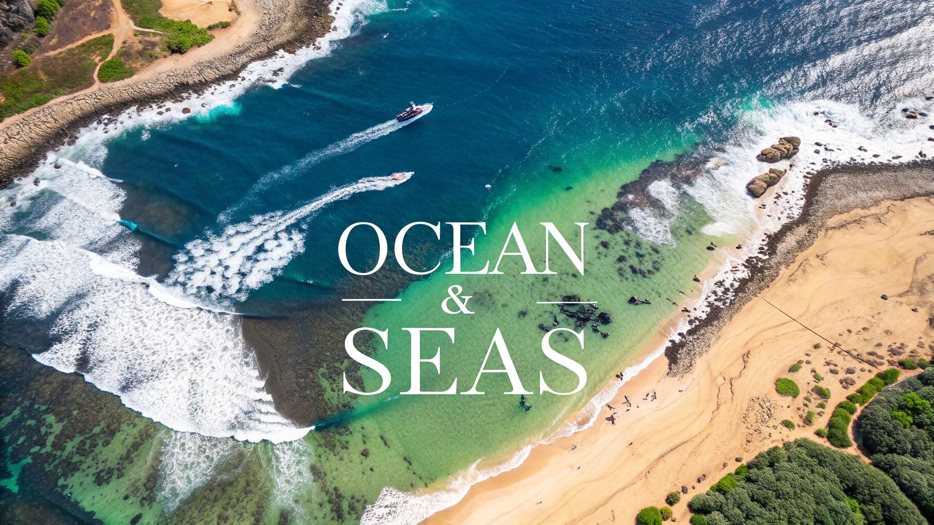
Discover the Ocean and Seas of the World: A Complete Guide
Explore the ocean and seas of the world with our comprehensive guide. Learn about Earth's vital waters, from the Pacific to the Arctic. Dive in now!
Ever wonder what it would be like to see our planet without continents? You'd be looking at one single, massive body of saltwater covering more than 70% of the Earth. This is our world ocean.
This guide will take you on a journey through this incredible, interconnected system. We'll dive into the unique personalities of the five major oceans and explore the character of the world's most important seas.
Mapping Our Planet's Aquatic Realms
To really get a feel for the ocean and seas of the world, it helps to stop thinking of them as separate. Instead, picture one global ocean.
For convenience, we divide this vast expanse using continents as borders, giving us five major basins: the Pacific, Atlantic, Indian, Southern, and Arctic. But these aren't just names on a map; they are dynamic, living systems that shape our world.
These waters drive global climate, hold an unbelievable amount of biodiversity, and have steered the course of human history for thousands of years. From the first seafaring explorers to modern global trade, our story is fundamentally tied to the ocean.
Understanding the Sheer Scale
The numbers are just staggering. Our world ocean covers roughly 71% of the Earth's surface—that's about 361 million square kilometers. Its average depth is a dizzying 3,688 meters (12,100 feet).
All told, these waters hold an estimated 1.335 billion cubic kilometers of water. It's a scale that’s almost impossible to wrap your head around.
This guide sets the stage for a deeper dive, framing the oceans not just as big puddles but as critical players in Earth's systems. You'll discover:
- The Five Major Oceans: We'll break down the defining features that make each one unique.
- Significant Global Seas: We'll explore key seas and their cultural and ecological roles.
- Role in EarthChasers: You'll see how this knowledge translates to navigating the world in our game.
By the end of this journey, you'll see the world map differently—not as land separated by water, but as a single, magnificent ocean dotted with continents.
This exploration will give you the context you need to appreciate the individual stories of each ocean and sea we cover. For younger adventurers, these concepts are a fantastic starting point. You can find even more amazing geography facts for kids to spark their curiosity.
Get ready to dive in
Meet the Planet's Five Mighty Oceans
To really get a feel for our planet's geography, you have to know its five massive oceans. Don't think of them as separate pools of water—they're more like the world's primary continents, just made of water. Each one has its own distinct climate, personality, and massive influence on how our world works.
This is where we go beyond just memorizing names on a map. We'll introduce the Pacific, Atlantic, Indian, Southern, and Arctic oceans by exploring what makes them unique. We're talking about everything from the Pacific's volatile volcanic 'Ring of Fire' to the Atlantic's powerful Gulf Stream, a current that literally shapes the weather for millions. Just as you can learn about the seven continents on land, understanding these watery realms is crucial for any geography enthusiast. You can even see how they stack up against the landmasses in our guide on what are the seven continents.
Getting a Sense of Scale
It's tough to wrap your head around just how enormous the oceans and seas of the world really are. The image below breaks down some of the key numbers, giving you a snapshot of their immense scale, depth, and complexity.
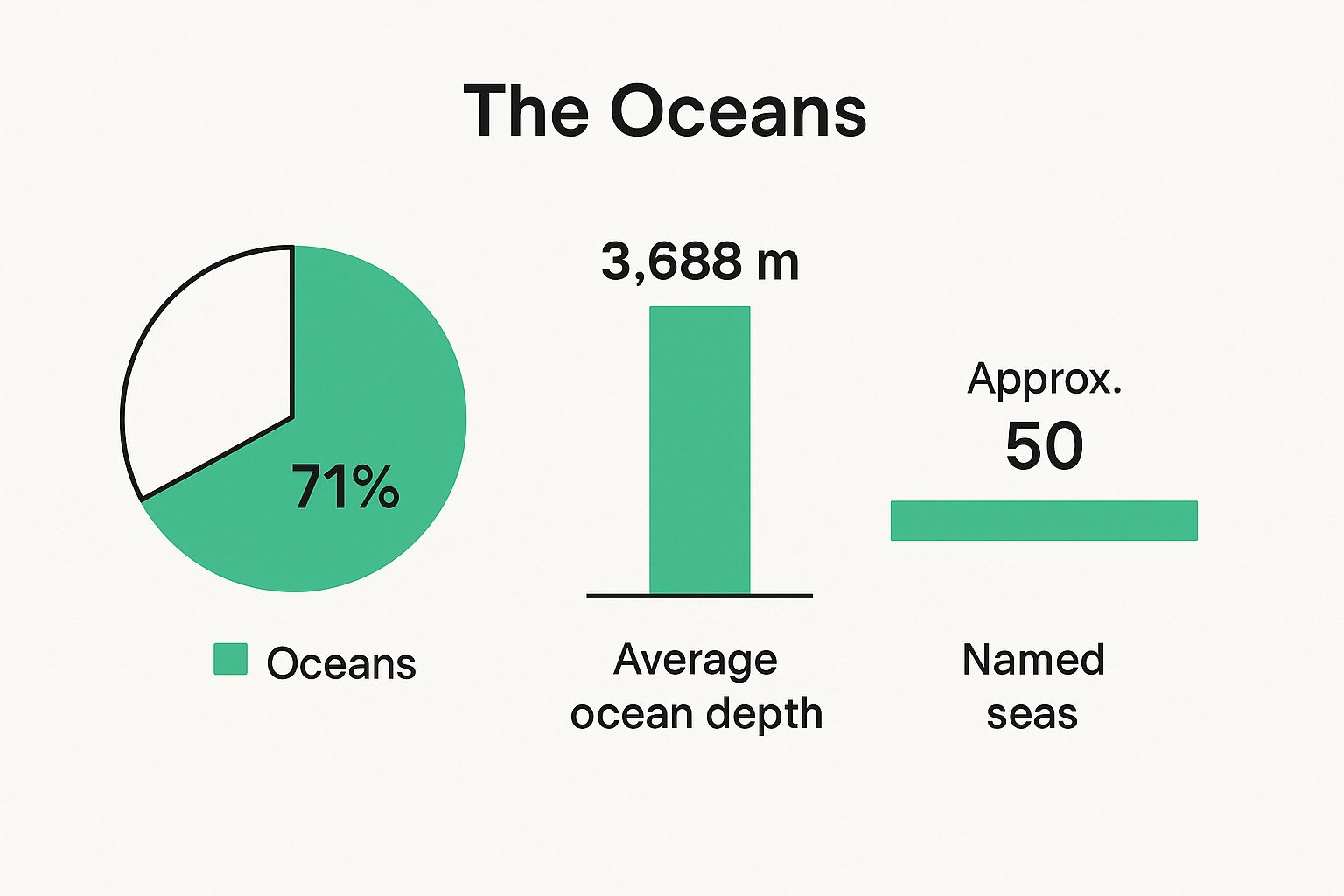
This visual drives home a powerful point: we live on a water world. Land is just the supporting actor here, taking up less than a third of the Earth's surface.
The World's Five Oceans at a Glance
To build a clear mental map, it helps to put the oceans side-by-side. They're all giants, but they differ wildly in size, depth, and character. For example, the Pacific Ocean is so big it could swallow every single landmass on Earth and still have room to spare.
The table below gives you a quick reference to grasp their sheer magnitude before we dive into each ocean's unique story. It’s a great way to compare the key stats that define these mighty bodies of water.
| Ocean | Area (sq km) | Average Depth (meters) | Deepest Point | Key Feature |
|---|---|---|---|---|
| Pacific | 165,250,000 | 4,280 | Mariana Trench | Largest and deepest; home to the "Ring of Fire" |
| Atlantic | 106,460,000 | 3,646 | Puerto Rico Trench | Second largest; bisected by the Mid-Atlantic Ridge |
| Indian | 73,556,000 | 3,741 | Java Trench | Warmest ocean; defined by powerful monsoon winds |
| Southern | 20,327,000 | 3,270 | South Sandwich Trench | Circles Antarctica; driven by the Antarctic Circumpolar Current |
| Arctic | 14,056,000 | 1,205 | Molloy Deep | Smallest and shallowest; mostly covered by sea ice |
This comparison sets the stage perfectly. Now, let’s get ready to journey into each ocean, uncovering the unique ecosystems, geological wonders, and history that make them so vital to our world—and to the adventures waiting in EarthChasers.
Discovering the Pacific and Atlantic Oceans
Our journey into the major oceans and seas of the world kicks off with the two undisputed titans: the Pacific and the Atlantic. These aren't just massive pools of water; they're the powerful engines driving our planet's geology, climate, and even history. First up, we’ll dive into the ocean of superlatives—a body of water so immense it makes everything else look small.
The Pacific Ocean: A World of Extremes
The Pacific Ocean is a masterclass in scale. It’s hard to wrap your head around just how big it is, covering roughly 30% of the Earth's surface. To put that in perspective, if you took all the planet's landmasses and squished them together, the Pacific would still have room to spare.
This incredible size creates a world of extremes. The Pacific is home to the deepest known point on Earth, the Mariana Trench, which plunges nearly 11,000 meters (36,000 feet) into the abyss. If you dropped Mount Everest into the trench, its peak would still be more than a kilometer underwater.
On top of that, the Pacific is sprinkled with an estimated 25,000 islands—more than all the other oceans combined—creating a vast network of unique ecosystems and cultures.
The Ring of Fire
The entire Pacific basin is defined by one of the most dramatic geological features on our planet: the Ring of Fire. This isn't a literal ring of flames, but a massive, horseshoe-shaped path where the planet's tectonic plates are constantly crashing into and grinding against each other.
All this geological friction makes it a hotbed of intense seismic and volcanic activity. Here’s what’s happening along this path:
- Volcanic Power: Around 75% of the world's active volcanoes are found along the Ring of Fire, forming a chain of mountains both above and below the sea.
- Seismic Activity: A staggering 90% of the world's earthquakes happen here, making it the most seismically active region on Earth.
- Constant Creation: This is where the Earth is literally remaking itself. One plate slides under another in a process called subduction, melting rock and fueling the volcanic chain above.
This geological drama has shaped the coastlines and cultures of countries from Japan to Chile, making the Pacific a place of both incredible beauty and immense power.
The Atlantic Ocean: Backbone of a Connected World
Now, let's shift our focus to the Atlantic Ocean. While it's the second-largest ocean, its influence on global trade, climate, and history is absolutely monumental. It’s younger and narrower than the Pacific, with a distinct 'S' shape that has served as a natural highway for exploration and commerce for centuries.
The Atlantic just feels more intimate than the sprawling Pacific. It connects Europe, Africa, and the Americas in a way that has profoundly shaped our modern world, and its currents are vital to life on both sides of its shores.
The Atlantic Ocean can be thought of as the world's circulatory system. Its currents, like the Gulf Stream, act like massive arteries, transporting heat and nutrients across the globe and regulating the climate for billions of people.
One of the most critical parts of this system is a powerful "river" flowing right within the ocean itself.
The Gulf Stream: A Climate Regulator
The Gulf Stream is a swift, powerful ocean current that carries warm water from the Gulf of Mexico all the way across the Atlantic. This isn't just a gentle flow; it's a massive conveyor belt of thermal energy.
This heat transfer has a profound impact on weather patterns. It's the main reason Western Europe—especially places like the United Kingdom and Ireland—enjoys a much milder climate than regions at similar latitudes in North America. Seriously, without the Gulf Stream, winters in London would feel a lot more like winters in Newfoundland.
This current is a perfect example of how the oceans and seas of the world are not static pools but dynamic systems that directly influence our daily lives.
The Mid-Atlantic Ridge
Deep beneath the Atlantic's surface lies another geological marvel: the Mid-Atlantic Ridge. This is a colossal underwater mountain range that snakes down the center of the ocean basin, part of the longest mountain range on the entire planet.
But this isn't just a static feature. It’s a divergent tectonic plate boundary—a place where the Eurasian and North American plates are actively pulling apart. As they separate, magma from the mantle rises to fill the gap, creating brand-new oceanic crust.
This process means the Atlantic Ocean is actually growing, widening by a few centimeters every year. It’s a slow but relentless process of creation, constantly reminding us that the Earth’s surface is always in motion, quietly redrawing the world map.
Exploring the Indian, Southern, and Arctic Oceans
Embedded content
Our global tour now takes us to three oceans defined by their distinct, and often extreme, environments. We’re leaving the familiar currents of the Pacific and Atlantic behind to venture into waters shaped by monsoons, colossal currents, and ice. This leg of our journey through the ocean and seas of the world will transport us from the warmest ocean on the planet to its coldest, most remote frontiers.
Our first stop is the Indian Ocean, a body of water that has served as a cradle of commerce and culture for millennia.
The Indian Ocean: The Monsoon Realm
The Indian Ocean is the third largest of the five, but it holds a unique title: it's the warmest ocean on the planet. Its geography—largely enclosed to the north by the massive Asian continent—gives it a personality dominated by one of the world's most powerful climate phenomena: the monsoon winds.
Twice a year, these seasonal winds completely reverse direction, dictating the climate and livelihoods of billions of people across the region. For centuries, sailors mastered these predictable wind patterns, creating bustling trade routes that connected Africa, the Middle East, India, and Southeast Asia long before Europeans arrived. This mastery turned the Indian Ocean into a historic hub of cultural and economic exchange.
The Southern Ocean: The Wild Frontier
Next, we head way down south to the planet’s newest and wildest ocean. Officially recognized by the International Hydrographic Organization in 2000, the Southern Ocean is unlike any other. Its identity isn't defined by the continents that box it in, but by a powerful force of nature that encircles an entire continent.
That force is the Antarctic Circumpolar Current (ACC). Picture a colossal river, wider than any on land, flowing endlessly around Antarctica without interruption. The ACC is the strongest ocean current on Earth, and it plays two critical roles:
- Insulating Antarctica: It acts as a massive thermal barrier, preventing warmer waters from reaching the frozen continent, which helps maintain its immense ice sheets.
- Driving Global Circulation: The current is a vital link between the Atlantic, Pacific, and Indian oceans, mixing their waters and driving the global "conveyor belt" of circulation that regulates temperature and nutrients worldwide.
The Southern Ocean is the untamed heart of the world's marine circulatory system. Its powerful current is the engine that keeps the entire global ocean in motion, making it fundamentally important to the planet's climate stability.
The ecosystem here is both fragile and incredibly rich. These nutrient-packed waters support vast populations of krill, which in turn feed an amazing array of wildlife—from massive blue whales and penguins to seals and seabirds. This makes the Southern Ocean a biodiversity hotspot of global importance.
The Arctic Ocean: The Frozen Crown
Finally, our journey takes us to the top of the world: the Arctic Ocean. It’s the smallest, shallowest, and coldest of the five oceans, a realm long defined by its most prominent feature—sea ice. For much of the year, a vast portion of its surface is frozen solid, creating a unique and unforgiving environment.
The Arctic's ecosystem is highly specialized, with life perfectly adapted to the ice. Polar bears hunt on the ice floes, seals use them to rest and breed, and unique species of algae bloom on their undersides, forming the very base of the food web. This frozen world isn't a barren wasteland; it's a vibrant, interconnected system.
But this frozen frontier is changing faster than anywhere else on Earth.
A Rapidly Transforming Frontier
The Arctic is at the epicenter of global climate change, warming at a rate several times faster than the global average. This is causing the sea ice to shrink and thin at an alarming rate, especially during the summer. This transformation has profound consequences that ripple far beyond the Arctic Circle.
- Rising Sea Levels: The melting of land-based ice, like the Greenland ice sheet which drains into the Arctic, contributes directly to a rise in global sea levels.
- Altered Weather Patterns: A warmer Arctic can disrupt the jet stream, leading to more extreme and unpredictable weather in North America, Europe, and Asia.
- New Shipping Routes: As the ice recedes, new shipping lanes like the Northwest Passage and the Northern Sea Route are opening up. This creates new economic opportunities but also introduces the risks of pollution and ecological disruption.
The rapid changes in the Arctic are a stark reminder of just how interconnected the ocean and seas of the world truly are. What happens at the planet's northernmost point directly impacts coastlines, climates, and communities thousands of miles away, highlighting the delicate balance of our global ocean system.
Charting the World's Major Seas
If oceans are the planet's superhighways, then seas are the busy regional roads that connect everything. So, what’s the difference? A sea is basically a large body of salt water partially boxed in by land. Think of them as massive, semi-enclosed extensions of their parent oceans, each with a unique personality shaped by local geography and climate.
Getting this distinction down is a big step toward mastering the ocean and seas of the world. Oceans separate continents, but seas forge distinct regional identities. Let's take a tour of the world’s most important seas and see what makes them such critical pieces of the global puzzle.
The Mediterranean Sea: The Cradle of History
Tucked between Europe, Africa, and Asia, the Mediterranean is more than just water—it’s the liquid heart of Western civilization. It connects to the massive Atlantic Ocean only through the tiny Strait of Gibraltar. Its famously calm, blue waters set the stage for ancient empires like the Greeks, Romans, and Phoenicians to rise and fall.
Its name, from the Latin mediterraneus, literally means "in the middle of the land," and that's exactly what it was: a crossroads of culture, trade, and ideas. The sea's predictable currents and close-knit coastlines made it the perfect incubator for early maritime trade and exploration, shaping the world we know today.
The Mediterranean isn't just a sea; it's a historical archive. Every island, coastline, and underwater ruin tells a story of trade, innovation, and empire that has echoed through millennia.
This legacy continues. The Mediterranean is still one of the world's busiest shipping lanes, linking Europe to Asia via the Suez Canal and serving as a vital artery for global commerce.
The Caribbean Sea: A Hotspot of Biodiversity
Flowing between North and South America, the vibrant Caribbean Sea is a tropical paradise connected to the Atlantic Ocean. Its warm, turquoise waters are the stuff of legends, but its real treasure is hidden just below the surface. The Caribbean is one of the planet's most critical hotspots for marine biodiversity.
It’s home to the Mesoamerican Barrier Reef System, the second-largest coral reef on Earth. This underwater metropolis supports a staggering array of life:
- Fish Species: Over 1,000 species of fish, from colorful parrotfish to majestic groupers, call these waters home.
- Marine Mammals: It’s a crucial habitat for manatees, dolphins, and several species of whales.
- Coral Formations: About 9% of the world's coral reefs are found here, creating intricate ecosystems for countless creatures.
The health of the sea is directly tied to the economies of the dozens of island nations that rely on it for tourism and fishing. It's also the birthplace of many hurricanes that sweep into North America, making it a major driver of regional weather patterns.
The South China Sea: A Point of Global Focus
Stretching from Singapore to the Strait of Taiwan, the South China Sea is a marginal sea of the Western Pacific. While it boasts incredible biological diversity, its modern identity is all about economic and strategic power.
An estimated one-third of all global shipping passes through these waters every year, carrying trillions of dollars in trade. That alone makes it one of the most important commercial waterways on the planet. On top of that, its seabed is believed to hold huge reserves of oil and natural gas, adding another layer of geopolitical tension.
The South China Sea's importance goes beyond economics. It’s a focal point of overlapping territorial claims by several nations, which keeps it in the international spotlight as a region of constant strategic maneuvering.
Other Notable Seas of the World
Beyond these three giants, countless other seas add to the rich tapestry of the ocean and seas of the world. Each one has its own story, ecosystem, and role in global affairs.
| Sea | Parent Ocean | Location | Defining Feature |
|---|---|---|---|
| Bering Sea | Pacific Ocean | Between Alaska & Russia | A highly productive fishery and a critical highway for migrating marine mammals. |
| North Sea | Atlantic Ocean | Between UK & Scandinavia | A major source of oil and gas for Europe and a historically vital maritime area. |
| Red Sea | Indian Ocean | Between Africa & Asia | Famed for its stunning coral reefs and extremely high salinity due to intense evaporation. |
| Black Sea | Atlantic Ocean | Eastern Europe & Asia | A unique meromictic basin, meaning its deep waters don't mix with the upper layers and are anoxic (lacking oxygen). |
From the icy expanse of the Bering Sea to the coral gardens of the Red Sea, these bodies of water prove that the world's aquatic geography is far more complex than just five great oceans. They are the local stages where the grand drama of climate, biology, and human history plays out.
Charting the Unseen Depths of Our Oceans
We've toured the familiar oceans and seas, the ones we see on every globe. Now, our journey pivots from the known to the great unknown. It's a staggering thought, but while we have stunningly detailed maps of Mars and the Moon, the vast majority of our own planet's seafloor remains one of Earth’s last great mysteries. We know more about the surface of other planets than we do about what lies beneath the waves.
This incredible gap in our knowledge represents a massive frontier for modern-day explorers. The simple truth? We’ve barely scratched the surface of what our oceans hold.
Peering into the Abyss
So, how do scientists actually chart these hidden depths? The go-to tool is sonar mapping. It works a lot like a bat’s echolocation. Ships send sound waves down to the seafloor and then listen for the echo. By measuring the time it takes for that sound to bounce back, they can build incredibly detailed three-dimensional maps of the underwater landscape.
And what this technology reveals is a world far more dramatic than a flat, sandy bottom. Sonar has uncovered:
- Massive underwater mountain ranges that absolutely dwarf the ones we see on land.
- Deep, yawning trenches where sunlight has never, ever reached.
- Hydrothermal vents that spew superheated, mineral-rich water straight from the Earth’s crust.
These maps are the crucial first step, giving explorers the "lay of the land" before they send in the big guns for a closer look.
Venturing into Uncharted Territory
Once a promising area is flagged on the sonar map, the real adventure begins. This is where remotely operated vehicles, or ROVs, come in. Think of them as high-tech, unoccupied submarines tethered to a ship, decked out with powerful cameras, lights, and robotic arms. They become the eyes and hands of the scientists on the surface, allowing them to explore environments far too hostile and crushing for any human diver.
It's through the cameras of these ROVs that we’ve witnessed alien-like landscapes and discovered thousands of new species that somehow thrive in complete darkness under unimaginable pressure. These finds completely rewrite our understanding of where—and how—life can exist.
The deep ocean is a constant source of wonder. Every single dive has the potential to reveal a new species, a new geological formation, or a new piece of the puzzle of how our planet works. It’s a powerful reminder that the age of exploration is far from over.
The scale of this unexplored realm is immense. As of June 2025, only about 27.3% of the world’s seafloor has been mapped using modern, high-resolution sonar. That leaves nearly three-quarters of the ocean floor as a massive blind spot on our map—a vast territory filled with who-knows-what. If you want to dive deeper, the National Oceanic and Atmospheric Administration has some fascinating ocean facts.
This ongoing mission reframes the ocean and seas of the world not just as blue patches on a map, but as a living, breathing frontier. It’s a profound reminder of how much we still have to learn about our planet’s watery heart, and hopefully, it inspires a new generation of explorers—perhaps even EarthChasers adventurers like you.
Common Questions About Oceans and Seas
To wrap things up, let's tackle a few of the most common questions that pop up about the world's oceans and seas. Think of this as a rapid-fire round to lock in the key concepts and add a few more interesting facts to your mental atlas.
What Is the Main Difference Between an Ocean and a Sea?
It really comes down to two things: scale and enclosure.
Oceans are the colossal bodies of saltwater that carve up continents—think of the immense Pacific. Seas, on the other hand, are smaller and usually partially hugged by land. They're often found where the edges of oceans and continents meet, like the Mediterranean Sea, which is a massive sea but still just a branch of the Atlantic.
Which Ocean Is the Saltiest?
While salinity can change depending on where you are, the Atlantic Ocean generally takes the crown for the saltiest of the big five. Why? A combination of a higher evaporation rate and the massive freshwater inflow from rivers creates conditions that give it a higher average salt concentration across its basin.
At its core, ocean geography is about connections. Understanding how oceans and seas are defined—whether by landmasses or by powerful currents—is key to seeing the world as one interconnected system.
How Are the Boundaries of the Oceans Defined?
For the most part, ocean boundaries are pretty straightforward—they’re drawn by the continents that frame them. Groups like the International Hydrographic Organization (IHO) work to get everyone on the same page with official definitions.
But sometimes, it's not land that draws the line. The Southern Ocean is a perfect example. Its northern boundary isn't a coastline but a powerful oceanographic feature: the Antarctic Circumpolar Current.
Why Is the Ocean Blue?
The ocean gets its famous blue hue because water is a natural filter for sunlight. It absorbs longer wavelengths of light (like reds and yellows) far more easily than it absorbs shorter, blue wavelengths.
That leftover blue light gets scattered and reflected back to our eyes. Of course, the reflection of the blue sky on a calm day definitely helps deepen that brilliant color we all recognize. If you’re hungry for more geographic know-how, diving into how to learn world geography is a fantastic next step.
Ready to put your newfound knowledge to the test? In the EarthChasers game, you can explore every ocean and sea mentioned in this guide. Start your global adventure today at https://earthchasers.com