The Ultimate Outline of Countries Quiz [2025 Edition]
Test your geography skills with our ultimate outline of countries quiz. Discover easy, medium, and hard challenges, plus printable resources and learning tips.
![The Ultimate Outline of Countries Quiz [2025 Edition]](https://cdn.outrank.so/6b33a22e-afe6-4bf6-bc20-09c230996607/baf32f85-849e-4368-88d1-bbcbd337db64/outline-of-countries-quiz-geography-study-materials.jpg)
Recognizing a country from its outline alone is a classic test of geographical knowledge, separating casual map-glancers from true geography enthusiasts. This guide is more than just a list of questions; it's a complete, ready-to-use outline of countries quiz designed to challenge you, teach you, and provide the tools to master the world map. We've structured this quiz into three distinct difficulty levels: Beginner, Intermediate, and Expert, each featuring high-quality images of country silhouettes.
Following each quiz section, you'll find a detailed answer key and practical tips to improve your shape recognition skills. Whether you're a student preparing for an exam, a teacher looking for engaging classroom resources, or a trivia buff eager for a new challenge, you'll find everything you need right here.
We will provide you with a full, playable quiz directly on this page, complete with answer keys and learning strategies. Additionally, we'll guide you to the best platforms for practicing this skill, including Sporcle, Seterra, and Worldle. You will also see how innovative tools like EarthChasers can transform this simple challenge into an immersive 3D adventure, helping you connect country shapes to their real-world locations. Let’s begin.
1. EarthChasers
EarthChasers transforms the standard outline of countries quiz into an immersive, three-dimensional adventure. Leveraging Google Maps' photorealistic 3D engine, this platform moves beyond static images, allowing users to explore countries from dynamic, real-world perspectives. It stands out by integrating gameplay with powerful mapping utilities, making it an exceptional resource for students, trivia enthusiasts, and geography lovers alike.
The platform offers a robust and engaging experience that solidifies its position as a top-tier choice. Its core strength is the seamless blend of education and entertainment, turning a simple quiz into a memorable virtual journey.
Key Strengths and Features
EarthChasers excels with a multi-faceted approach to geographic learning. While it features a dedicated "Countries" game mode perfect for outline recognition, its value extends much further.
- Photorealistic 3D Gameplay: Instead of just showing a 2D outline, EarthChasers drops you into a photorealistic 3D view of the country. This provides rich context, helping you recognize a nation not just by its shape but by its iconic landmarks, topography, and coastlines.
- Multiple Game Modes: Beyond the country-specific challenges, modes like "Daily Hunt" and "Cities" keep the content fresh. This variety ensures high replayability and helps users build a more holistic understanding of world geography.
- Community and Competition: Daily challenges and weekly leaderboards foster a vibrant sense of community and friendly competition. This gamified structure motivates consistent engagement and learning.
- Free Professional Tools: Uniquely, the platform includes a suite of powerful, no-account-required utilities like an Elevation Finder and a Line of Sight Calculator. These tools add a layer of practical, real-world application for educators, hikers, and planners.
Expert Tip: Use the 3D exploration feature to your advantage. Before starting a quiz, take a few minutes to virtually "fly over" a continent. This helps build spatial memory, making it easier to identify countries by their shape and geographic neighbors during the quiz.
User Experience and Accessibility
The interface is clean and intuitive, designed for both quick gameplay sessions and deeper exploration. Because it operates on Google Maps 3D, performance is generally smooth, though users with slower connections or older browsers might experience longer load times. The core gaming and tool features are completely free and accessible without an account, removing barriers for casual users and classrooms. While a "Pro" tier is mentioned, its features and pricing are not detailed on the site, leaving some ambiguity for power users.
| Feature Analysis | Description |
|---|---|
| Quiz Format | Interactive 3D identification, not just static 2D outlines. |
| Content Variety | Countries, cities, natural wonders, and community-created maps. |
| Accessibility | Free to play; no account required for core features. |
| Unique Offering | Integrated professional-grade mapping tools for deeper analysis. |
Website: EarthChasers.com
2. Sporcle
Sporcle is a trivia giant, and its massive, user-driven library is its greatest strength. While it offers quizzes on every topic imaginable, its geography section is a treasure trove for anyone looking for an outline of countries quiz. The platform thrives on variety; you can find quizzes that challenge you to identify all the countries of Africa by their shape, timed silhouette speed-runs, or even "click the country" map challenges that progressively reveal more of a continent. This sheer volume means there's a quiz for every skill level and specific learning goal.
What truly sets Sporcle apart is its community and structured learning tools. With a free account, you can track your progress, earn badges, and even create your own quizzes to share. For those seeking a more guided experience, Sporcle's "Lessons" mode provides a curriculum-style approach, combining articles and videos with targeted quizzes to build knowledge methodically. For a deeper dive into how to leverage these features for study, you can explore our guide to Sporcle's geography quizzes for practical tips.
Key Features and Usage Tips
The platform’s user-friendly interface makes it easy to jump right in. Gameplay is typically fast-paced, with a timer adding an element of pressure that helps build quick recall skills.
- Best For: Variety seekers and those who enjoy a competitive, game-like atmosphere with leaderboards and stats.
- Practical Tip: Use the search filters to find specific types of outline quizzes. Search for terms like "silhouette," "shape," or "outline" combined with a continent or "world" to narrow down the vast selection.
- Access: Sporcle is free to use with ads. An optional "Sporcle Orange" subscription ($4.99/month or $49.99/year) removes ads and unlocks advanced features, including full access to the Lessons library and enhanced stat tracking.
Sporcle's community-generated content ensures a constant stream of new and creative outline quizzes, making it a dynamic resource that never gets stale.
Website: https://www.sporcle.com
3. JetPunk
JetPunk is celebrated in the trivia community for its fast, no-frills interface, making it a powerhouse for rapid-fire drills. While offering a broad range of quizzes, its geography section is particularly strong for anyone seeking an outline of countries quiz designed for repetition and speed. The platform features dedicated "Country Shape" quizzes and comprehensive "Every Country by its Shape" challenges. This focus on streamlined gameplay allows users to quickly benchmark their knowledge and engage in quick, effective practice sessions without unnecessary clicks or animations.
What makes JetPunk a standout choice is its emphasis on user statistics and performance tracking. For every quiz, you can see your previous scores, how you compare to the average, and a graph of your progress over time. This data-driven approach transforms a simple guessing game into a measurable training tool, allowing you to see tangible improvement in your recall speed and accuracy. The clean, minimalist design keeps the focus squarely on the quiz itself, which is ideal for learners who prefer practice over presentation.
Key Features and Usage Tips
The platform’s quiz flow is built for efficiency; you simply start typing a country's name, and it autofills if correct, letting you move to the next outline almost instantly. This rapid feedback loop is excellent for building muscle memory.
- Best For: Users who want to track their progress with detailed stats and prefer fast-paced, repeatable drills for memorization.
- Practical Tip: After completing a quiz, review the stats page. It shows which countries you answered correctly and which you missed, helping you identify specific shapes you need to study more.
- Access: JetPunk is free to use with ads. A JetPunk Premium subscription ($3/month or $24/year) removes all ads and unlocks advanced analytics for quiz creators.
JetPunk’s streamlined design and robust statistical feedback make it an exceptional tool for anyone serious about mastering country outlines through consistent practice.
Website: https://www.jetpunk.com
4. Seterra (online.seterra.com)
Seterra is a purpose-built geography quiz platform that excels in teaching the locations and shapes of countries, states, and regions. Its approach is less about trivia and more about cartographic mastery. If your goal is specifically to learn how to identify countries by their shape, Seterra’s focused design makes it a premier educational tool. It offers hundreds of map quizzes where the core mechanic is to click on the correct location or identify the highlighted outline of countries quiz style. The platform’s clean, zoomable maps and clear outlines are ideal for detailed study and recognition practice.
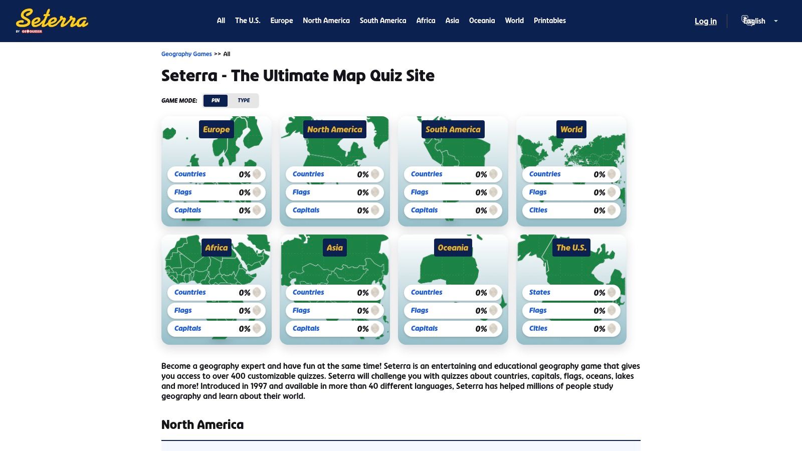
What makes Seterra stand out is its dedicated "Learn Mode," which allows you to study the map at your own pace before taking a timed quiz. This methodical approach is perfect for building foundational knowledge from scratch. The platform's extensive library covers everything from world countries to specific regional details, like the states of India or the mountains of Europe. For those interested in mastering a specific continent, you can deepen your knowledge with our Asia geography quiz guide, which complements Seterra's learning style.
Key Features and Usage Tips
The gameplay is straightforward: the quiz asks you to find a country, and you click on its outline on the map. This direct interaction helps reinforce visual memory more effectively than text-based quizzes.
- Best For: Students, educators, and anyone seeking a structured, curriculum-like approach to learning world geography and country shapes.
- Practical Tip: Start with a continent in "Learn Mode." Click on each country to see its name, then switch to the timed "Pin" mode to test your speed and accuracy. Repeat this process until you achieve a high score.
- Access: The website is free with ads. Seterra also offers a paid, ad-free mobile app for iOS that works offline, making it a fantastic resource for classroom use or travel without an internet connection. Note that features can differ slightly between the web and app versions.
Seterra’s singular focus on map-based learning makes it one of the most effective tools for anyone serious about mastering the outline of countries quiz.
Website: https://online.seterra.com
5. Lizard Point Geography
Lizard Point Geography is a veteran in the online learning space, offering a straightforward, education-focused platform that excels at teaching country locations and shapes. Its strength lies in its simplicity and direct approach to learning. The quizzes are designed as interactive map challenges where you click on the correct country outline, making it an ideal tool for reinforcing visual recognition. Instead of flashy game mechanics, Lizard Point prioritizes foundational knowledge, offering a clean and effective outline of countries quiz experience suitable for both students and self-learners.
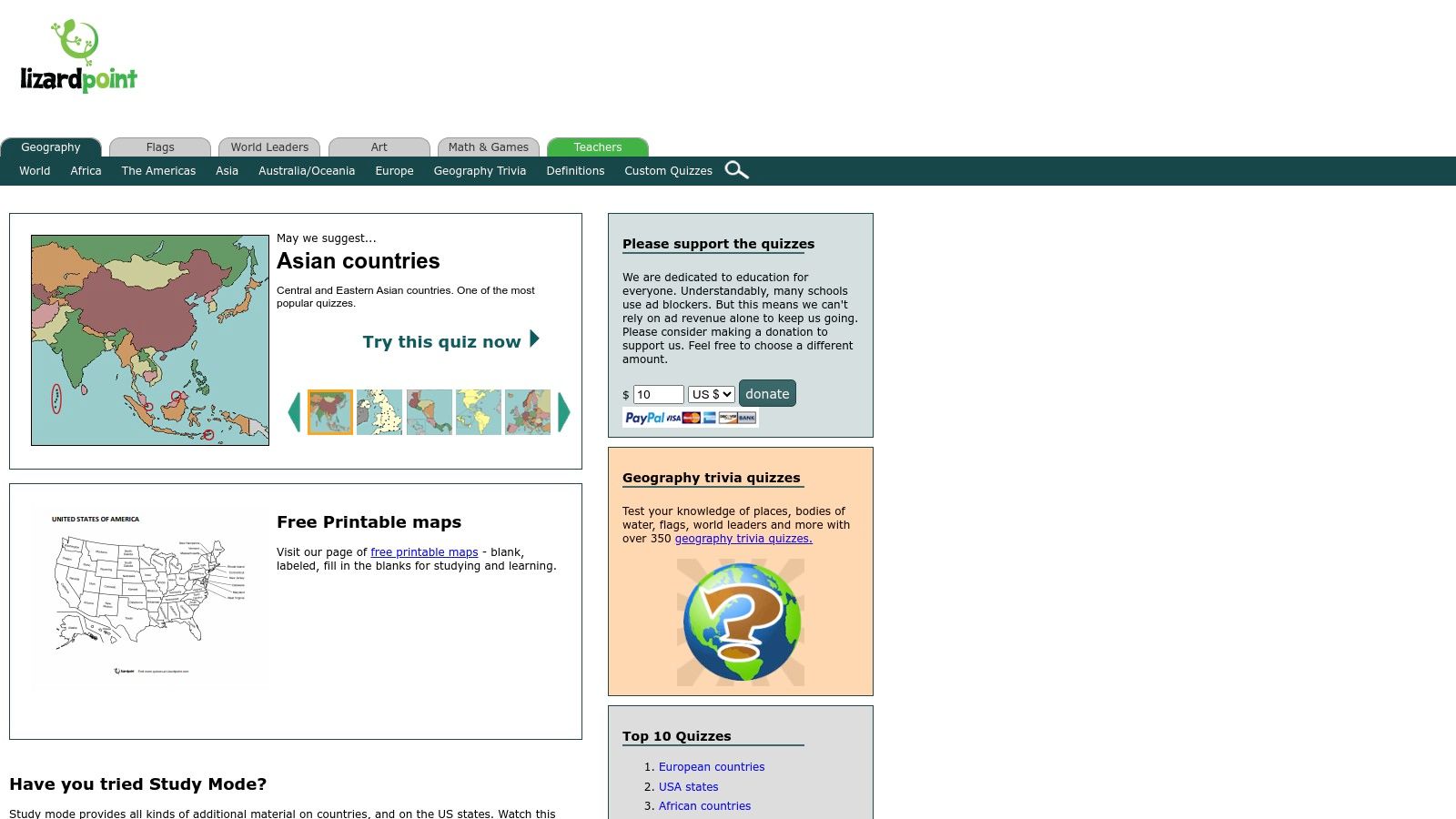
What makes this platform particularly valuable for structured learning is its "Study Mode" and extensive printable resources. Before taking a quiz, users can enter Study Mode to see country names, capitals, and other key facts overlaid on the map. This feature turns the platform from a simple testing tool into a comprehensive study guide. Furthermore, the availability of free printable blank and labeled maps makes it an invaluable resource for teachers who want to bring geography practice into the classroom for offline activities.
Key Features and Usage Tips
The platform’s no-frills interface ensures that the focus remains purely on the educational content. It's less of a game and more of a digital workbook, designed for progressive learning.
- Best For: Students, teachers, and learners who prefer a curriculum-style approach over competitive gameplay.
- Practical Tip: Use the "Customize this Quiz" option before starting. This allows you to select specific countries within a region, letting you focus on a smaller set of outlines before tackling an entire continent.
- Access: Lizard Point is completely free to use. While a former teacher/student account system was discontinued, all quizzes and resources remain accessible to everyone without charge.
Lizard Point’s dedication to providing practical learning tools, like its printable maps, makes it a standout choice for anyone serious about mastering world geography from the ground up.
Website: https://lizardpoint.com/geography/
6. Worldle (by Teuteuf)
Capitalizing on the viral success of daily puzzle games, Worldle offers a focused and addictive daily challenge centered entirely on an outline of countries quiz. Each day, players are presented with a black silhouette of a single country and given six attempts to guess its identity. The platform’s genius lies in its hint system; after each incorrect guess, Worldle tells you how far away your guess was and in which direction the correct country lies, turning each attempt into a valuable learning moment. This simple, bite-sized format encourages a daily habit of geographic practice.
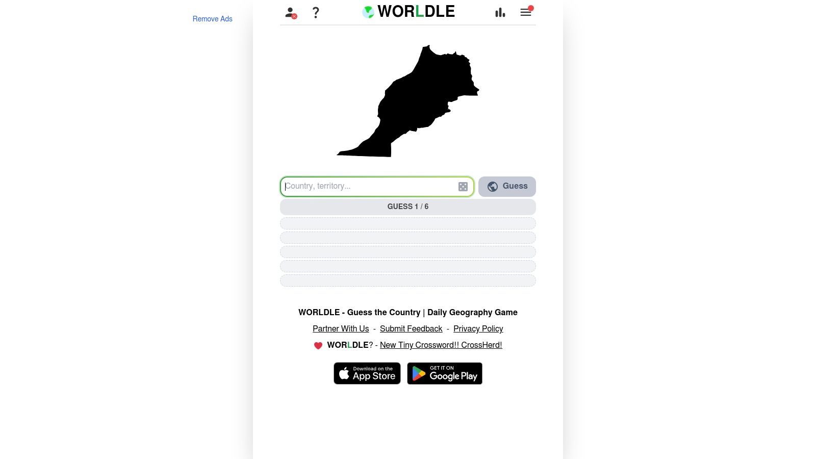
What makes Worldle stand out is its singular focus and clever feedback loop. It isn’t a sprawling trivia platform but a dedicated tool for improving country shape recognition and relative location awareness. After successfully identifying the country, the game offers bonus rounds to guess its neighbors, flag, and capital, reinforcing multiple layers of geographic knowledge. This makes it an excellent warm-up exercise or a quick daily test. If you enjoy this style of daily challenge, you can discover similar experiences in our roundup of the best free online geography games for more engaging ways to learn.
Key Features and Usage Tips
The game's straightforward browser-based interface requires no installation, allowing for immediate play. Its daily nature and shareable results make it a fun, social way to test your knowledge against friends.
- Best For: Daily practice, building a consistent learning habit, and improving knowledge of country locations through directional hints.
- Practical Tip: Pay close attention to the distance and direction arrows. Use them to make strategic subsequent guesses, mentally zeroing in on the correct region of the world.
- Access: The daily Worldle game is free to play with ads. An optional Premium membership unlocks the full puzzle archive and allows you to sync your account and stats across devices.
Worldle’s success lies in its simplicity, transforming the outline quiz into an engaging daily ritual that steadily builds your global awareness.
Website: https://worldle.teuteuf.fr/
7. Sheppard Software – Geography Games
Sheppard Software is a long-standing educational hub known for its straightforward, browser-based games. While its interface may feel classic compared to newer sites, its effectiveness in teaching geography fundamentals is undeniable. The platform provides a structured learning path perfect for beginners looking to master an outline of countries quiz. Its core strength lies in its progressive difficulty levels, which guide users from simply clicking on labeled countries to identifying them based purely on their shape, making it an excellent tool for building foundational knowledge.
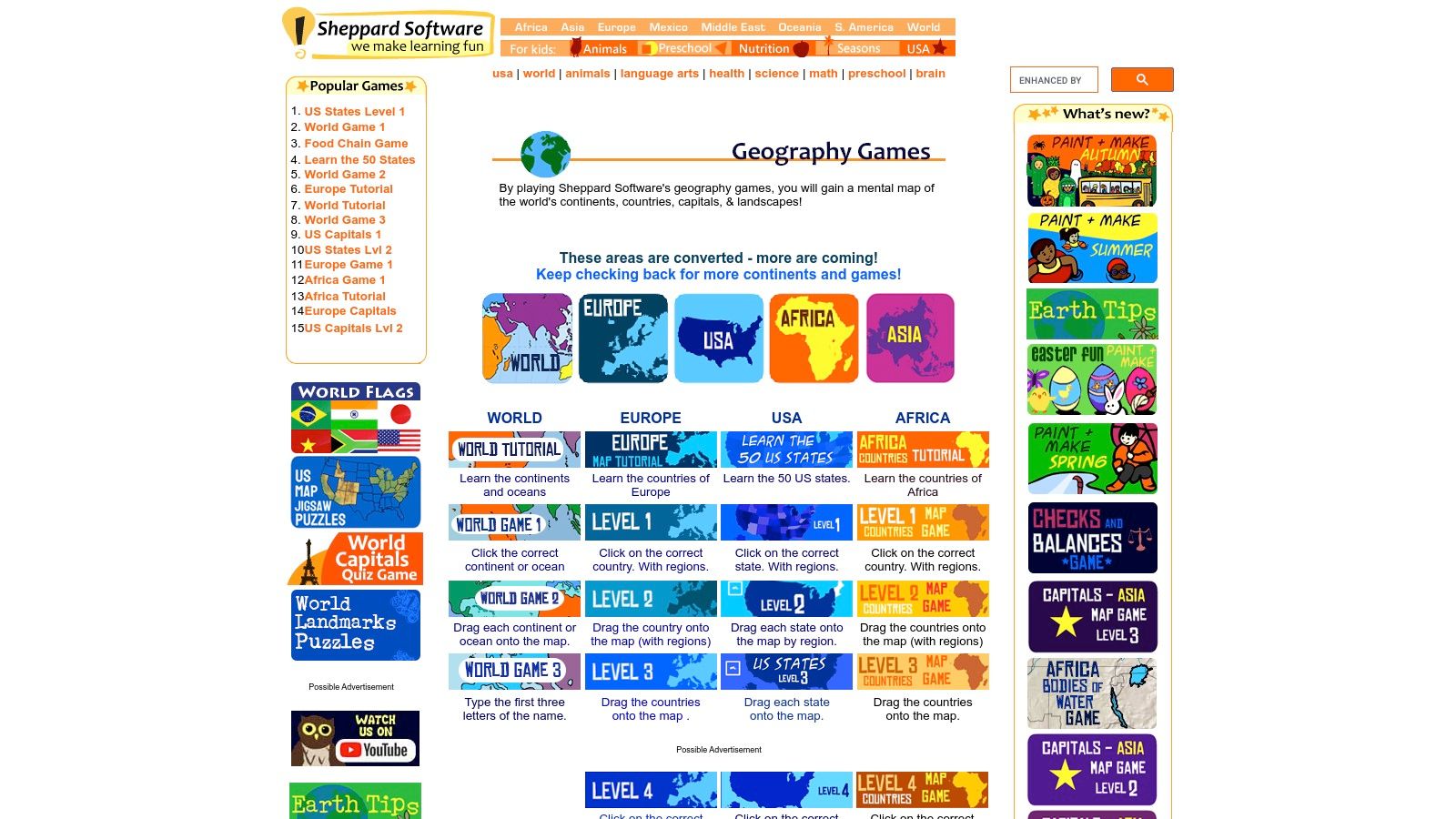
What makes Sheppard Software particularly valuable is its classroom-friendly approach. The games are designed to be accessible and intuitive, requiring no sign-ups or complex instructions. Each continent has a dedicated section with multiple game modes, such as a "Tutorial" level that names the country as you hover over it, and a "Drag-and-Drop" level that challenges you to place the unlabeled country shape onto the correct spot on the map. This scaffolded approach ensures that learners can build confidence and skills at their own pace.
Key Features and Usage Tips
The platform’s simple, click-based gameplay makes it easy for learners of all ages to start immediately. Its games focus on reinforcement through repetition, which is highly effective for memorizing country shapes and locations.
- Best For: Beginners, young learners, and educators looking for free, no-fuss educational resources to teach country recognition.
- Practical Tip: Start with the "Tutorial" mode for a new region to familiarize yourself with the names and shapes. Progress to the "Level 1" click-based game and then challenge yourself with the "Drag & Drop" mode to test your outline recognition skills without borders.
- Access: Sheppard Software's geography games are 100% free to play in any web browser and are supported by ads. No account or subscription is required.
Its no-frills, content-first design makes Sheppard Software a reliable and highly effective resource for anyone starting their journey with world geography.
Website: https://www.sheppardsoftware.com/Geography.htm
Outline of Countries Quiz: 7-Site Comparison
| Platform | Implementation complexity 🔄 | Resource requirements ⚡ | Expected outcomes 📊 | Ideal use cases 💡 | Key advantages ⭐ |
|---|---|---|---|---|---|
| EarthChasers | Medium — interactive 3D mapping, browser-dependent | Modern browser + stable internet; Google Maps 3D support; core free (Pro exists) | High — immersive spatial learning and engagement ⭐⭐⭐⭐ | Classrooms, casual explorers, route planning, competitive play | Photorealistic 3D visuals; daily challenges & leaderboards; free pro tools; community maps |
| Sporcle | Low — straightforward quiz platform | Browser or mobile app; free with ads, Sporcle Orange for extras ⚡ | Moderate — broad recall practice across many formats ⭐⭐⭐ | Casual players, teachers embedding quizzes, lesson supplements | Massive user-generated content; Lessons mode; mobile apps & progress tracking |
| JetPunk | Low — fast, minimal interface for drills | Browser (ad-supported) or Premium for ad-free/analytics | Moderate — quick repetition and benchmarking ⭐⭐⭐ | Rapid practice sessions, timed drills, self-benchmarking | Streamlined fast flow; quiz statistics; extensive related quiz sets |
| Seterra (online) | Low–Medium — focused map-quiz experience | Browser or paid iOS full app (offline/ ad-free) ⚡ | High — structured mastery of locations/outlines ⭐⭐⭐⭐ | Classrooms, progressive learning, offline practice on mobile | Purpose-built geography quizzes; Learn Mode; wide topic coverage; offline app option |
| Lizard Point Geography | Low — simple, study-focused quizzes | Browser; printable PDFs for offline study | Moderate — progressive shape recognition and facts ⭐⭐⭐ | Teacher-led lessons, homework, printable practice | Study Mode with facts; printable blank/labeled maps; varied difficulty levels |
| Worldle (Teuteuf) | Very low — single daily puzzle format | Browser; free daily play, Premium for archives | Moderate — habit-forming daily outline practice ⭐⭐⭐ | Daily micro-practice, outline recognition habit-building | Daily silhouette puzzle; distance/direction hints; bonus rounds |
| Sheppard Software – Geography | Low — kid-friendly interactive games | Browser; free with ads; multiple difficulty levels | Moderate — strong for beginners and early learners ⭐⭐⭐ | Elementary classrooms, beginners, scaffolded learning | Multiple modes for progression; classroom-friendly; printable/region coverage |
From Quiz Taker to Geography Chaser
You've navigated the tricky silhouettes of Africa, traced the familiar coastlines of Europe, and perhaps even conquered the challenging outlines of Oceania. This journey through our comprehensive outline of countries quiz has done more than just test your knowledge; it has laid the foundation for a deeper, more intuitive understanding of world geography. The core takeaway is that mastering geography is an active, continuous process. It begins by recognizing iconic shapes like Italy's boot and evolves into confidently identifying less distinct nations like Burkina Faso or Belarus.
This article provided a multi-faceted toolkit designed to support every stage of your learning adventure. From the ready-to-use quiz images perfect for classrooms or trivia nights, to a detailed answer key for immediate feedback, you have the resources to build a strong base. The true power, however, lies in consistent practice. The tools we explored, each with its unique strengths, are your gateways to turning passive knowledge into active recall.
Choosing Your Next Geographic Adventure
Your next step depends entirely on your learning style and goals. To help you decide, consider what you want to achieve:
- For Competitive Drills and Speed: If your goal is rapid-fire recognition and climbing leaderboards, platforms like Sporcle and JetPunk offer a high-energy, competitive environment perfect for honing your speed and accuracy.
- For Structured, Academic Learning: If you prefer a more systematic approach to learning, Seterra and Lizard Point Geography provide customizable quizzes that allow you to focus on specific regions or continents, reinforcing knowledge through repetition.
- For Daily, Casual Engagement: To make geography a fun daily habit, the puzzle-like nature of Worldle is an excellent choice. It sharpens your spatial reasoning skills one country at a time.
- For Immersive, Visual Exploration: To transform abstract outlines into tangible, memorable places, EarthChasers stands alone. By exploring countries in a photorealistic 3D environment, you connect the shape on a map to the actual, living world.
Taking Your Skills to the Next Level
As your confidence grows, you might be inspired to create your own geography challenges for friends, family, or students. Crafting a custom quiz allows you to focus on specific learning objectives, such as differentiating between similarly shaped countries or highlighting nations from a particular historical period. For those interested in innovative formats, you can even learn how to create your own interactive video quiz, a dynamic way to engage an audience by embedding questions directly into geographical video tours.
Ultimately, the goal is to keep the spark of curiosity alive. The world is a vast and fascinating place, and every country's border tells a story. By continuing to engage with these shapes, you are not just memorizing facts; you are building a mental map of the world that will enrich your understanding of global events, cultures, and connections. You've moved beyond simply taking a quiz; you are now equipped to be a true geography chaser.
Ready to see country outlines in a whole new dimension? Move beyond 2D maps and test your skills in a stunningly realistic 3D world with EarthChasers. Visit EarthChasers to play our 'Countries' game mode and experience geography like never before.