Top 12 Sources for a Printable Blank Map of Africa in 2025
Discover the 12 best sites for a free printable blank map of Africa. Find high-quality PDF, SVG, and PNG maps for students, teachers, and crafters.
Whether you're an educator crafting the perfect geography lesson, a student preparing for an exam, a hobbyist designing a creative project, or a traveler charting your next adventure, a high-quality printable blank map of Africa is an indispensable tool. But with countless resources scattered across the web, from simple outlines to complex vector files, finding the right one can feel like a quest in itself. This guide cuts through the noise and gets straight to the point.
We've curated and reviewed the top 12 sources, evaluating them for quality, format availability, ease of use, and specific applications. Forget endless searching; this resource list is designed to help you quickly identify the ideal map for your specific needs. We will explore everything from classroom-ready PDFs and editable digital files on platforms like Teachers Pay Teachers and MapChart to large-format physical posters available through Amazon and Etsy.
Each entry provides a concise overview, key feature analysis, and direct links, so you can spend less time searching and more time using your map. This comprehensive list helps you pinpoint the perfect resource, whether you need a simple outline for a school project or a detailed, customizable map for professional use.
1. Amazon
While not a direct source for a printable blank map of Africa, Amazon excels at providing large, physical maps suitable for classrooms, offices, or study spaces. Instead of downloading and printing a file, you purchase a ready-to-hang product. This is ideal for educators or professionals who need a durable, high-quality, and large-format map without the hassle of home printing and assembly. The platform's primary offering in this category is laminated political maps, which often feature country borders and major cities but are otherwise sparse on detail, allowing for annotation with dry-erase markers.
The main advantage is convenience. With options for Prime shipping, you can receive a classroom-sized map (e.g., 36" x 48") quickly. Brands like Maps International and Cool Owl are popular sellers, and the vast number of customer reviews helps gauge the quality and accuracy of a specific map before purchase. However, finding a truly blank map with only continental outlines is rare here; most options are political maps.
Key Features & Use Case
- Best For: Educators needing a large, durable, and reusable wall map for classroom activities.
- Pros: Extensive customer reviews, fast shipping with Prime, and durable laminated options.
- Cons: Limited selection of truly blank maps; quality can vary significantly between third-party sellers.
Pro-Tip: Use search terms like "laminated Africa map dry erase" to find options suitable for interactive lessons or strategic planning. Always check recent customer photos to verify the map's level of detail and print quality.
Website: https://www.amazon.com
2. Etsy
Etsy serves as a creative marketplace for instant digital downloads, making it an excellent source for a unique or stylized printable blank map of Africa. Unlike traditional map repositories, Etsy offers artistic and customizable files created by independent designers. You can find everything from minimalist outlines and detailed silhouette vector graphics to educational worksheets. This is perfect for crafters, DIY project enthusiasts, or educators looking for a map with a specific aesthetic for a presentation or classroom activity. The platform excels at providing affordable, high-resolution digital files ready for immediate printing.
The primary advantage is the variety of file types available. Many sellers offer packages that include PDF, PNG, JPG, and SVG formats, providing flexibility for different uses. SVG files are particularly valuable as they are vector-based, allowing you to scale the map to any size without losing quality. Prices are typically very low, often under a few dollars for a digital download. However, the quality and licensing terms are set by individual sellers, so it's crucial to read the item descriptions carefully.
Key Features & Use Case
- Best For: Creatives, teachers, and DIY enthusiasts needing a stylized or vector-based map for projects.
- Pros: Immediate access after purchase, vector files (SVG) allow for lossless scaling, and a wide variety of artistic styles.
- Cons: Quality and license terms can vary significantly between sellers; no returns are offered on instant digital downloads.
Pro-Tip: Look for listings that include multiple file types (especially SVG) to ensure maximum flexibility. Always check the seller's terms to confirm if the map can be used for your intended purpose, whether personal, educational, or commercial.
Website: https://www.etsy.com
3. Zazzle
Similar to Amazon, Zazzle provides physical products rather than instant digital downloads, but with a focus on customization. It's a print-on-demand marketplace where you can find user-designed blank outline maps of Africa available as posters. This is perfect for someone who needs a high-quality print in a specific size or paper type but doesn't want the hassle of finding a local print shop. You can select the exact dimensions, choose from different paper finishes like matte or semi-gloss, and even add a frame directly at checkout.
The platform's strength lies in its ability to deliver large-format prints, with some posters available up to 60 inches wide, making them ideal for classroom walls or large-scale projects. While you can't get an instantly printable blank map of Africa, Zazzle bridges the gap between a small home printout and a professionally produced wall map. The trade-off is the shipping time and cost, but frequent site-wide discounts can make it an affordable option for a custom, high-quality physical product.
Key Features & Use Case
- Best For: Individuals seeking a custom-sized, high-quality poster print of a blank Africa map for decor or projects.
- Pros: Highly customizable sizes and paper types, classroom-friendly large formats, and frequent promotional discounts.
- Cons: Not an instant digital download; requires lead time for printing and shipping.
Pro-Tip: Pay close attention to the poster's size options and paper stock. A matte finish is often better for writing or coloring activities, as it reduces glare and accepts ink more readily than a glossy finish.
Website: https://www.zazzle.com
4. Teachers Pay Teachers (TpT)
Teachers Pay Teachers (TpT) is an online marketplace specifically designed for educators, making it a treasure trove for classroom-ready resources. Unlike general image sites, the platform offers a printable blank map of Africa often bundled with lesson plans, worksheets, and related activities created by other teachers. These resources are tailored for educational use, with options ranging from simple outlines for coloring to more complex political maps for geography quizzes, all available as downloadable files.
The primary advantage of TpT is its educational focus. You can filter resources by grade level, subject, and resource type, ensuring the map you find is age-appropriate and meets specific learning objectives. While many high-quality items require a small payment, which supports the teacher creators, there are also numerous free options available. The review and rating system provides valuable insight into the quality and classroom effectiveness of each resource before you download or purchase.
Key Features & Use Case
- Best For: Teachers and homeschool parents looking for curriculum-aligned map activities and worksheets.
- Pros: Huge selection with detailed previews, supports teacher creators, and resources are designed for classroom use.
- Cons: Quality can vary significantly between sellers, and many of the best resources are paid, not free.
Pro-Tip: Use the filters on the left-hand side to narrow your search by "Free," grade level, and "Resource Type" (e.g., "Worksheets" or "Printables") to quickly find a suitable printable blank map of Africa for your needs.
Website: https://www.teacherspayteachers.com
5. Super Teacher Worksheets
Super Teacher Worksheets is a go-to resource for educators and parents seeking a printable blank map of Africa designed specifically for elementary and middle school students. The platform offers a variety of PDF worksheets, including completely blank outlines, labeled maps for study, and versions with country names for labeling exercises. The focus is less on cartographic detail and more on providing clear, simple, and classroom-ready materials that are easy for young learners to understand and use.
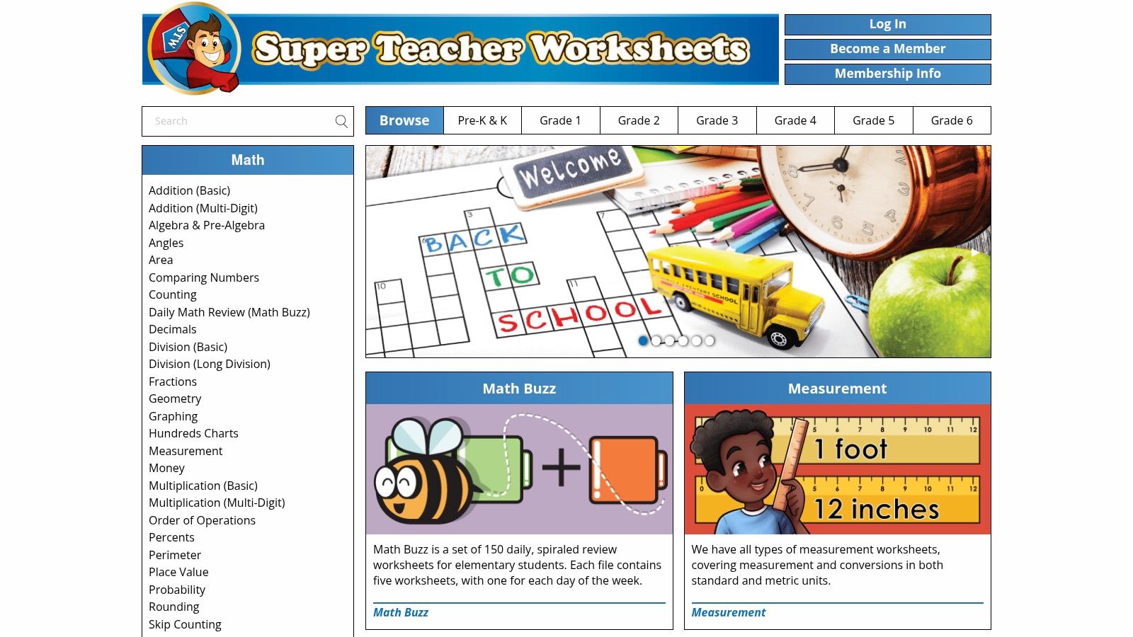
The primary strength of this site is its educational focus. Every map is part of a larger ecosystem of teaching aids, ensuring consistency in style and difficulty. While a small selection of maps is available for free, the vast majority of resources require a paid membership. This makes it an excellent value for teachers who need a wide range of subjects, but less ideal for someone just looking for a single map download. The straightforward PDFs print cleanly on standard paper, perfect for quick classroom activities.
Key Features & Use Case
- Best For: K-6 teachers who need reliable, age-appropriate geography worksheets for their lesson plans.
- Pros: Trusted resource for early education, consistent formatting across worksheets, and clear, simple outlines.
- Cons: Most high-quality downloads require a paid membership; limited styling and customization options.
Pro-Tip: Before committing to a membership, browse the "Free Worksheets" section to download sample maps. This helps you evaluate if the style and level of detail are a good fit for your students' needs and can be a great way to improve geography study skills.
Website: https://www.superteacherworksheets.com
6. Education.com
Education.com is a well-established resource hub for parents and educators, offering a vast library of standards-aligned worksheets, including a simple printable blank map of Africa. While not a dedicated map repository, its offerings are specifically designed for educational assignments. The maps provided are straightforward, featuring clear country outlines perfect for labeling exercises, coloring activities, or basic geography quizzes in a K-8 classroom setting. These are not high-resolution cartographic files but rather practical, easy-to-use printouts for homework.
The platform's strength lies in its integration with other learning materials. You can find a map worksheet and pair it with lesson plans, articles, and games related to African geography all in one place. Accessing many of the printable resources requires a free account sign-up, which is a minor hurdle. The maps are typically basic political outlines, so users seeking detailed physical or topographical maps will need to look elsewhere.
Key Features & Use Case
- Best For: Teachers and homeschooling parents needing a simple, assignment-ready map for elementary or middle school students.
- Pros: Trusted by educators, worksheets are often standards-aligned, and many resources are available for free with sign-up.
- Cons: Requires an account to download many resources; limited variety and resolution of map types available.
Pro-Tip: Use the site's search filter to narrow results by grade level (e.g., "4th grade Africa map") to quickly find age-appropriate worksheets for your students or children.
Website: https://www.education.com
7. Teach Starter
Teach Starter is an educator-focused resource platform that offers a high-quality, curriculum-aligned printable blank map of Africa. Specifically designed for grades 3–5, this resource is more than just an image; it’s an instructional tool. The map comes as an unlabeled black-and-white outline, making it a perfect canvas for lessons on geography, history, or social studies. Its primary value lies in its direct integration into classroom activities, whether printed for individual work or projected for group annotation.
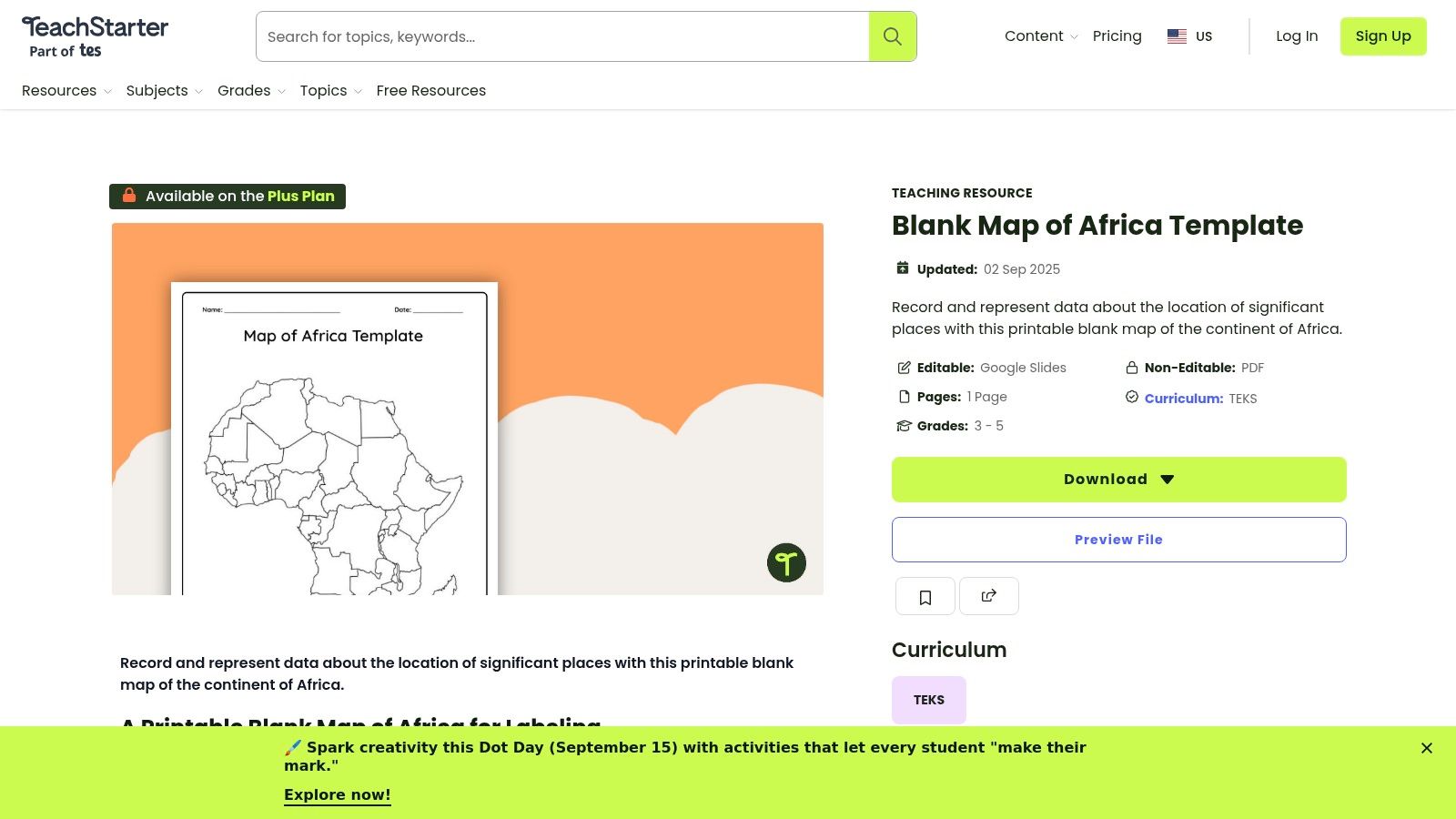
What sets this platform apart is its classroom-ready format. The map is available as a downloadable PDF and an editable Google Slides file, allowing for seamless use in digital or traditional settings. However, accessing this specific resource requires a paid Teach Starter Plus subscription. While this paywall is a significant limitation for casual users, it ensures the materials are professionally designed and vetted for educational standards, making it a reliable choice for teachers.
Key Features & Use Case
- Best For: K-6 educators who need curriculum-aligned, interactive teaching materials for geography lessons.
- Pros: Professionally designed for classroom use, available in PDF and Google Slides formats, and aligned with educational standards.
- Cons: Requires a paid subscription for access; primarily targets a younger student demographic (K-6).
Pro-Tip: If you are an educator, utilize the Google Slides version for interactive digital lessons. Students can digitally label countries, draw trade routes, or identify geographical features directly on the slide.
Website: https://www.teachstarter.com/us/teaching-resource/blank-map-africa-template-us/
8. National Geographic Education – MapMaker
For educators and students seeking cartographic accuracy, National Geographic's MapMaker is a top-tier resource. This free, browser-based tool allows for the creation of a highly customized and printable blank map of Africa. Instead of a simple download, users interact with a dynamic map, selecting the "Outline Map" basemap to remove topographical and political details, leaving just the essential borders. This process gives you unparalleled control over the final product, ensuring the map fits your specific educational needs.
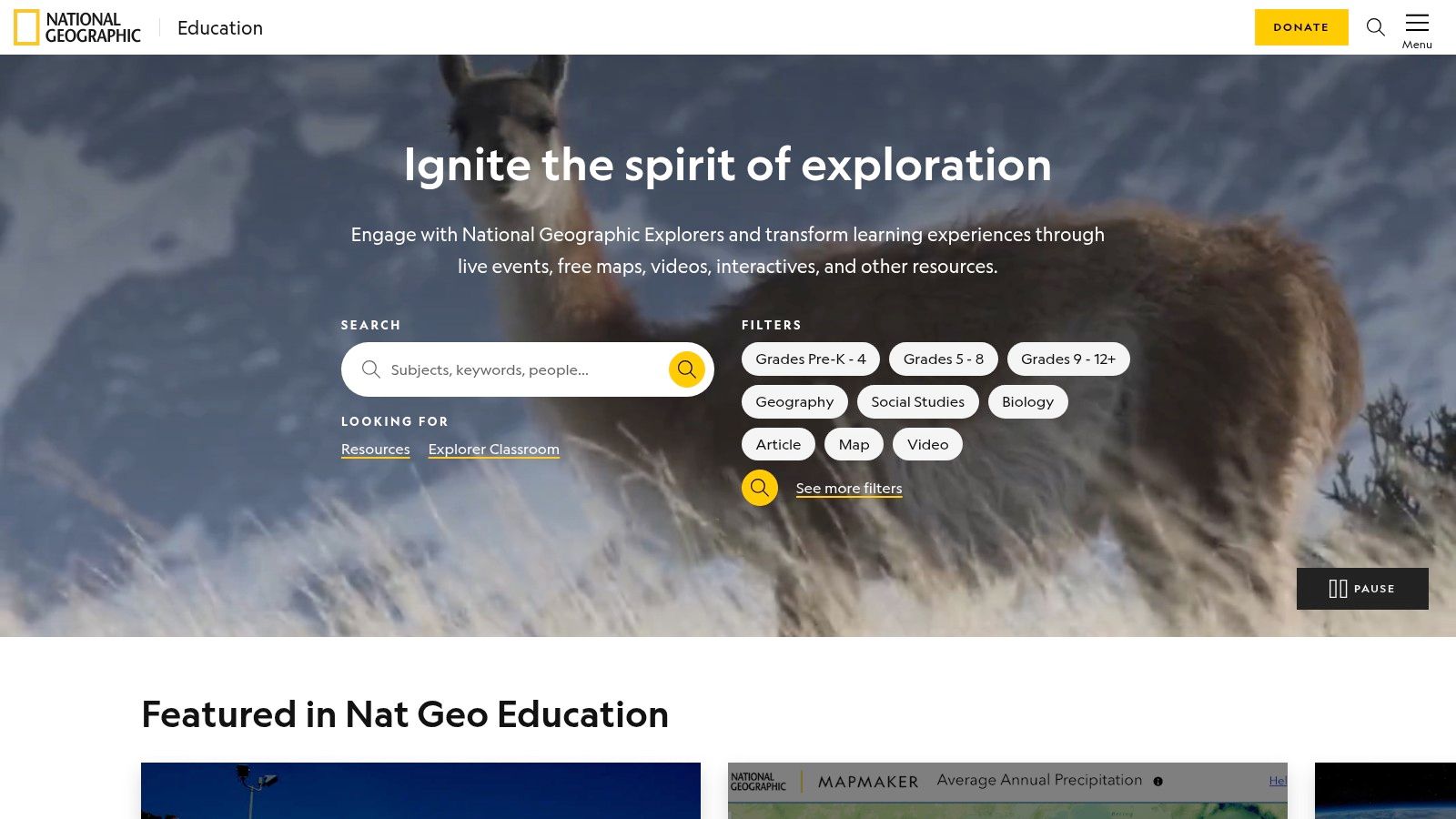
The primary advantage is the source's authority; you are getting a map built on reputable, current geographic data. Users can zoom to specific regions, add or remove layers like country names or major rivers before printing, and even draw on the map digitally. While it requires more effort than a one-click PDF download, the flexibility it offers for creating a tailored classroom resource is unmatched, making it a powerful tool for geography lessons.
Key Features & Use Case
- Best For: Educators and students who need an accurate, customizable blank map for specific school projects or lessons.
- Pros: Highly reputable and accurate cartography, flexible customization options, and completely free to use.
- Cons: Not a simple one-click download; the interface has a slight learning curve for first-time users.
Pro-Tip: Before printing, use the MapMaker tools to add specific markers or draw boundaries for a particular lesson, such as outlining historical empires or tracing major trade routes on your blank map.
Website: https://education.nationalgeographic.org
9. MapChart
MapChart is an interactive, browser-based tool that lets you create a custom printable blank map of Africa in seconds. Instead of just downloading a static file, you can color-code individual countries, add a legend, and then clear all labels to produce a truly unique map. This approach is perfect for projects that require a stylized or color-coded blank map for presentations, educational materials, or personal use.
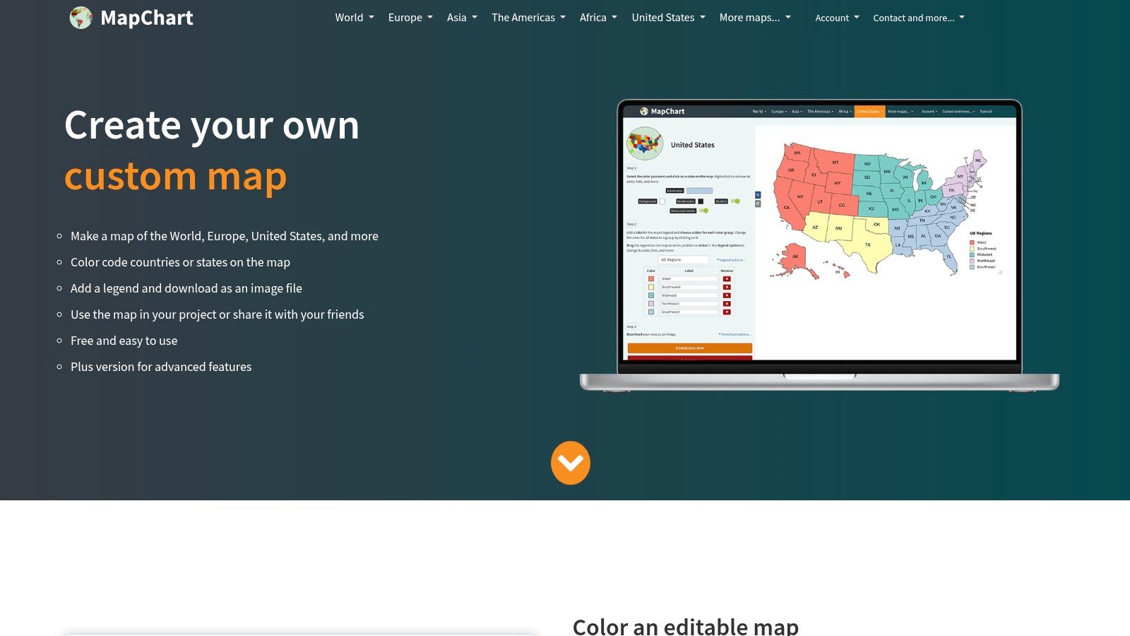
The platform's simplicity is its greatest strength. You simply click on countries to change their color, adjust settings like the background or border color, and preview the results in real-time. Once satisfied, you can download your creation as a high-resolution PNG image, ready for printing. This makes it an excellent resource for quickly visualizing data or creating a custom study guide without any graphic design skills. For those interested in more advanced tools, you can learn more about how MapChart functions as a custom map creator.
Key Features & Use Case
- Best For: Students, hobbyists, and presenters who need a color-coded or visually specific blank map without using complex software.
- Pros: Extremely easy-to-use interface, real-time map customization, and high-resolution PNG downloads are free.
- Cons: Output is a raster PNG, not a scalable vector file; free use requires attribution.
Pro-Tip: Before downloading, use the "Hide all" button in the legend/labels section to instantly create a clean, untitled, and completely blank map for your specific needs.
Website: https://www.mapchart.net
10. SimpleMaps
SimpleMaps is a developer-focused resource that offers a powerful, no-frills solution for those who need a high-quality vector map. The platform provides a free, lightweight SVG file of Africa in the Robinson projection, which is perfect for graphic designers, web developers, or anyone comfortable with vector editing software. Unlike raster images, this SVG can be scaled infinitely without any loss of quality, making it ideal for creating a high-resolution printable blank map of Africa for large-format projects.
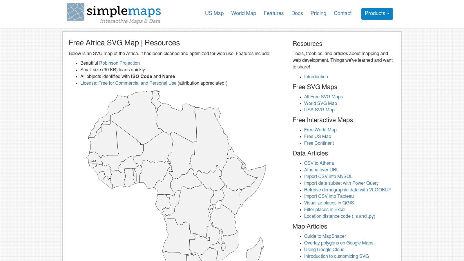
The map’s true strength lies in its customizability. Each country is a separate, editable object identified by its name and ISO code within the SVG file. This allows users to easily color, remove, or highlight specific nations using software like Adobe Illustrator or the free alternative, Inkscape. While it requires technical proficiency, the permissive license allows for broad personal and commercial use, giving you complete creative control.
Key Features & Use Case
- Best For: Graphic designers, developers, and researchers needing a scalable and fully editable vector map for custom projects.
- Pros: Infinitely scalable SVG format for crisp printing at any size; easy to customize colors and borders; permissive usage license.
- Cons: Requires knowledge of vector editing software; not a ready-to-print PDF, as users must export their own file.
Pro-Tip: Once you open the SVG in a vector editor, use the "Layers" or "Objects" panel to quickly find and select specific countries by their official names or ISO codes for quick customization.
Website: https://simplemaps.com/resources/svg-africa
11. FreeWorldMaps
FreeWorldMaps delivers high-quality, straightforward resources for users needing a free and easily accessible printable blank map of Africa. The site specializes in offering clean vector PDFs and PNG files, which are perfect for projects requiring sharp lines and scalability. Its standout feature is the no-hassle download process; no registration or sign-up is required to access the files. The maps are primarily formatted for A4 paper, making them ready to print for users in most parts of the world.
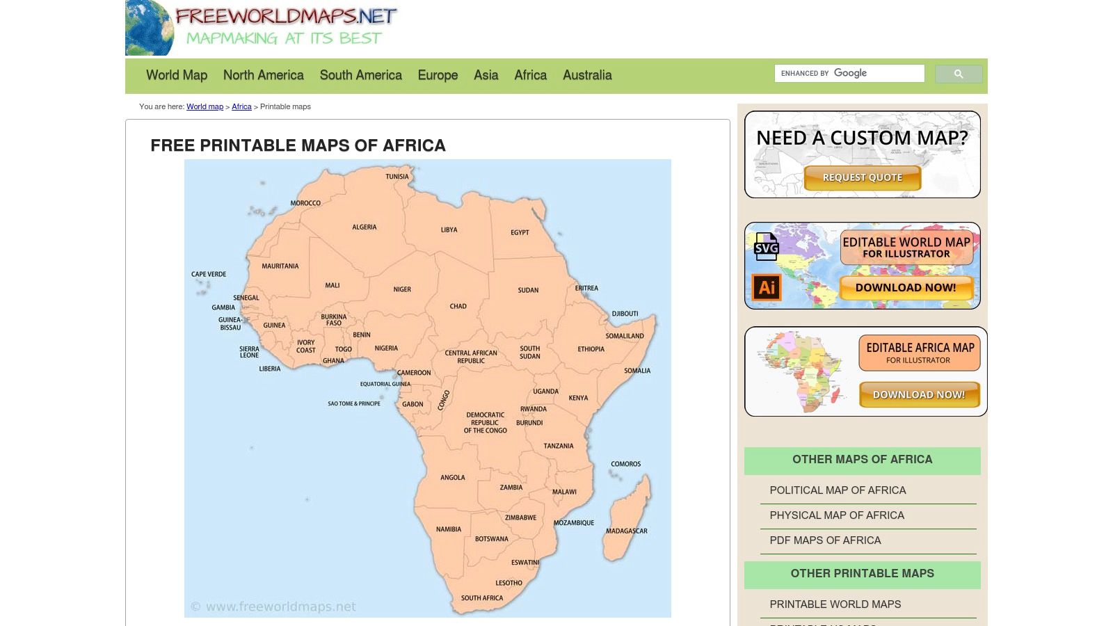
The platform provides several useful variants, including a simple continental outline and another with country borders clearly delineated. This flexibility serves different educational needs, from basic geography tracing for young learners to more detailed political mapping exercises for older students. While it may not offer extensive customization, its simplicity and the high quality of the vector files make it a reliable choice for anyone needing a print-ready map quickly and without cost. You can learn more about the geography of the seven continents to complement your map studies.
Key Features & Use Case
- Best For: Students and educators who need a high-resolution, print-ready PDF map without any cost or registration hurdles.
- Pros: Completely free, high-quality vector PDFs available, and offers clear previews before downloading.
- Cons: Limited styling options; default A4 size might require minor scaling for standard US Letter printers.
Pro-Tip: When printing the PDF, use your printer’s "Fit to Page" or "Scale to Fit" setting to ensure the entire map prints correctly on US Letter-sized paper without cutting off the edges.
Website: https://www.freeworldmaps.net/printable/africa/
12. WorldMapBlank.com
WorldMapBlank.com is a straightforward resource offering a collection of free, downloadable blank Africa map PDFs. The site caters directly to educators and students by providing several clean and simple variants, including a basic outline, a map with country borders, and one with capitals marked. Its primary strength lies in its simplicity and accessibility, making it an excellent choice for anyone needing a quick, no-fuss printable for classroom activities or study sessions. All resources are conveniently optimized for standard A4 and A5 paper sizes.
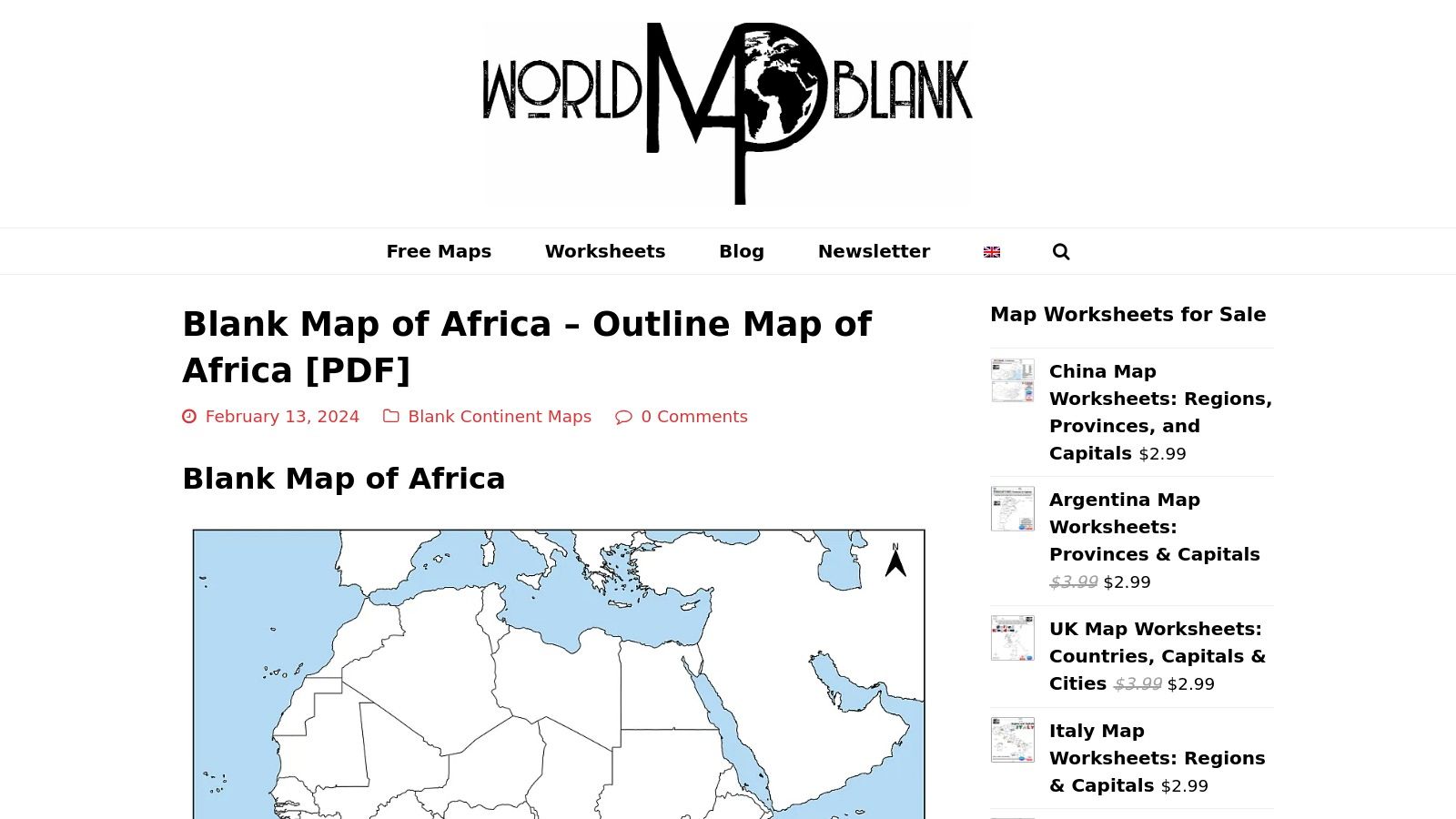
The platform stands out by bundling its maps with related educational materials like worksheets and fully labeled reference maps. This makes it a one-stop-shop for creating a complete lesson plan. Downloads are instant and do not require any registration, removing barriers for users. The main limitation is the lack of customization beyond the pre-set formats and the fixed A4/A5 sizing, which may require minor scaling adjustments for users printing on US Letter paper.
Key Features & Use Case
- Best For: Teachers and students who need quick, free, and easy-to-use handouts for geography lessons.
- Pros: Completely free with no registration, multiple map variations available, includes supplementary worksheets.
- Cons: Limited to A4/A5 sizing; no options for customization or different file formats beyond PDF.
Pro-Tip: Before printing, use your PDF viewer’s "Fit to Page" or "Scale to Fit" setting to ensure the map prints correctly on US Letter paper without cutting off the edges.
Website: https://worldmapblank.com/blank-map-of-africa/
Comparison of 12 Printable Blank Africa Map Resources
| Provider | Core Features/Characteristics | User Experience / Quality ★ | Value Proposition 💰 | Target Audience 👥 | Unique Selling Points ✨ |
|---|---|---|---|---|---|
| Amazon | Large laminated political maps, classroom-ready | ★★★★ Durable, multiple brands, varied quality | 💰 Moderate, Prime shipping | Teachers, classrooms, general buyers | 🏆 Ready-to-hang, fast US delivery |
| Etsy | Instant digital downloads (PDF, PNG, SVG) | ★★★★ Instant access, vector scalability | 💰 Very affordable (<$5 items) | Crafters, designers, home users | ✨ Multiple formats & small-commercial licenses |
| Zazzle | Customizable physical posters with framing options | ★★★★ Classroom & home print quality | 💰 Affordable, discounts available | Teachers, home users | ✨ Custom sizes & framing options |
| Teachers Pay Teachers | Printable teacher-created maps & activity packs | ★★★★ Community-rated educational content | 💰 Paid resources, educator-supported | Educators, schools | 🏆 Educational standards & grade filters |
| Super Teacher Worksheets | Printable labeled/unlabeled maps, K–6 focus | ★★★★ Trusted, consistent formatting | 💰 Membership needed, some free | Elementary teachers, parents | ✨ Simple, classroom-ready worksheets |
| Education.com | Standards-aligned printables for K–8 | ★★★★ Widely used, many free worksheets | 💰 Mostly free with sign-in | Educators, parents | 🏆 Standards-aligned, easy-to-use |
| Teach Starter | Printable map templates (PDF, Google Slides), US aligned | ★★★★ Clear instructional targets | 💰 Paid subscription required | US K–6 educators | ✨ Editable Google Slides & curriculum aligned |
| NatGeo Education | Free web tool for custom printable outline maps | ★★★★★ Accurate, reputable cartography | 💰 Free | Teachers, advanced users | 🏆 Custom maps with updated data |
| MapChart | Free editable online map with PNG export | ★★★★ Quick, no software needed | 💰 Free with optional Plus plan | Casual users, educators | ✨ Easy map customization instantly |
| SimpleMaps | Free SVG blank map, vector format | ★★★★ Infinite scaling, editable vectors | 💰 Free | Designers, advanced users | 🏆 Vector format, permissive license |
| FreeWorldMaps | Free downloadable PDF vector maps | ★★★★ High-quality vector PDFs | 💰 Free | Teachers, general users | ✨ No registration, multiple variants |
| WorldMapBlank.com | Free PDFs with multiple map variants | ★★★★ Clean, consistent PDFs | 💰 Free | Teachers, classrooms | ✨ Worksheets & labeled reference maps |
From Blank Page to Global Explorer
Navigating the vast landscape of online resources for a printable blank map of Africa can seem daunting, but as we've explored, the perfect map is simply a matter of matching the right tool to your specific project. From the curated, often artistic, offerings on marketplaces like Etsy and Zazzle to the education-focused worksheets available on Teachers Pay Teachers and Education.com, the options are diverse and plentiful. Your journey began with a simple need, a blank canvas, and now you are equipped with a comprehensive guide to transform that empty page into a powerful tool for learning, creativity, or strategic planning.
The key takeaway is that no single source serves every purpose. A teacher preparing a geography quiz will find immense value in the structured, classroom-ready materials from sites like Super Teacher Worksheets, while a digital artist or researcher will benefit more from the high-resolution, customizable vector files offered by platforms like SimpleMaps. The most effective approach involves first defining your end goal with clarity.
How to Choose Your Ideal Map
To make the best selection, consider these final points before you click "download":
- For Classroom and Educational Use: Prioritize resources from educational platforms. These often include helpful additions like labels for major rivers, mountain ranges, or surrounding oceans, which provide essential context for students. Check for different versions, such as maps with or without country borders, to tailor the lesson's difficulty.
- For Creative and Artistic Projects: Look for high-resolution PNG or vector (SVG, AI) files. These formats are crucial for scaling your map without losing quality, a vital consideration for creating large posters, custom game boards, or detailed digital illustrations. Marketplaces like Etsy often feature unique, stylized outlines that can add a creative flair.
- For Quick Reference and Study: Simple, clean JPEG or PDF files from sites like FreeWorldMaps or WorldMapBlank.com are your best bet. These are lightweight, easy to print, and perfect for quick study sessions, plotting travel routes, or filling in countries and capitals as a memory exercise.
- For Interactive and Digital Customization: If your goal is to create a digital presentation or a color-coded analysis, interactive tools like MapChart or National Geographic's MapMaker are unparalleled. They allow you to manipulate the map directly in your browser, adding colors, labels, and data layers before exporting the final image.
Beyond the Static Page
Ultimately, a printable blank map of Africa is more than just an outline on paper; it is a gateway to understanding the continent's immense diversity, complex history, and vibrant cultures. It serves as the first step in a much larger exploration. By carefully selecting a resource that aligns with your objectives, you are not just printing a map, you are unlocking a world of potential for discovery and engagement. Whether you are a student, a teacher, a hobbyist, or a gamer, the right map will serve as your reliable foundation for countless adventures in learning.
Ready to take your geographical exploration beyond the printed page? If filling in a map sparks your curiosity, imagine bringing it to life. EarthChasers transforms learning into an epic adventure, allowing you to explore the cities and landmarks of Africa and the world in an immersive, interactive game. Start your global quest today at EarthChasers and turn your passion for maps into an unforgettable experience.