12 Top Sources for a Printable Map of North America (2025)
Find the perfect printable map of North America. Our 2025 guide covers 12 top free and premium sources for educators, students, and geography fans.
Whether you're a teacher preparing a geography lesson, a student studying for an exam, or a traveler planning your next continental adventure, a high-quality printable map of North America is an indispensable tool. The challenge isn't finding a map, but sifting through countless online options to find one that fits your specific needs. Are you looking for a detailed political wall map for a classroom, a blank outline for a quiz, or a customizable digital file for a project? The right resource makes all the difference.
This guide cuts through the noise. We have curated a definitive list of the 12 best resources for every possible use case, saving you the time and frustration of endless searching. We will explore the unique strengths of each source, from professional cartography giants like National Geographic to versatile and free online tools perfect for specific projects. Our goal is to help you pinpoint the perfect map for your purpose without the guesswork.
Forget generic lists. For each platform, we provide a detailed analysis of its features, practical applications, and potential limitations to ensure you get exactly what you need. From high-resolution downloads for large-format printing to interactive map makers for educational activities, this comprehensive resource covers it all. Each entry includes screenshots and direct links, so you can immediately access the best printable map of North America for your specific requirements. Let's dive into the top options available today.
1. National Geographic Maps (official store)
For those seeking the gold standard in cartographic excellence, the official National Geographic Maps store is the definitive source. While primarily focused on professionally printed physical wall maps, it offers a premium option for anyone needing an authoritative and visually stunning representation of the continent. The "North America Classic" map is a benchmark product, ideal for academic, professional, or decorative purposes where accuracy and aesthetic quality are paramount.

This platform isn't for a quick, free download. It's for purchasing a high-quality physical product that serves as a long-term reference tool. The laminated finish is particularly useful for educators and strategists, turning the map into an interactive, dry-erase surface for planning routes, marking territories, or teaching geography lessons.
Key Features and Considerations
The value of National Geographic lies in its reputation and the tangible quality of its products. Their maps are meticulously researched and updated, reflecting the latest geopolitical boundaries and geographical data.
- Map Style: Classic political map with subtle, shaded physical relief that provides topographic context without cluttering the view.
- Finish Options: Available in standard paper, laminated for durability, or as a more decorative canvas print.
- Use Case: Best for classrooms, boardrooms, offices, or as a high-quality decorative piece in a study or library.
Limitations and Digital Access
The primary limitation is the focus on physical products. If you need a truly printable map of North America for immediate digital use, this isn't the most direct route. While a digital version is available, it requires a separate purchase through the Avenza Maps app, adding an extra step and cost. The platform is best viewed as a source for a premium, non-disposable map.
- Pros: Unmatched cartographic accuracy and quality; durable, classroom-ready laminated finish.
- Cons: Primarily sells physical maps, not direct printables; digital version requires a separate app and purchase.
Website: National Geographic North America Classic Map
2. National Geographic MapMaker (free printable/export)
For educators, students, and anyone needing a custom map without the cost, National Geographic's MapMaker is a powerful, free, and browser-based tool. It moves beyond static downloads, offering an interactive platform where users can build a printable map of North America tailored to specific educational needs. This tool is designed for creating functional, informative maps for worksheets, presentations, and classroom activities.
Unlike its official store counterpart, MapMaker is entirely focused on digital creation and immediate printing. Users can toggle various layers, such as political boundaries, city labels, physical features, and even climate zones. This makes it incredibly easy to generate a blank outline map for a quiz or a detailed political map for a lesson, all within minutes and without any software installation.
Key Features and Considerations
MapMaker's strength lies in its simplicity and educational focus. It empowers users to control the information density of their map, ensuring it's perfectly suited for the task at hand. The interface is intuitive, allowing for quick zooming, panning, and layer selection before exporting the final product.
- Map Style: Customizable base maps with toggleable layers for political, physical, and thematic data.
- Finish Options: Digital export as a PNG image or a direct printout, optimized for standard paper sizes.
- Use Case: Ideal for teachers creating classroom materials, students completing geography assignments, or anyone needing a quick, custom reference map.
Limitations and Digital Access
The platform's primary limitation is its aesthetic simplicity. The generated maps are functional and clear but are not designed to be high-resolution, decorative wall art. The export options are geared toward standard document printing, not large-format posters. This tool is a practical resource for learning and teaching, serving as an excellent entry point for those wanting to Learn more about how to study geography.
- Pros: Completely free to use; highly customizable with layer controls; perfect for fast, classroom-ready printables.
- Cons: Export quality is suited for documents, not large-scale decorative prints; visual style is utilitarian.
Website: National Geographic MapMaker
3. PrintableWorldMap.net
For those in search of a no-fuss, immediate solution, PrintableWorldMap.net delivers exactly what its name promises. This platform is the epitome of simplicity, providing users with a direct path to a free, printer-ready printable map of North America. It bypasses complex customization tools in favor of one-click PDF downloads, making it an excellent resource for students, teachers, and parents needing maps for school projects or homework assignments.
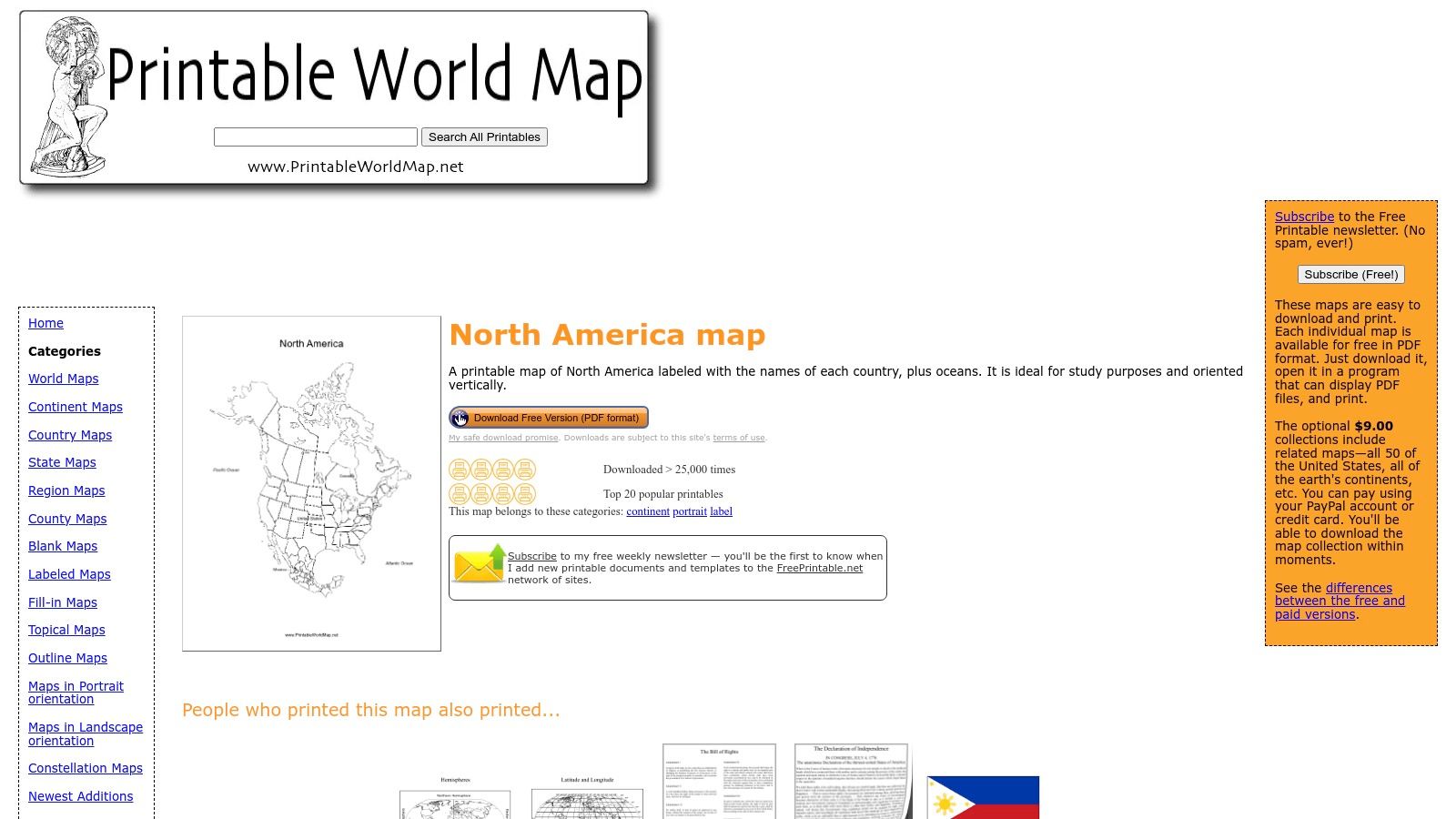
The website is designed for pure utility. Users can instantly download various map versions without any registration or fees. The focus is on providing functional, clear outlines of the continent perfect for educational activities like labeling countries, coloring geographical features, or creating quick study guides. While it's a great tool to learn about one of the seven continents on earthchasers.com, it is not intended for decorative or professional use.
Key Features and Considerations
The main appeal of PrintableWorldMap.net is its straightforward accessibility. It offers a handful of essential map types that cover most academic needs, all pre-formatted for standard letter-sized paper, removing any guesswork from the printing process.
- Map Style: Simple, clean-line political maps available in several functional variations.
- Finish Options: Digital PDF format only, designed for immediate home or school printing.
- Use Case: Ideal for classroom handouts, student quizzes, geography homework, and practice exercises for identifying countries and capitals.
Limitations and Digital Access
The platform's primary strength, its simplicity, is also its main limitation. The maps feature a basic, utilitarian design and lack the detail, visual flair, or customization options found on more advanced platforms. There are no tools for adding layers, changing colors, or adjusting projections. Optional paid bundles are available for users who want a larger collection of maps in one package, but the core offering remains free.
- Pros: Completely free with instant, one-click PDF downloads; no registration required; perfect for educational activities and quizzes.
- Cons: Very basic design with no aesthetic or decorative appeal; limited map variations and no customization features.
Website: PrintableWorldMap.net North America Map
4. D-Maps.com
For educators, students, or hobbyists needing a no-frills, functional map, D-Maps.com is a treasure trove of free cartographic resources. This platform excels by offering an extensive library of base maps in various formats and styles, making it one of the most versatile free options available. Whether you need a simple blank outline for a classroom exercise or a colored map showing major cities, D-Maps likely has a suitable version ready for immediate download.
The site's strength lies in its simplicity and sheer volume of choice. It bypasses complex customization tools in favor of a straightforward directory of pre-made maps. Users can quickly find a printable map of North America tailored to specific needs, such as highlighting states, provinces, or just the continent's outline, and download it in formats like PDF, GIF, or AI without any registration or cost.
Key Features and Considerations
The appeal of D-Maps is its directness and utility. It serves a clear purpose: providing a wide variety of basic maps for educational and personal use, and it does so effectively. The interface is dated but highly functional, prioritizing access over aesthetics.
- Map Style: A vast collection of outline, blank, political, and physical base maps. Includes variants with or without labels, cities, and colors.
- Finish Options: Direct digital downloads are available in multiple formats, including PDF, GIF, CDR, SVG, AI, and WMF, offering flexibility for printing or digital editing.
- Use Case: Ideal for classroom handouts, homework assignments, test creation, or as a base layer for personal projects and presentations.
Limitations and Digital Access
The primary limitation of D-Maps is the utilitarian design quality; these maps lack the professional polish of paid alternatives. While free for personal and educational use, the licensing terms require careful review for any commercial or public-facing applications, often requiring attribution. The website is also ad-supported, which can be a minor distraction.
- Pros: Completely free to download and print; huge selection of map styles and variants; multiple file formats available.
- Cons: Basic, unpolished design; licensing requires careful attention for non-personal use.
Website: D-Maps.com North America Maps
5. Mapswire
Mapswire offers a streamlined and highly accessible source for high-quality, free printable maps of North America. It stands out by providing clean, modern map designs under a Creative Commons license (CC-BY 4.0), making it an excellent choice for educators, students, and content creators who need professional-grade maps without licensing fees. The platform focuses on delivering high-resolution, logo-free files that are ready for immediate use.
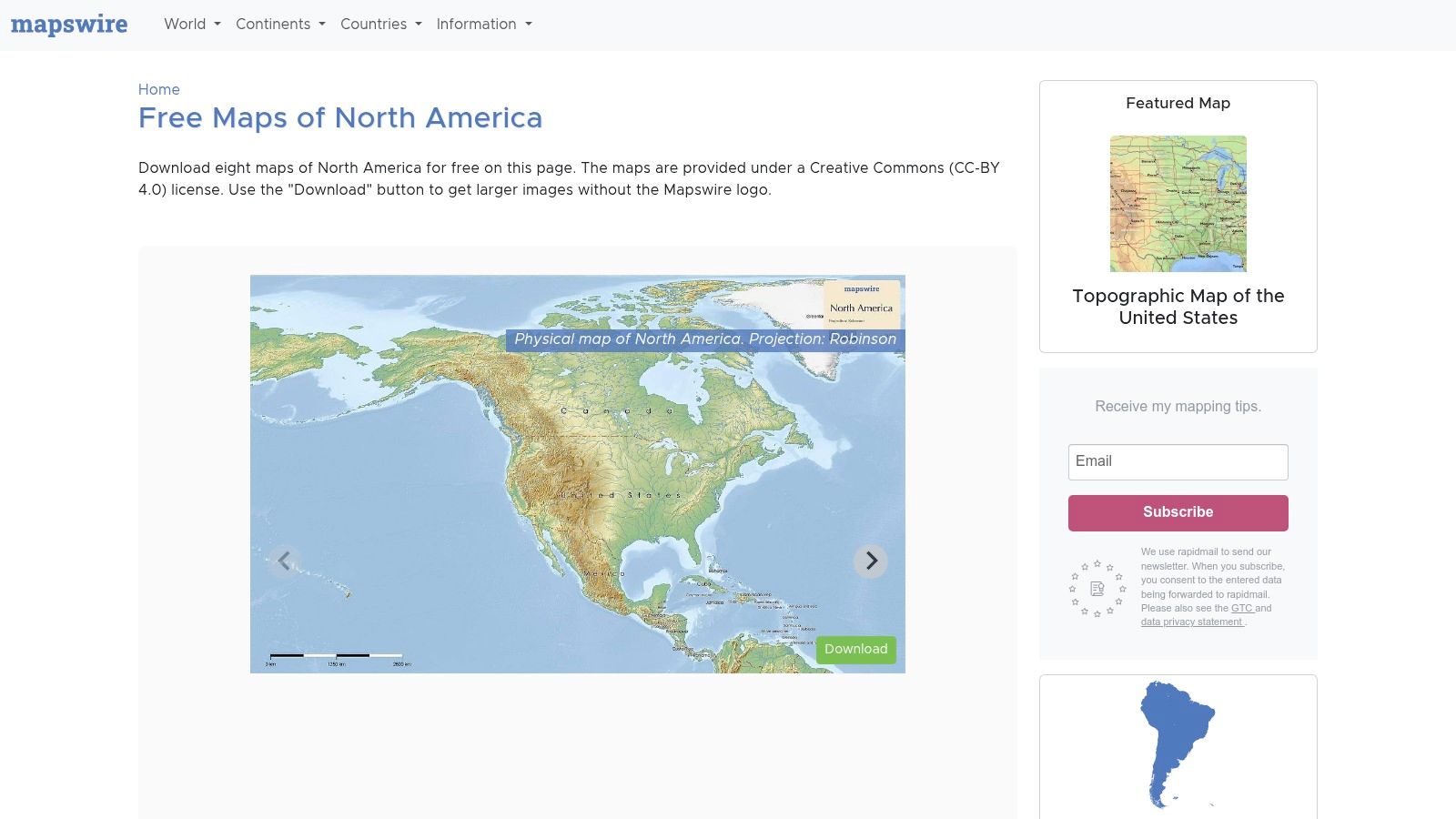
This website is perfect for users who require flexibility. The clear attribution-based licensing allows for wide-ranging use in presentations, school projects, or non-commercial publications, as long as proper credit is given. Mapswire provides various styles, including political outlines, physical terrain, and completely blank versions, catering to diverse needs from classroom labeling exercises to strategic planning overlays.
Key Features and Considerations
The primary appeal of Mapswire is its simplicity and permissive usage rights. Users can quickly download a high-resolution printable map of North America in PNG format, with options for different cartographic projections to suit specific analytical or visual requirements.
- Map Style: Includes physical, political, and blank outline maps with clear, easy-to-read typography and color schemes.
- Finish Options: Digital download only (high-resolution PNG), ready for printing on standard or large-format paper.
- Use Case: Ideal for educational materials, academic presentations, student homework, and non-commercial creative projects where attribution is feasible.
Limitations and Digital Access
Mapswire's strength is its direct, no-cost digital access. The main limitation is its focused scope; it provides maps and not much else. Unlike comprehensive educational platforms, you won't find accompanying lesson plans, interactive quizzes, or detailed classroom activity guides. The collection, while high-quality, is also less extensive than massive subscription-based archives.
- Pros: Completely free with clear Creative Commons licensing; high-resolution, logo-free downloads; clean and modern map designs.
- Cons: Limited variety of supplementary educational resources; requires attribution for use.
Website: Mapswire North America Maps
6. FreeVectorMaps.com
For graphic designers, publishers, or anyone needing a high-resolution, infinitely scalable map, FreeVectorMaps.com is a specialized and powerful resource. It moves beyond standard image files like JPG or PNG, offering professional-grade vector files (SVG, AI, EPS) of the continent. This format allows for complete customization and enlargement without any loss of quality, making it perfect for large-format printing or detailed design work.
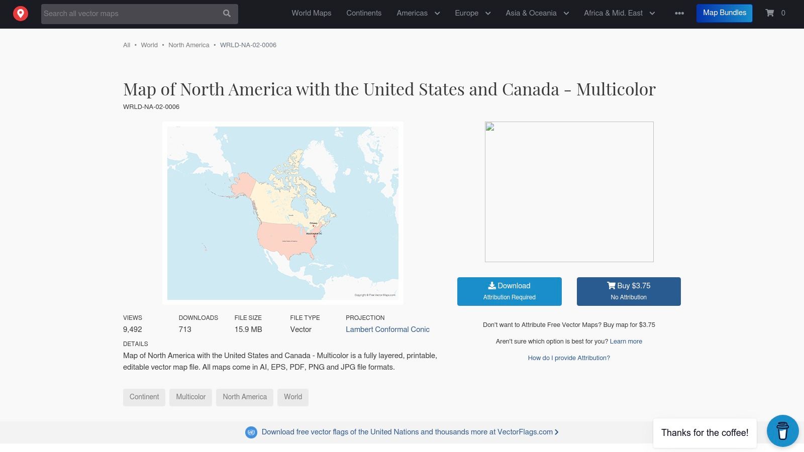
The platform operates on a freemium model. You can download a high-quality printable map of North America for free, but it requires you to give attribution to the site. For a very small fee, you can purchase a license that removes this requirement, making it an incredibly affordable solution for commercial or professional projects where attribution isn't feasible.
Key Features and Considerations
The main advantage here is the editable nature of the maps. Users with access to software like Adobe Illustrator or Inkscape can modify layers, change colors, isolate specific countries or states, and add their own data before printing. This level of control is unmatched by static image-based map providers.
- Map Style: Clean, modern vector outlines available in full color or single-color versions.
- Finish Options: Digital files only; the final "finish" depends on how you print the file.
- Use Case: Ideal for graphic design projects, academic presentations, custom wall art, and professional publications requiring high-resolution cartography.
Limitations and Digital Access
The primary limitation is its target audience. This is not a "click-and-print" solution for casual users. To get the most out of FreeVectorMaps.com, you need access to and familiarity with vector editing software. The files are not simple PDFs and require technical skill to manipulate effectively.
- Pros: Infinitely scalable vector files for perfect print quality at any size; very affordable licensing to remove attribution.
- Cons: Requires specialized vector editing software (e.g., Adobe Illustrator) to use; not suitable for users seeking a simple, ready-to-print PDF.
Website: FreeVectorMaps North America
7. MapChart
For users who need to create a custom-themed or color-coded printable map of North America quickly, MapChart is an outstanding free tool. It excels at producing clear, simple political maps ideal for presentations, educational projects, or personal tracking. The platform's strength lies in its interactive simplicity: users can click on countries, states, or provinces to color them in, add labels, and generate a unique map in minutes without needing an account.
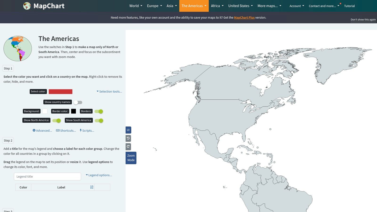
This web-based tool is not for creating detailed physical or topographical maps. Instead, it serves a specific niche for visualizing data, illustrating territories, or creating visuals for reports. Once customized, the map can be downloaded as a high-resolution PNG, JPEG, or SVG file, making it perfectly suited for direct printing or embedding into digital documents. As a powerful custom map creator, MapChart provides a fast and efficient solution for on-demand map generation.
Key Features and Considerations
MapChart’s value is its speed and ease of use. The intuitive interface allows anyone to become a map-maker, translating data or ideas into a clean visual format without any complex software or design skills.
- Map Style: Simple, clean political outlines focused on countries, states, and provinces.
- Finish Options: Digital download only, available in PNG, JPEG, or SVG formats for flexible use.
- Use Case: Best for students visualizing data for a project, presenters needing a custom graphic, or hobbyists tracking travels.
Limitations and Digital Access
The primary limitation is the map's simplicity. It lacks any significant physical geography details like mountains, rivers, or detailed city placements, focusing strictly on political boundaries. This makes it unsuitable for in-depth geographical study or for use as a decorative wall map where rich detail is desired. Access is entirely free and browser-based, with no software to install.
- Pros: Completely free with no account needed; incredibly fast and easy to create custom color-coded maps; multiple high-quality export options.
- Cons: Limited to political boundaries with minimal physical detail; not suitable for professional cartographic or decorative purposes.
Website: MapChart Americas Map
8. Amazon (Maps International and National Geographic listings)
For those who prefer a tangible product delivered quickly, Amazon serves as a massive marketplace for high-quality wall maps from reputable publishers like Maps International and National Geographic. While not a source for an instantly printable map of North America, it offers a vast selection of professionally printed, physical maps that can be ordered and delivered, often with the convenience of Prime shipping. This makes it an excellent choice for educators, businesses, or decorators who need a durable, high-resolution map without the hassle of printing and mounting it themselves.
The platform's strength lies in its variety and the power of customer reviews. You can easily compare different styles, sizes, and finishes from multiple sellers in one place, reading feedback from other buyers to gauge quality and accuracy. Options range from detailed political maps to stunning physical relief charts, with many available in a laminated finish perfect for classroom or office use.
Key Features and Considerations
Amazon streamlines the process of acquiring a professional-grade map by consolidating inventory from numerous cartographic brands. The user-friendly interface and reliable delivery network make it a go-to for convenience.
- Map Style: Extensive range including political, physical, and satellite imagery maps from various publishers.
- Finish Options: Paper, laminated (for dry-erase use), framed, and canvas print options are widely available.
- Use Case: Ideal for classrooms, offices, logistics planning, or home decor where a ready-to-hang physical map is preferred.
Limitations and Digital Access
The primary drawback is the same as any physical retailer: you are buying a finished product, not a digital file for printing. This is a source for purchasing a pre-printed map, not for downloading a printable version. Prices and quality can vary significantly between sellers, so it's crucial to read product descriptions and reviews carefully to ensure the dimensions and material meet your expectations.
- Pros: Huge variety from trusted brands; fast shipping with Prime; customer reviews help guide purchasing decisions.
- Cons: Not a source for digital printables; quality and pricing vary by seller; requires careful verification of product details.
Website: Amazon North America Maps
9. Target (National Geographic North America Wall Map)
For those looking for the reliability of National Geographic cartography through a familiar and convenient retail channel, Target offers a straightforward option. The platform sells a specific National Geographic laminated wall map of North America, making it an accessible choice for U.S.-based consumers, educators, and parents who need a durable, classroom-ready map without navigating specialty map stores. This isn't a source for a free printable map of North America, but rather a way to easily purchase a high-quality physical product.
The primary advantage is the streamlined purchasing experience within the Target ecosystem, complete with standard shipping options and return policies. The map's modest size is well-suited for smaller classrooms, study areas, or children's rooms where a massive wall map would be overwhelming. Its laminated surface makes it interactive for lessons and planning, allowing for the use of dry-erase markers.
Key Features and Considerations
Target serves as a convenient distributor for a specific, high-quality National Geographic product, simplifying the buying process for a reliable educational tool. The map itself maintains the high standards of accuracy and clarity expected from its publisher.
- Map Style: Classic political map featuring clearly defined countries, states, and provinces, with shaded physical relief for geographical context.
- Finish Options: Comes in a standard 1.6 mil laminated finish, designed for durability and repeated use with dry-erase markers.
- Use Case: Ideal for home learning environments, K-12 classrooms, or as a functional decorative piece in a student's bedroom or playroom.
Limitations and Digital Access
The main limitation is the lack of choice. Target offers a single size (approximately 24" x 30") and finish, unlike dedicated map retailers that provide a wide variety of options. This platform does not offer any digital or directly printable versions; it is exclusively for the purchase of this specific physical wall map. It's a great option for convenience, but not for customization.
- Pros: Accessible through a major U.S. retail storefront; modest size is perfect for smaller spaces and classrooms.
- Cons: Very limited selection with only one size and finish available; not a source for instant printable downloads.
Website: Target National Geographic North America Wall Map
10. Staples (National Geographic North America Wall Map)
For educators and office managers who prefer a streamlined procurement process, Staples offers a convenient channel to acquire a high-quality National Geographic North America map. This option merges the cartographic authority of National Geographic with the reliable logistics of a major office supplier. It’s an ideal solution for institutions that already have accounts with Staples, allowing them to bundle a map purchase with other essential supplies.
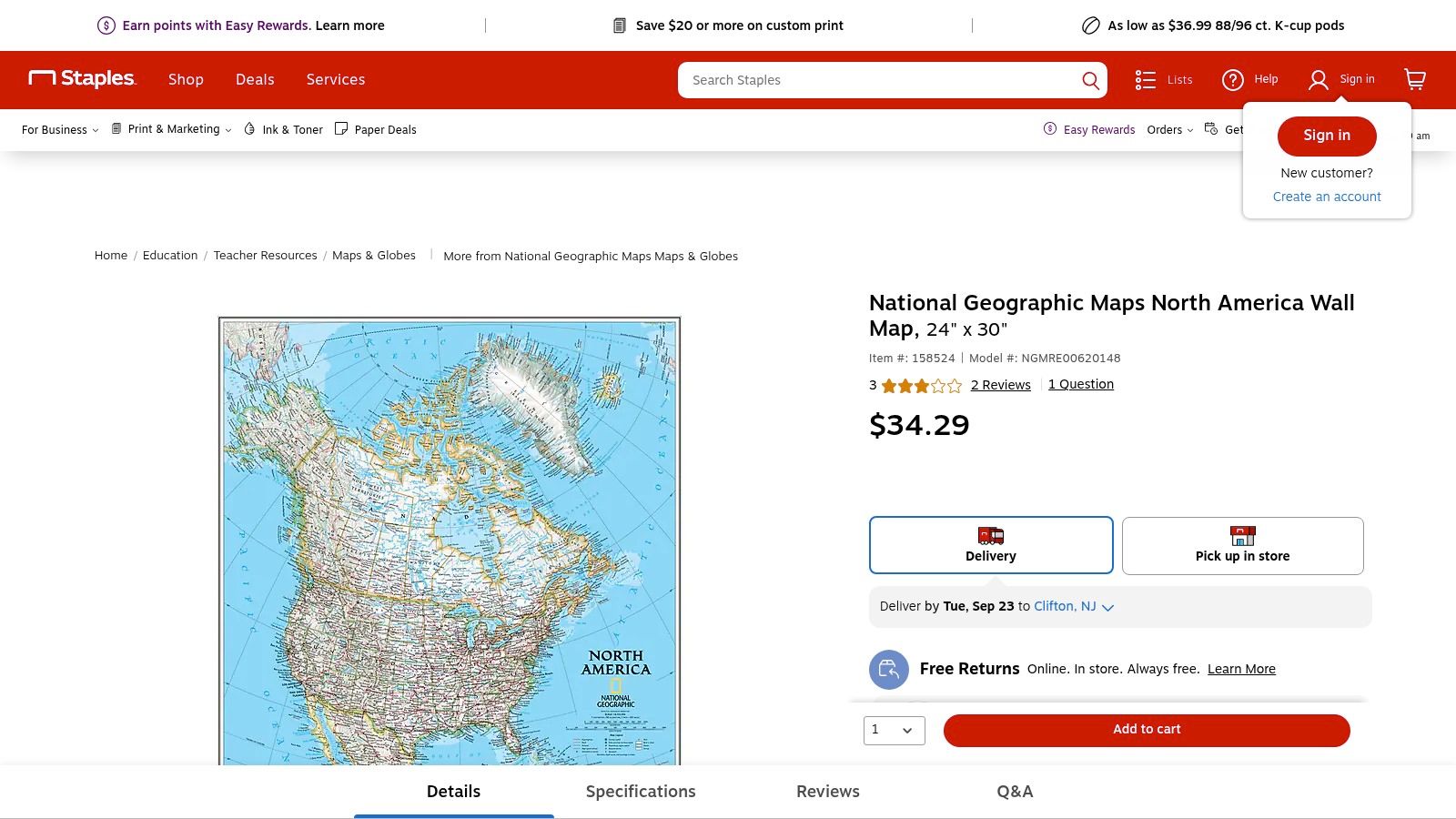
This platform isn't a direct source for a printable map of North America that you can download and print yourself. Instead, it provides a ready-made, physical, laminated product perfect for classroom or professional settings. The convenience of in-store pickup, fast delivery, and a straightforward return policy makes it a practical choice for those who need a durable map without navigating specialized cartography websites.
Key Features and Considerations
The primary advantage here is convenience and trusted fulfillment. You're getting a proven National Geographic product through a familiar, business-friendly vendor, simplifying the purchasing process for schools and companies. The laminated surface is essential for interactive use in educational or planning environments.
- Map Style: Classic political map with physical relief shading from National Geographic.
- Finish Options: Comes in a standard 24" x 30" laminated format, ready for wall mounting and use with dry-erase markers.
- Use Case: Best suited for classrooms, corporate offices, and logistical planning hubs that need a reliable, physical map sourced through a standard office supplier.
Limitations and Digital Access
The main limitation is the lack of variety. Staples typically offers one specific size and style, unlike a dedicated map store. This is a source for a physical product only, so there are no options for an instant digital download or printable file. It's a transactional platform for a specific item, not a resource for diverse or customizable map options.
- Pros: Convenient purchasing for schools and offices with existing accounts; reliable shipping and easy, free returns.
- Cons: Very limited selection of styles and sizes; sells only a physical product, not a digital printable file.
Website: Staples National Geographic North America Wall Map
11. Maps International (official site)
Maps International is another specialist map publisher catering to users who need a high-quality physical map rather than a simple digital download. It offers a large, detailed North America wall map that balances political information with vivid physical geography. The map is an excellent resource for educational settings, logistical planning, or as an impressive decorative piece, providing a clear and comprehensive view of the continent's topography and infrastructure.
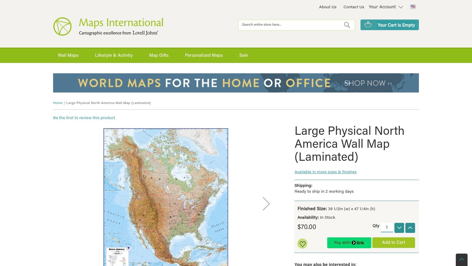
Similar to other premium map stores, this platform focuses on tangible products designed for longevity and clarity. Its detailed rendering of transportation lines, city tiers, and physical features like elevation and water depth makes it a powerful tool for academic study or business analysis. The availability of various sizes and finishes allows for customization based on specific needs, whether for a classroom wall or a corporate boardroom.
Key Features and Considerations
The standout quality of Maps International products is the sheer density of accurate information presented in an accessible format. The physical map provides a level of detail that is often difficult to appreciate on a screen, making it a superior reference for in-depth geographical exploration.
- Map Style: A hybrid physical-political map with vibrant colors to denote terrain and clear labeling for cities, borders, and transportation routes.
- Finish Options: Available in multiple sizes with options for paper, laminated, or mounted finishes to suit different durability and display requirements.
- Use Case: Ideal for classrooms, logistics and transport offices, libraries, or anyone needing a detailed physical reference map of North America.
Limitations and Digital Access
The primary drawback is its focus on physical products, making it less suitable for those seeking a quick, free printable map of North America for immediate use. Users must purchase a physical item and wait for shipping. Furthermore, stock and lead times can vary depending on the selected size and finish, which may impact planning for time-sensitive projects.
- Pros: High-quality, detailed physical cartography; flexible sizes and finishes for different applications.
- Cons: Not a source for instant printable files; shipping and potential lead times for physical products.
Website: Maps International Large North America Wall Map
12. Teachers Pay Teachers (TPT)
For educators, parents, and students, Teachers Pay Teachers (TPT) is an invaluable marketplace for classroom-ready resources, including a vast assortment of printable North America maps. Instead of offering a single, static map, TPT provides access to materials created by teachers for teachers. This means you can find everything from simple blank outlines for labeling quizzes to detailed political maps, coloring pages, and comprehensive worksheet packets designed for various grade levels.
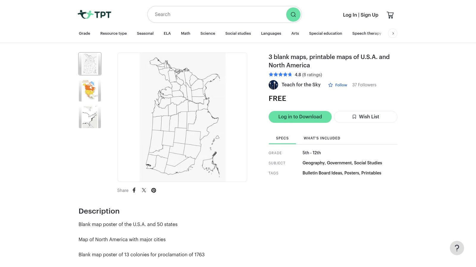
The platform operates on an instant-download model, with both free and paid options available as low-cost PDFs. This makes it exceptionally convenient for last-minute lesson planning or finding a specific type of map for a homework assignment. User ratings and detailed previews help you assess the quality of a resource before purchasing, ensuring it meets your specific educational needs.
Key Features and Considerations
The strength of TPT lies in its sheer variety and focus on educational utility. The resources are designed by people who understand classroom dynamics, resulting in practical and effective teaching tools.
- Map Style: Wide variety including blank, labeled, political, physical, and activity-based worksheets (e.g., Montessori-style, labeling exercises).
- Finish Options: Digital PDF files, typically formatted for standard letter-size (8.5x11 inch) paper for easy printing.
- Use Case: Ideal for classroom activities, student assessments, homeschooling lessons, and supplemental learning materials.
Limitations and Digital Access
The primary consideration with TPT is the variability in quality and style. Since resources are created by countless individual sellers, there is no standardized cartographic accuracy or design aesthetic. It is essential to carefully review the product previews and user feedback before downloading or purchasing. While many resources are free, premium, more comprehensive map packets require a small payment.
- Pros: Huge selection of education-focused maps; instant downloads for immediate use; user reviews help guide selection.
- Cons: Quality and accuracy can vary significantly between creators; requires sifting through options to find the best fit.
Website: Teachers Pay Teachers North America Maps
12-Source Printable North America Map Comparison
| Item | Core Features/Characteristics | User Experience/Quality ★★★★☆ | Value Proposition 💰 | Target Audience 👥 | Unique Selling Points ✨ |
|---|---|---|---|---|---|
| National Geographic Maps (official store) | Laminated, durable wall maps; multiple sizes | Trusted cartography; high durability ★★★★☆ | Premium physical maps 💰💰 | Classrooms, offices, decor 👥 | Laminated dry-erase option; official brand 🏆 |
| National Geographic MapMaker (free printable/export) | Browser-based customizable maps | Fast, free, easy to use ★★★★☆ | Free tool 💰 | Educators, students 👥 | Instant print/export; no install required ✨ |
| PrintableWorldMap.net | Printer-ready PDFs in various formats | Utilitarian style; easy access ★★★☆☆ | Mostly free, optional paid bundles 💰 | Teachers, students 👥 | Quick one-click downloads ✨ |
| D-Maps.com | Wide range: blank, labeled, colored maps | Basic design quality ★★★☆☆ | Free for personal/educational use 💰 | Educators, hobbyists 👥 | Extensive style/format options |
| Mapswire | High-res, Creative Commons maps | Clean, easy to read ★★★★☆ | Free with attribution 💰 | Educators, flexible users 👥 | Multiple projections; logo-free downloads ✨ |
| FreeVectorMaps.com | Editable vector (SVG, AI, EPS) files | Professional design, requires software ★★★★☆ | Free with attribution, low-cost licenses 💰 | Designers, print pros 👥 | Scalable, editable vectors; affordable licenses ✨ |
| MapChart | Interactive coloring and labeling | Fast, simple customization ★★★★☆ | Free to use 💰 | Presenters, educators, students 👥 | No account needed; multiple export formats ✨ |
| Amazon (Maps International & NatGeo) | Wide variety, laminated and framed | Convenient shopping; variable quality ★★★☆☆ | Pricing varies by seller 💰💰 | General buyers 👥 | Prime shipping; extensive reviews 🏆 |
| Target (National Geographic Wall Map) | Laminated, classroom-sized wall maps | Modest options, reliable quality ★★★☆☆ | Affordable retail price 💰 | Classrooms, general users 👥 | Easy U.S. retail access |
| Staples (National Geographic Wall Map) | Laminated wall maps with delivery/pickup | Reliable service, limited variety ★★★☆☆ | Standard pricing 💰 | Schools, offices 👥 | Free returns, local pickup option |
| Maps International (official site) | Large, detailed physical maps with multilayer info | High cartographic detail ★★★★☆ | Premium pricing 💰💰 | Classrooms, decor, logistics 👥 | Elevation, transport details; flexible finishes ✨ |
| Teachers Pay Teachers (TPT) | Printable maps in various styles & teaching levels | Variable quality; user ratings helpful ★★★☆☆ | Low-cost PDFs; some free 💰 | Teachers, homeschoolers 👥 | Instant download; diverse educational styles ✨ |
Choosing the Right Map for Your Journey
Navigating the vast landscape of cartographic resources can feel as daunting as exploring the continent itself. Throughout this guide, we have journeyed through an extensive collection of tools and platforms, each offering a unique approach to creating or acquiring the perfect printable map of North America. From the authoritative, high-quality prints available at National Geographic and Maps International to the versatile, free-to-use digital customization tools like MapMaker and MapChart, the options are as diverse as the continent's geography.
The key takeaway is that the "best" resource is entirely dependent on your specific mission. There is no single, one-size-fits-all solution. Your ideal map is a direct reflection of your intended use, whether you are a geography enthusiast planning a detailed study, an educator crafting an engaging lesson plan, or a gamer building a rich, immersive world. The journey begins with clearly defining your purpose.
Recapping Your Cartographic Toolkit
To streamline your decision-making process, let's distill our findings into actionable categories. Think of this as your final checklist before embarking on your map-based project.
For Unmatched Detail and Durability: If your goal is a permanent, high-fidelity wall display for an office, classroom, or study, investing in a professionally printed map is the superior choice. Sources like the National Geographic official store, Maps International, and even retail giants like Amazon and Target offer professionally produced maps that serve as both beautiful decor and authoritative reference materials. These are built to last and provide a level of detail that home printing simply cannot replicate.
For Ultimate Customization and Interactivity: When your project demands flexibility, digital tools are your best allies. National Geographic's MapMaker stands out for its powerful layering and annotation features, making it ideal for creating specific, data-rich educational materials. Similarly, MapChart offers unparalleled ease for color-coding regions, perfect for visualizing data, planning gaming campaigns, or creating quick study guides.
For Niche and Specialized Applications: For those needing specific outlines or vector files, resources like D-Maps.com and FreeVectorMaps.com are invaluable. They provide the clean, scalable base maps that graphic designers, researchers, and hobbyists need for more technical projects. These platforms are the go-to for when you need a blank canvas to build upon.
For Classroom-Ready Educational Content: Educators looking for a time-saving solution will find a treasure trove on Teachers Pay Teachers (TPT). This marketplace offers a vast library of worksheets, lesson plans, and activities centered around North American geography, created and tested by fellow teachers. It bridges the gap between a blank map and a fully-formed, engaging lesson.
From Static Page to Dynamic Adventure
Your exploration of North America shouldn't end with a printed page. A physical printable map of North America is an essential tool for foundational learning, helping to build a mental framework of the continent's countries, cities, and physical features. However, to truly solidify that knowledge and bring geography to life, integrating your static map with an interactive experience is the most effective next step.
Once you have studied the mountains, rivers, and borders on your printed map, challenge yourself to apply that knowledge in a dynamic setting. This synthesis of tactile and digital learning creates stronger neural pathways, transforming abstract names on a page into memorable, tangible locations. The ultimate goal is to move beyond simple memorization and foster a genuine, lasting understanding of the spatial relationships that define the continent.
Ready to put your newfound geographical knowledge to the ultimate test? Take your learning from the page to the planet with EarthChasers. After studying your printed map, jump into our immersive 3D geography game to see if you can pinpoint locations and landmarks across the globe in a fun, competitive environment. Visit EarthChasers to start your adventure and turn map-reading into a thrilling chase