What Are Latitude and Longitude Explained Simply
Understand what are latitude and longitude with our simple guide. Learn how these invisible lines map our world and power GPS technology everywhere.
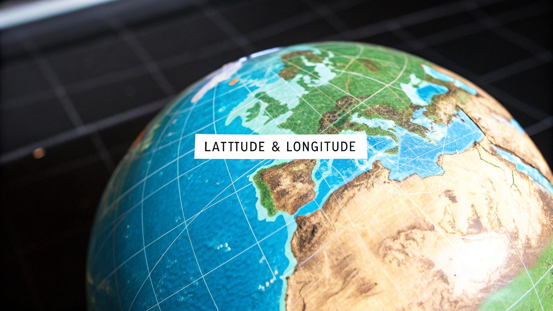
Ever tried to describe a specific spot on a map without just pointing? It's tough. You need a reference system, a universal address book for the entire planet. That’s exactly what latitude and longitude give us.
Think of latitude lines as horizontal rungs on a ladder, wrapping around the globe. They tell you how far north or south you are from the Equator. Then you have longitude lines, which run vertically like the slices of an orange, telling you how far east or west you are from a starting line in Greenwich, London.
Unlocking Your Global Address
Without this grid, the Earth would just be a giant, unmarked sphere. How would you tell a friend where to meet you in the middle of a national park, or guide a ship to a specific port? This system of invisible lines creates a geographic coordinate system that lets us pinpoint any location with incredible precision.
This isn't just some old-school concept for mapmakers and sailors. It's the engine running the GPS in your phone, the navigation in your car, and the location tags on your photos. Every time you ask for directions or see where a friend has checked in, you're tapping into a system that's been around for centuries.
The Two Halves of a Coordinate
To really get a feel for how this works, you have to look at the two parts separately.
Latitude (Parallels): These lines run east-west, but they measure your position north or south. The baseline is the Equator, which sits at 0° latitude. Anything above it is in the Northern Hemisphere, and anything below is in the Southern Hemisphere.
Longitude (Meridians): These lines run north-south, from pole to pole. They measure your position east or west of the starting point, the Prime Meridian, which is 0° longitude and passes through Greenwich, London.
When you put a latitude and a longitude value together, they cross at one single point on Earth. That gives every spot its own unique address. For example, the Statue of Liberty is at roughly 40.6892° N (its latitude) and 74.0445° W (its longitude). If you only had one of those numbers, you’d just have a very long line, not a specific place.
A simple trick to keep them straight: Latitude sounds like "ladder," and you climb a ladder up (north) or down (south). Longitude lines go the long way around the Earth.
This simple but brilliant grid is the foundation of global navigation. Let's break down the key differences in a quick comparison.
Here's a handy table that puts the core concepts side-by-side, making it easy to see how they differ.
Latitude vs Longitude Quick Comparison
| Feature | Latitude | Longitude |
|---|---|---|
| Direction | Runs East-West | Runs North-South |
| Measures | Distance North or South | Distance East or West |
| Reference Line | Equator (0°) | Prime Meridian (0°) |
| Range of Values | 0° to 90° North or South | 0° to 180° East or West |
| Shape of Lines | Parallel circles | Semicircles converging at poles |
| Common Name | Parallels | Meridians |
Having this clear distinction in mind is the first step to mastering how we map and navigate our world. Each coordinate plays its own crucial role, but they only become a powerful tool when used together.
Understanding Latitude: The Rungs on Earth's Ladder
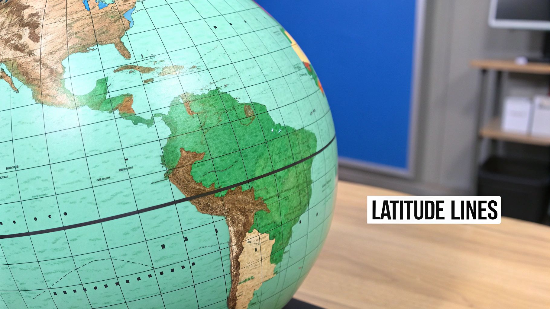
Let's start with the first piece of our global address system: latitude. The easiest way to picture it is to think of Earth as a giant orange. The lines of latitude are like perfectly even slices cut horizontally, running parallel to one another all the way around. They're often called the "rungs on Earth's ladder" because they let us measure how far north or south we are.
Right in the middle of it all is the most important line, the Equator. This is the widest part of our planet, wrapping around its belly. We use the Equator as the official starting point for all north-south measurements, giving it the value of 0° latitude. Everything is measured in degrees away from this baseline.
This natural starting point is what makes latitude feel so intuitive. Unlike longitude, which we'll get to later, the Equator is a real, physical reference. For centuries, this allowed sailors to figure out their latitude with surprising accuracy just by measuring the angle of the sun at noon or certain stars above the horizon. This ancient practice is a core part of the answer to "what are latitude and longitude." You can dive deeper into how these astronomical observations worked with this detailed explainer on EBSCO.
Key Parallels and Their Purpose
As you move away from the Equator, the degrees of latitude get bigger. Heading north, the numbers climb from 0° at the Equator all the way up to 90° N at the North Pole. If you go south, they increase to 90° S at the South Pole. These lines are also called "parallels" for a simple reason: they run perfectly parallel to each other and never, ever cross.
A key takeaway: One degree of latitude covers a distance of roughly 69 miles (111 kilometers) on the ground. This measurement stays pretty much the same whether you're relaxing on the Equator or bundled up near the poles.
While every degree marks a spot, a few specific parallels have special significance. They aren't just random lines; they're directly tied to Earth's climate zones and the changing of the seasons.
- Tropic of Cancer (23.5° N): This is the northernmost line where the sun can appear directly overhead at noon. It marks the beginning of summer in the Northern Hemisphere.
- Tropic of Capricorn (23.5° S): The southern equivalent, this is the most southerly point for the overhead sun, kicking off summer in the Southern Hemisphere.
- Arctic Circle (66.5° N): Once you cross this line heading north, you enter the land of the midnight sun, experiencing at least one full day of 24-hour daylight in summer and 24-hour darkness in winter.
- Antarctic Circle (66.5° S): The same phenomenon occurs south of this parallel, which defines the boundary of the Antarctic region.
These lines aren't just pulled out of thin air. They're a direct result of Earth's 23.5° axial tilt. It’s this very tilt that gives us seasons. As our planet makes its yearly trip around the sun, different parts of the globe are angled to receive more direct sunlight. This makes latitude far more than a simple coordinate—it's a powerful clue to a location's climate and the amount of daylight it receives throughout the year.
Exploring Longitude: The Slices of Our Globe
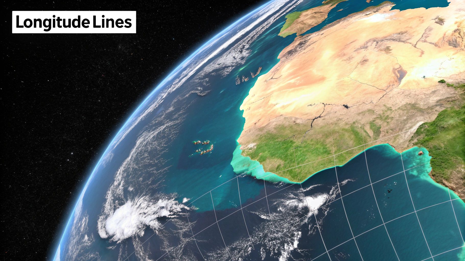
We've covered the horizontal "rungs" of Earth's grid, so let's move on to the vertical lines that complete the picture: longitude. If latitude lines are neat, parallel hoops around the planet, longitude lines are more like the seams on a basketball, running from the North Pole all the way down to the South Pole.
Think of the Earth as an orange. Each line of longitude, or meridian, is like the edge of one of the slices, meeting at a single point at the top and bottom. These lines are what we use to measure our position east or west.
But there was a catch. Unlike latitude, which has a clear, natural starting point with the Equator, longitude had no obvious "zero" line. This created a massive headache for sailors and explorers for centuries, a famous challenge that became known as the "longitude problem." Trying to pinpoint a ship's east-west position without a fixed reference was a dangerous guessing game that led to countless disasters at sea.
The Prime Meridian: A Man-Made Starting Line
To solve the problem, the world had to agree on an official starting line. Finally, in 1884, an international conference chose the Royal Observatory in Greenwich, London, as the spot for the Prime Meridian. This established 0° longitude as the universal reference point for global mapping and timekeeping.
This single line neatly divides the globe into the Eastern and Western Hemispheres. From this starting point, we measure longitude 180° to the east and 180° to the west. On the opposite side of the planet, the 180° meridian serves as the basis for the International Date Line.
Here’s a key difference: A degree of latitude is always the same distance, but a degree of longitude isn't. The distance shrinks as you move toward the poles. At the Equator, one degree of longitude is about 69 miles wide. At the poles, all the lines converge, so the distance is 0 miles.
How Longitude Shapes Your Day
Longitude isn't just about location; it's also about time. You experience its effects every single day. Since the Earth is a sphere that rotates 360° in about 24 hours, there's a direct and simple link between longitude and the clock on your wall.
This relationship is exactly why we have time zones:
- The planet spins at a rate of about 15 degrees of longitude per hour (360° divided by 24 hours).
- For every 15 degrees you travel east, the local time jumps ahead by one hour.
- Travel 15 degrees west, and the clock rolls back by an hour.
It’s the reason a flight from New York to London feels like you've fast-forwarded through time, and a trip from San Francisco to Tokyo can land you in "tomorrow." The lines of longitude you cross are directly tied to the hours and minutes on your watch, making this coordinate system fundamental to our modern, connected world.
How We Learned to Map Our World
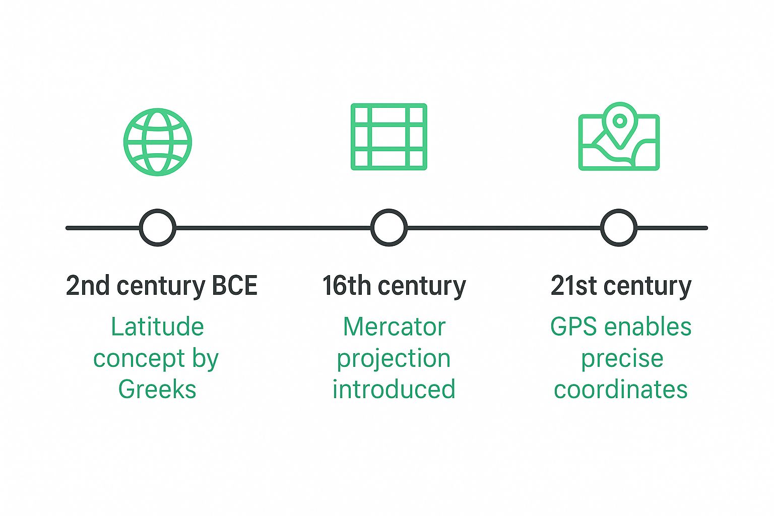
That precise grid of latitude and longitude powering your phone’s GPS wasn’t just invented; it was earned. It's the culmination of a dramatic human story, a centuries-long quest to solve one of the most dangerous puzzles in history. The journey began with ancient navigators and astronomers who first dreamed of a global grid, setting the stage for an incredible journey of scientific discovery.
Early Greek thinkers like Eratosthenes and Ptolemy laid the essential groundwork. They knew the Earth was a sphere and came up with the idea of latitude lines, which were relatively easy to calculate by watching the sun or the stars. But longitude remained a deadly mystery. Without a reliable way to figure out their east-west position, sailors were constantly getting lost at sea, leading to countless shipwrecks and failed expeditions. This challenge became famously known as the "longitude problem."
The Great Longitude Problem
At its heart, the issue was time. To know your longitude, you need to compare your local time (easy enough to find with the sun) to the time at a known, fixed reference point, like your home port. The key was an accurate clock. Unfortunately, the pendulum clocks of the day were completely useless on the violently rocking deck of a ship. The search for a solution became a global obsession, with governments offering massive rewards to anyone who could finally crack the code.
The idea of using time to measure longitude wasn't new. Ancient Greek astronomers like Hipparchus and Ptolemy even tried using lunar eclipses to sync up time between different places. While the theory was solid, actually making accurate, simultaneous observations was next to impossible. The stakes were so high that countries like Spain started offering huge cash prizes as early as 1567, underlining just how critical this was for trade and empire.
This really puts it into perspective: while the core ideas are ancient, the ability to use them with pinpoint accuracy is a very recent achievement in the grand sweep of human history.
The Clockmaker Who Changed Everything
The hero of this story wasn't a famous astronomer or a royal mathematician. He was a humble English carpenter and self-taught clockmaker named John Harrison. He dedicated his entire life to a single, stubborn goal: building a clock that could keep perfect time at sea, no matter how rough the journey.
After decades of relentless tinkering and obsession, he produced his masterpiece, the H4 marine chronometer. It was a game-changing timepiece, small enough to hold but tough enough to maintain incredible accuracy through storms and brutal ocean voyages. For the first time, sailors could finally calculate their longitude with confidence.
Harrison’s invention was a true turning point. It transformed maritime navigation from a dangerous, high-stakes guessing game into a precise science, saving countless lives and opening the door for safe global trade and exploration.
So, the next time you pull up a map on your screen, take a moment to appreciate the incredible history behind those simple lines. You can even chart your own adventures and explore historical locations with our custom map creator to see this amazing system in action. That invisible grid in your pocket is a direct descendant of this incredible story of human ingenuity.
How to Read and Write Geographic Coordinates
Knowing what latitude and longitude are is the first step. The real fun starts when you can actually use them to pinpoint a location anywhere on the planet. Let's break down how to read and write geographic coordinates.
When you look up a location's coordinates, you'll almost always see them presented in one of two standard formats.
The first, and more traditional, format is Degrees, Minutes, Seconds (DMS). This system breaks down each degree into smaller, more precise units. It helps to think of it like telling time: a degree is like an hour, a minute is a smaller slice of that hour, and a second is an even finer slice of that minute.
A DMS coordinate for the Eiffel Tower, for instance, looks like this: 48° 51' 29.1" N, 2° 17' 40.2" E. The 'N' tells you it's in the Northern Hemisphere, and the 'E' places it in the Eastern Hemisphere. Simple enough.
The Simpler Decimal Format
The second format, and the one you'll see most often with digital maps and GPS, is Decimal Degrees (DD). This system gets rid of the minutes and seconds altogether, using a single decimal number for each coordinate. This makes it much cleaner and easier for computers to work with.
For the Eiffel Tower, the same location in DD format is simply: 48.858083, 2.294500.
You might notice the N, S, E, and W are gone. That's because, in this format, the direction is built right into the number itself using positive and negative values:
- Positive latitude = North
- Negative latitude = South
- Positive longitude = East
- Negative longitude = West
Since both numbers for the Eiffel Tower are positive, we know instantly that it's north of the Equator and east of the Prime Meridian.
To give you a clearer picture, here's how the coordinates for a famous landmark—the Statue of Liberty—look in both formats, plus a third common variation.
Coordinate Formats for a Famous Landmark
| Format | Latitude | Longitude |
|---|---|---|
| Degrees, Minutes, Seconds (DMS) | 40° 41' 21.4" N | 74° 02' 40.2" W |
| Degrees Decimal Minutes (DDM) | 40° 41.3567' N | 74° 02.6700' W |
| Decimal Degrees (DD) | 40.689278 | -74.044500 |
As you can see, they all point to the exact same spot on the globe—they're just different ways of writing the same address.
The order is crucial: latitude always comes first, followed by longitude. A good way to remember this is that you have to climb a "ladder" (latitude) before you can walk along a path (longitude). Getting them mixed up could put your point in the middle of an ocean!
Switching between formats involves a bit of math, but thankfully you don't have to break out the calculator. If you ever need to convert coordinates for a project or are just curious, an online tool is the way to go.
We built our own simple tool to handle it for you. Check out the EarthChasers coordinate converter to switch between formats instantly. Now you're ready to read any map and know exactly what those numbers mean.
Latitude and Longitude in Your Daily Life
It’s easy to think of latitude and longitude as dusty old concepts, something you’d find on a pirate's treasure map. But the truth is, this coordinate system is the invisible engine humming away behind so much of our modern world. It’s working silently in the background every single day, making countless things we take for granted possible.
Think about the last time you used a map app on your phone. The moment you opened it, your phone’s GPS receiver calculated its precise latitude and longitude, dropping that little blue dot on the screen to show you exactly where you are. When you snap a photo and post it online, the geotag embedded in the image file is nothing more than a set of coordinates marking the spot.
More Than Just Maps
This system goes way beyond just personal navigation; it's a critical part of global safety and commerce. When you call for help, emergency services use your phone’s coordinates to pinpoint your location, shaving off precious minutes that can literally save lives.
The applications are massive, forming the backbone of entire global industries.
- Global Aviation: Every single commercial flight follows a predetermined path made up of latitude and longitude waypoints. Air traffic controllers rely on this grid to keep thousands of planes safely separated in the sky.
- Shipping and Logistics: Imagine a massive container ship crossing the Pacific. It navigates the vast, open ocean by constantly checking its GPS coordinates, ensuring that global supply chains keep moving.
- Weather Forecasting: Meteorologists use coordinate data to track hurricanes, predict the path of snowstorms, and issue targeted warnings for a specific town or an entire region.
From finding the nearest coffee shop to coordinating international disaster relief, this system provides the universal language of location. It’s the framework that allows us to connect a digital instruction to a physical place on Earth.
Far from being an abstract classroom topic, understanding latitude and longitude helps you appreciate the fundamental technology that connects our world. It's the system that allows us to create everything from a simple hiking trail map to a detailed map of world capitals, turning our enormous planet into a manageable and understandable space.
FAQs: Putting Latitude and Longitude into Practice
Once you get the hang of what latitude and longitude are all about, a few practical questions almost always come up. Let's dig into some of the most common ones to clear up any lingering confusion.
A classic trip-up is remembering which coordinate to write first. The rule is simple and universal: always latitude, then longitude. If you need a mental hook, think about climbing a ladder (latitude) before you can walk across a hall (longitude). Getting them backward will send you to a completely different part of the world, so it's a detail worth remembering!
People also ask if you can actually see these lines on the ground. The answer is no. The entire grid of latitude and longitude is a human invention—a brilliant one, at that. They're imaginary lines we all agree to use, creating a universal language for location anywhere on the planet.
Is One More Important Than the Other?
This is a great question because the answer has changed over time. For ancient mariners navigating by the stars, latitude was king. It was far easier to figure out how far north or south you were. But today, with GPS in our pockets, both are equally essential.
Think of it like a street address. "123 Main Street" isn't enough; you also need the city and state. Latitude and longitude work the same way—you need both to find a single, precise point.
They are a team. One tells you how far up or down you are, and the other tells you how far left or right. Only when they work together do you get a specific location.
So, just how specific can they get? Incredibly. Using the Decimal Degrees format, modern GPS can pinpoint a location to within a few centimeters. This isn't just for navigating your car; this kind of accuracy is critical for land surveyors, drone operators, and even farmers using precision agriculture.
Ready to see this system in action? EarthChasers lets you jump into a global adventure using these very coordinates. It’s a fun, hands-on way to explore the world and put your new knowledge to the test. Start your first chase and see the globe in a whole new light.