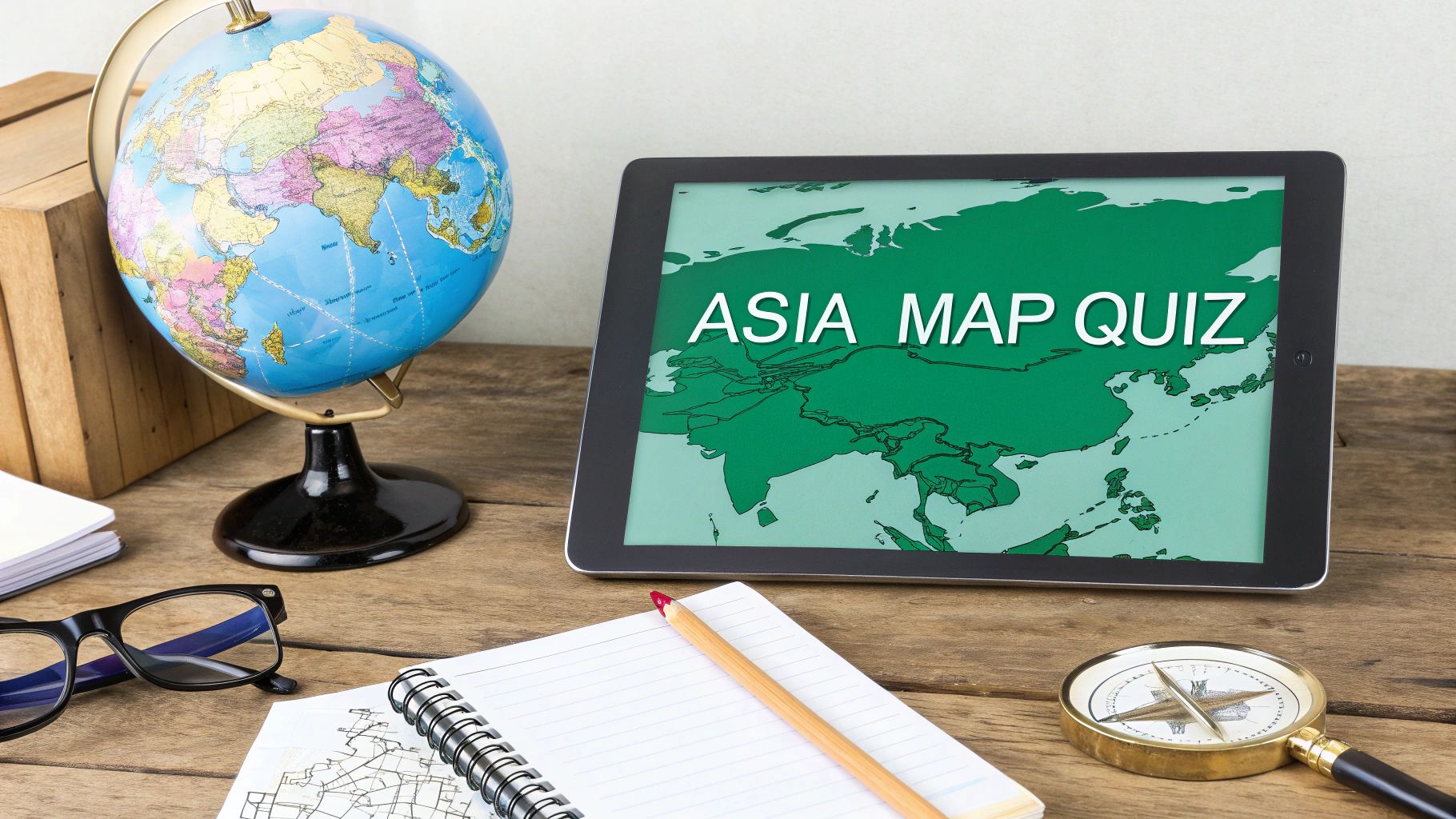
How to Create an Engaging Asia Map Quiz
Learn how to create a compelling Asia map quiz. This guide covers map selection, question design, and interactive tools for classrooms or online learning.
An engaging Asia map quiz is so much more than a memory test. It's a key that unlocks one of the world's most fascinating continents. When done right, a quiz can turn a dry geography lesson into a genuine journey, building a real appreciation for Asia's incredible scale and diversity.
Why a Great Asia Map Quiz Matters
Let's be honest, just asking "Where is Mongolia?" isn't going to light anyone's fire. A truly compelling quiz moves past simple memorization. It tells a story about the continent's rich cultural, historical, and political tapestry. The goal isn't just to test what someone knows—it's to spark their curiosity and make them want to learn more.
The sheer size of Asia makes this approach a necessity. The continent covers roughly 30% of Earth's land area and is home to nearly 60% of the world's population. A standard quiz means identifying up to 49 countries, from giants like China to tiny island nations like the Maldives. You can get a great overview of Asia's geography and its major regions over on Infoplease.
Building an Experience, Not Just a Test
Turning a simple quiz into an adventure requires a bit of strategy. In this guide, I'll walk you through the whole process, focusing on the details that make a quiz both educational and genuinely fun.
Here’s what we’re going to cover:
- Choosing the Right Map: The map you choose—whether it's political, physical, or historical—is the foundation of everything. We'll find the perfect one for your needs.
- Crafting Effective Questions: I'll show you how to build questions with progressive difficulty, keeping learners hooked as their knowledge grows.
- Using Technology Creatively: We'll look at the best tools for the job, from printable PDFs perfect for a classroom to interactive web quizzes you can embed anywhere.
- Gamifying the Journey: You'll learn how to add scoring, leaderboards, and other game-like elements to drive engagement and a little friendly competition.
A great quiz doesn't just measure knowledge; it creates it. By focusing on the user's journey, you can transform a simple geography exercise into a memorable exploration of Asia’s rich and complex identity.
By the end, you'll have a complete blueprint for designing an Asia map quiz that can captivate any audience, whether they're students in a classroom or geography buffs in an online community.
Choosing the Right Map for Your Quiz
The map is the heart of your quiz. Get it right, and your quiz feels intuitive and engaging. Get it wrong, and you’ll just frustrate your players before they even start. The best choice always comes down to who your audience is and what you want them to learn.
For absolute beginners or younger students just dipping their toes into Asian geography, a political map is your best bet. These maps keep things simple, showing clear country borders. They're perfect for foundational questions like identifying India, Japan, or Indonesia without any distracting clutter.
But if you're building a quiz for seasoned geography buffs or want to create a real challenge, a physical map is where the fun begins. This opens up a whole new world of questions. You can ask players to pinpoint the Himalayas, trace the massive Yangtze River, or find the arid expanse of the Gobi Desert.
Here’s a great example of a simple political map of Asia that’s perfect for a beginner-level quiz.
See how clean and uncluttered it is? This design lets participants focus entirely on country shapes and locations, which is exactly what you want for a foundational quiz.
Comparing Map Types for an Asia Quiz
To make the decision a little easier, I've put together a quick comparison table. Think about your quiz goals and who will be taking it, and you'll quickly see which map type is the right fit.
| Map Type | Best For Quizzing | Ideal Audience | Key Challenge |
|---|---|---|---|
| Political | Country identification, capitals, and borders. | Beginners, K-12 students, general knowledge quizzes. | Can be overly simplistic for advanced learners. |
| Physical | Rivers, mountains, deserts, and landforms. | Geography enthusiasts, advanced students. | Can be overwhelming if too detailed or poorly labeled. |
| Topographic | Elevation, terrain, and specific geographic features. | Experts, hikers, environmental science students. | The level of detail can be confusing for non-specialists. |
| Satellite | Real-world appearance, land use, and major cities. | Modern geography classes, current events quizzes. | Cloud cover or low resolution can obscure key features. |
Ultimately, a good political map is the most versatile starting point, but don't be afraid to use a physical or satellite map to make your quiz stand out for a more experienced audience.
Static vs. Interactive Maps
Once you've picked a map type, you need to think about the format. Are you going old-school with a static map, or are you building a dynamic, interactive experience?
A static map—like a high-resolution image or a PDF—has its own unique strengths. It’s fantastic for classroom activities, offline study sessions, or just a simple, no-fuss quiz. If that’s what you need, you can grab a high-quality printable map of Asia to get started right away.
Interactive maps, on the other hand, are where the magic happens for digital learning. These are typically web-based maps that let users click, drag, or type their answers directly onto the screen.
The real power of an interactive map is its ability to provide immediate feedback. When a user clicks on a country and is instantly told if they are right or wrong, the learning cycle is completed much faster.
This instant reinforcement loop is a game-changer for learning and retention, and it's a core reason why platforms like EarthChasers are so effective.
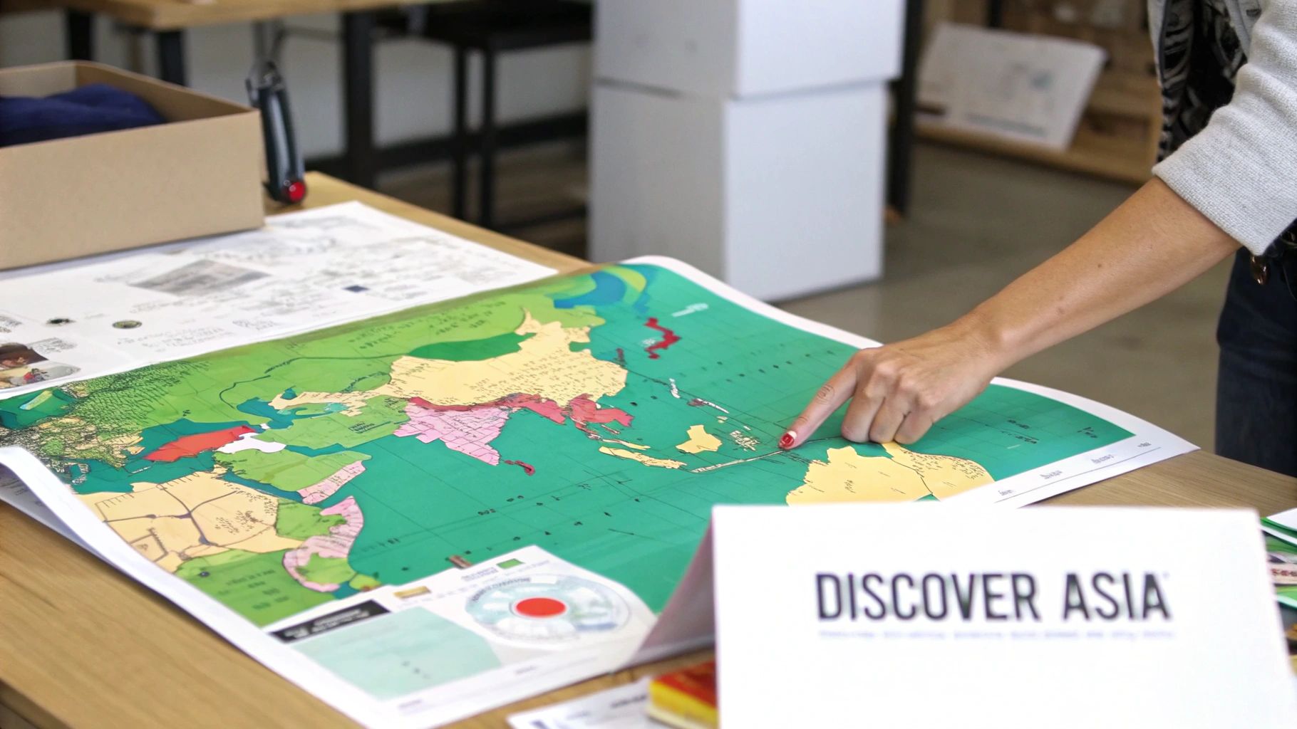
Finding Quality Maps for Your Quiz
Okay, final step: sourcing your map. This part is crucial. You need a map that's accurate, visually clear, and properly licensed for you to use. A blurry, out-of-date, or poorly labeled map can completely ruin even the most thoughtfully designed quiz.
Here are a few non-negotiables to look for:
- High Resolution: The map has to be sharp. Text and borders should be crisp and easy to read, even when someone zooms in.
- Clarity and Simplicity: Don't go for a map cluttered with every city, road, and railway line unless those details are the point of your quiz. For most quizzes, less is definitely more.
- Accurate Licensing: This is a big one. To avoid any copyright headaches, stick to reputable sources like Wikimedia Commons or other public domain archives. Always, always check the usage rights before you use a map.
Designing Questions That Build Knowledge
The heart of any great Asia map quiz isn't just the map—it's the questions. A quiz that kicks off by asking for the capital of Kyrgyzstan is going to have people clicking away in seconds. The real goal is to design a learning curve that builds confidence and pulls users deeper, not one that throws them into the deep end right away.
A good quiz should feel more like a journey than an interrogation. You want to start with the "low-hanging fruit" of Asian geography. These are the countries most people will recognize, giving them an instant feeling of accomplishment and a reason to keep going.
This first tier of questions should hit the big ones:
- Major Economic and Population Centers: Think China, India, Japan, and Indonesia. These are the anchors that give the rest of the map context.
- Geographically Prominent Countries: Russia is an obvious one. Its sheer size means that once a user identifies it, a huge chunk of the map is already cleared.
- Culturally Recognizable Nations: Thanks to media, food, and tourism, countries like South Korea, Thailand, and Vietnam are often familiar to a global audience.
Structuring Progressive Difficulty
Once players have their bearings, you can start guiding them into more specific regions. This is where the real learning happens. Instead of just throwing random countries at them, group the questions thematically to build regional familiarity.
A perfect next step is to focus on a region as a block, like Southeast Asia. Ask users to identify Malaysia, the Philippines, and Singapore one after another. This helps create a mental model of that specific area. From there, you could introduce the Central Asian 'stans'—like Kazakhstan or Uzbekistan—as another distinct group. This methodical approach is way more effective than just jumping all over the continent.
The best quizzes don't just test what people know; they strategically teach what they don't. By moving from broad, recognizable countries to specific, smaller regions, you make the map of Asia feel less intimidating and more manageable.
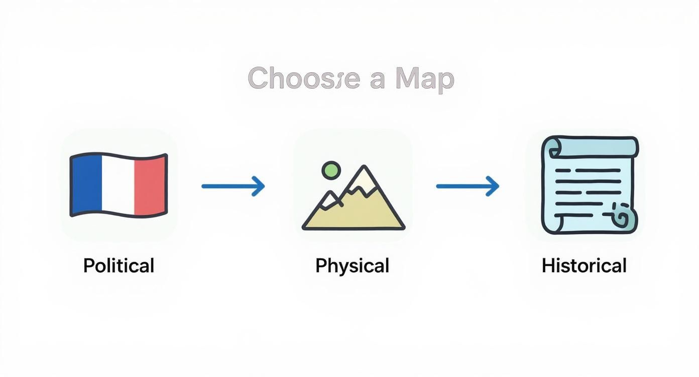
This flow from a simple political map to more complex physical or historical maps is a great way to visualize the ideal progression of your question difficulty.
Advanced and Expert Level Questions
For the real geography buffs, the final layers of your quiz can introduce some serious challenges. This is where you can bring in capitals, physical landmarks, and other nuances that go beyond just borders.
- Capital Challenges: A great follow-up after someone correctly identifies a country is to ask for its capital. For a ton of ideas on this, check out our complete capitals of Asia quiz.
- Physical Features: Mix things up with questions like "Identify the Himalayas" or "Click on the Mekong River." This adds a whole new dimension that goes beyond political boundaries.
- Obscure Nations: Finally, bring in the smaller or less-discussed countries like Bhutan, Brunei, or Timor-Leste to challenge even the most seasoned players.
Of course, crafting a quiz that’s not just accurate but also genuinely engaging means following some general content creation best practices. By carefully layering your questions from easy to expert, you create a rewarding Asia map quiz that keeps users hooked from the first click to the last.
Bringing Your Quiz to Life with Technology
Embedded content
Okay, you've got a great map and a killer question bank. Now for the fun part: bringing it all together with the right technology. The platform you choose is more than just a delivery method—it shapes the entire experience, from how people engage with the map to the feedback that helps them learn.
Your decision here really boils down to your audience and your goals.
Old School vs. New School: PDF or Interactive?
For educators, group leaders, or anyone needing an offline option, sometimes the simplest tool is the most powerful. A printable PDF quiz is a fantastic, no-fuss solution. It requires zero internet, eliminates digital distractions, and is perfect for focused classroom work or take-home assignments.
It's as easy as pairing a high-resolution map with a numbered question sheet. Reliable, straightforward, and effective.
But if you want a truly dynamic and engaging experience, you have to go digital. Interactive web quizzes provide instant feedback, a total game-changer for learning and retention.
Choosing Your Digital Platform
Once you decide to go online, you’ve got some excellent options. Platforms like Seterra or JetPunk are hugely popular for a reason—they make geography feel less like a test and more like a game. They specialize in map-based challenges and bake in features like timers and leaderboards that keep people coming back for one more try.
These are perfect for individual learners or for assigning as homework. A huge plus is that students often don't need to create an account, which removes a common barrier. For a really polished feel, many of these tools even let you embed quizzes right into your website or blog, creating a seamless piece of content for your audience.
An online quiz platform transforms a static test into a live event. The combination of immediate feedback, scoring, and competitive elements provides powerful motivation that a simple paper quiz just can't match.
Different quiz formats serve different needs. Let's break down the most common options to see which one fits your situation best.
Quiz Format Features and Use Cases
| Format | Engagement Level | Technical Skill Needed | Best For |
|---|---|---|---|
| Printable PDF | Low | Low (Basic document creation) | Classrooms, offline events, homework, or low-tech environments. |
| Interactive Web Quiz | High | Low (Using platforms like Seterra) | Individual learning, online courses, competitive challenges, and homework. |
| Embedded Quiz | High | Medium (Basic HTML/CMS knowledge) | Blogs, educational websites, and creating an integrated brand experience. |
| Custom App | Very High | High (Requires development) | Large-scale educational projects or commercial gamified learning apps. |
As the table shows, there's a format for every scenario, from a simple printout to a fully custom-built experience.
Designing an Intuitive User Experience
It doesn't matter how great your questions are if the quiz itself is a pain to use. A smooth user experience is absolutely non-negotiable. From the very first click, your quiz needs to feel intuitive.
This means using clear, simple instructions like "Click on Japan," and ensuring the map is responsive. When someone clicks on a country, the action should register instantly. No lag, no confusion.
Data from popular quiz sites gives us some fascinating insights. While most players can identify Asia's 49 countries, accuracy plummets for smaller or less-discussed nations. Countries like China and Japan consistently see identification rates above 90%, but Central Asian nations like Tajikistan often fall below 50%.
This is where you can be smart with your design. If a user misses a notoriously tricky country, don't just mark it wrong. Use it as a teaching moment. Your quiz could offer a helpful hint, a quick fact, or simply show the correct answer immediately.
That instant correction cycle is what makes digital quizzes so powerful for learning. It helps cement the knowledge far more effectively than making someone wait until the end for a score report. For more ideas on how to build this kind of smart, engaging challenge, you can dive deeper into our complete guide for crafting the ultimate Asia geography quiz.
Going Deeper: Creating Advanced Historical and Thematic Quizzes
So, your audience has mastered modern-day Asia. They can pinpoint Singapore, Nepal, and Kazakhstan without breaking a sweat. Does the journey end there? Not even close. This is where you can add incredible depth and keep even the most seasoned geography buffs hooked by digging into Asia’s rich past and its complex physical makeup.
We're moving beyond a standard geography test and into a richer exploration of the continent.
Historical quizzes are a fantastic challenge because they test knowledge of borders that have long since vanished. Forget asking for modern countries. Instead, build an Asia map quiz around the sprawling Mongol Empire in the 13th century or the intricate, winding path of the Silk Road. These topics force players to think about geopolitical history and how territories have morphed over hundreds of years.
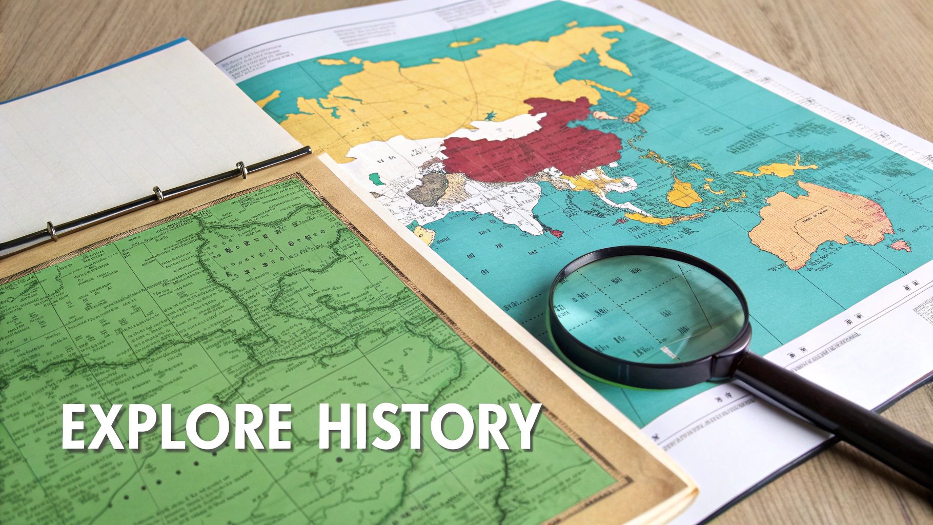
Venturing into Historical Maps
First things first: you need good maps. Sourcing accurate historical maps is crucial. I always start by looking at university archives or digital libraries—they often have high-resolution, well-documented maps that are perfect for this.
When you're writing the questions, don't just ask "What was this?" Instead, focus on highlighting significant changes or key historical locations. For instance, a quiz on the Mongol Empire could ask users to identify its farthest western and eastern points. Suddenly, it’s not just a location test; it's a story about historical influence and immense scale.
A historical map quiz tells a story. It’s not just about what a place is called now, but what it was and how it shaped the world we see today. This deeper context is what separates a good quiz from a great one.
The borders of Asia have changed wildly over time. By the mid-19th century, the map was a jumble of colonial territories and massive empires. Large parts of South Asia were under British rule, while Southeast Asia was carved up by the French, Dutch, and Spanish. To ace a quiz on this era, you’d need to know former states like Siam (now Thailand) right alongside vast entities like the Qing Dynasty.
To see just how much has changed, check out this historical countries quiz on JetPunk which uses a detailed 1850 map. It's a real eye-opener.
Exploring Thematic Geography
Beyond history, thematic quizzes offer another layer of advanced, engaging content. These quizzes ditch political boundaries altogether, focusing instead on the continent's physical and cultural geography. This is a brilliant way to appeal to learners with specialized interests and turn your quiz into a focused study.
Think about building quizzes around themes like these:
- Major River Systems: Challenge users to trace the paths of the Yangtze, Ganges, or Mekong rivers from source to sea.
- Significant Mountain Ranges: Ask them to pinpoint the Himalayas, the Urals, or the Tian Shan mountains.
- Linguistic Families: Create a map quiz where users identify regions where Sino-Tibetan or Indo-Aryan languages are predominantly spoken.
These kinds of thematic challenges test a much more holistic understanding of Asia. They encourage players to see the continent not as a collection of countries, but as a dynamic system of natural landscapes and cultural regions. It's exactly this type of specialized content that will keep your most dedicated users coming back for more.
Common Questions About Asia Map Quizzes
When you're diving into designing your first Asia map quiz, a few questions almost always come up. Getting these sorted out early will save you a headache and help you avoid common pitfalls that can frustrate your audience.
Let's walk through some of the most frequent ones. My goal is to give you straightforward, practical advice so you can build your quiz with confidence, knowing you're creating something that’s both fair and fun for everyone.
What Are the Most Common Mistakes to Avoid?
The biggest mistake I see is making the quiz too hard, too fast. It's tempting to flex your deep geographical knowledge, but leading with a question about the capital of Brunei is a surefire way to scare off most people. Always start with major, recognizable countries to build confidence.
Another classic error is using a low-resolution map. If players have to squint to see borders or read labels, you've already lost them. Always start with a crisp, clear map as your foundation.
Finally, keep your instructions simple. Something like "Click the correct country on the map" is so much better than a long, complicated prompt.
How Should I Handle Disputed Territories in Asia?
This is a sensitive one, but it’s crucial to get right. The key here is transparency. Asia has several regions with complex geopolitical situations, and the last thing you want is for your quiz to spark a political debate.
I’ve found two strategies work best:
- Acknowledge the Dispute: You can add a small note directly in the question or feedback. For instance, when asking about Kashmir, you could frame it as, "Identify the region administered by India."
- Exclude Them Carefully: The other option is to simply omit heavily disputed territories from the quiz altogether. This keeps the focus squarely on universally recognized geography.
The goal is education, not politics. By providing context or carefully curating your questions, you can keep the focus on geography while respecting the region's complexities. Being clear about your scope from the start keeps things fun and avoids confusion.
What's the Best Way to Use a Map Quiz in a Classroom?
In a classroom, an Asia map quiz should be an active learning tool, not just a test. I love using a low-stakes quiz to kick off a new unit on Asia. It’s a great way to see what students already know and where you might need to focus your lessons.
Turning it into a friendly competition also does wonders for engagement. Try dividing the class into teams to compete for the highest score. Afterward, you can review the class-wide results together. This often highlights common sticking points—like the Central Asian 'stans' or the island nations of Southeast Asia—giving you a perfect launchpad for the next lesson.
How Can I Add Timers and Leaderboards to My Quiz?
Gamification elements like timers and leaderboards are huge motivators. They add a bit of urgency and friendly competition that gets people to try again, aiming to beat their own high score or climb the ranks.
Most online quiz-building platforms have these features built right in. When you're picking a tool, look for settings that let you easily add a countdown timer and a scoring system that automatically generates a leaderboard. If you're building a quiz from scratch on your own website, you'll likely need a bit of basic JavaScript to manage the timer and track scores.
Ready to put your geography skills to the test in a whole new way? Explore the world with EarthChasers, where learning about the globe becomes an exciting 3D adventure. https://earthchasers.com