Learn label the continents and the oceans in minutes
Master map labeling with our guide on label the continents and the oceans. Quick tricks, printable maps, and fun facts to boost your geography skills.
Learning to label the continents and the oceans is a classic geography skill, but getting started can feel a bit overwhelming. The secret isn't just staring at a map for hours. It’s about building a mental picture of the world, piece by piece.
Your World Map Starter Guide
Looking at a blank map is like looking at an empty canvas. Your goal is to fill it in, but not by brute force. Instead of trying to memorize everything at once, we're going to focus on two things: recognizing the unique shape of each of the seven continents and understanding where the five major oceans sit in relation to them.
This way, you start to see how the world fits together. You’ll notice how the Atlantic Ocean creates a neat separation between the Americas and Europe/Africa, or how Asia’s massive landmass makes everything else look smaller. It becomes a puzzle you’re solving, not a list you’re memorizing.
A Simple Path to Mastery
I've found that the best way to learn is by following a simple, repeatable process. It breaks the task down into manageable chunks.
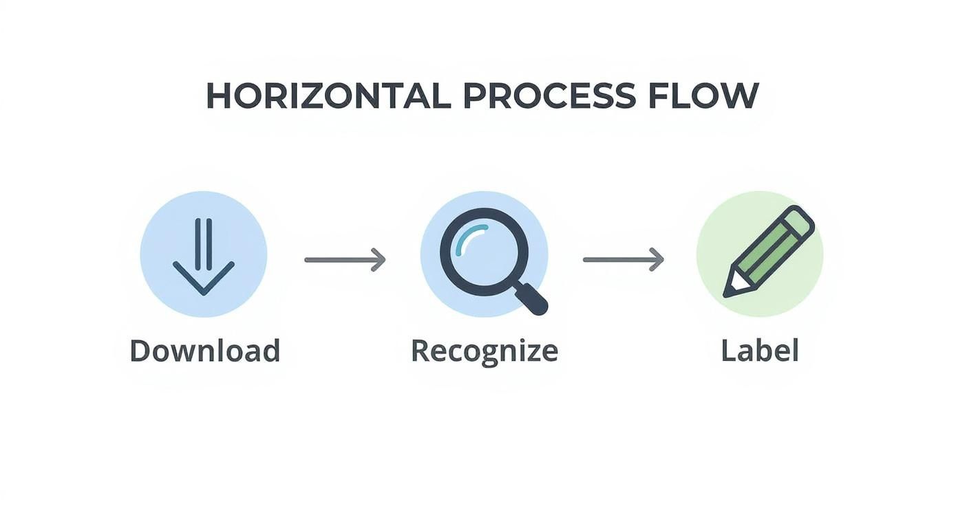
This flow takes you from getting the right tool (a blank map) to studying it, and then to actively recalling the information. It’s a classic study technique that just works.
To get you started, here is a clean, printable world map you can use for practice right now. Go ahead and print a few copies.
The first step? Just get familiar with it. Use your finger to trace the coastlines of each continent. Say their names out loud. The simple act of combining touch and speech helps lock the shapes and names into your memory.
Getting to Know the Seven Continents
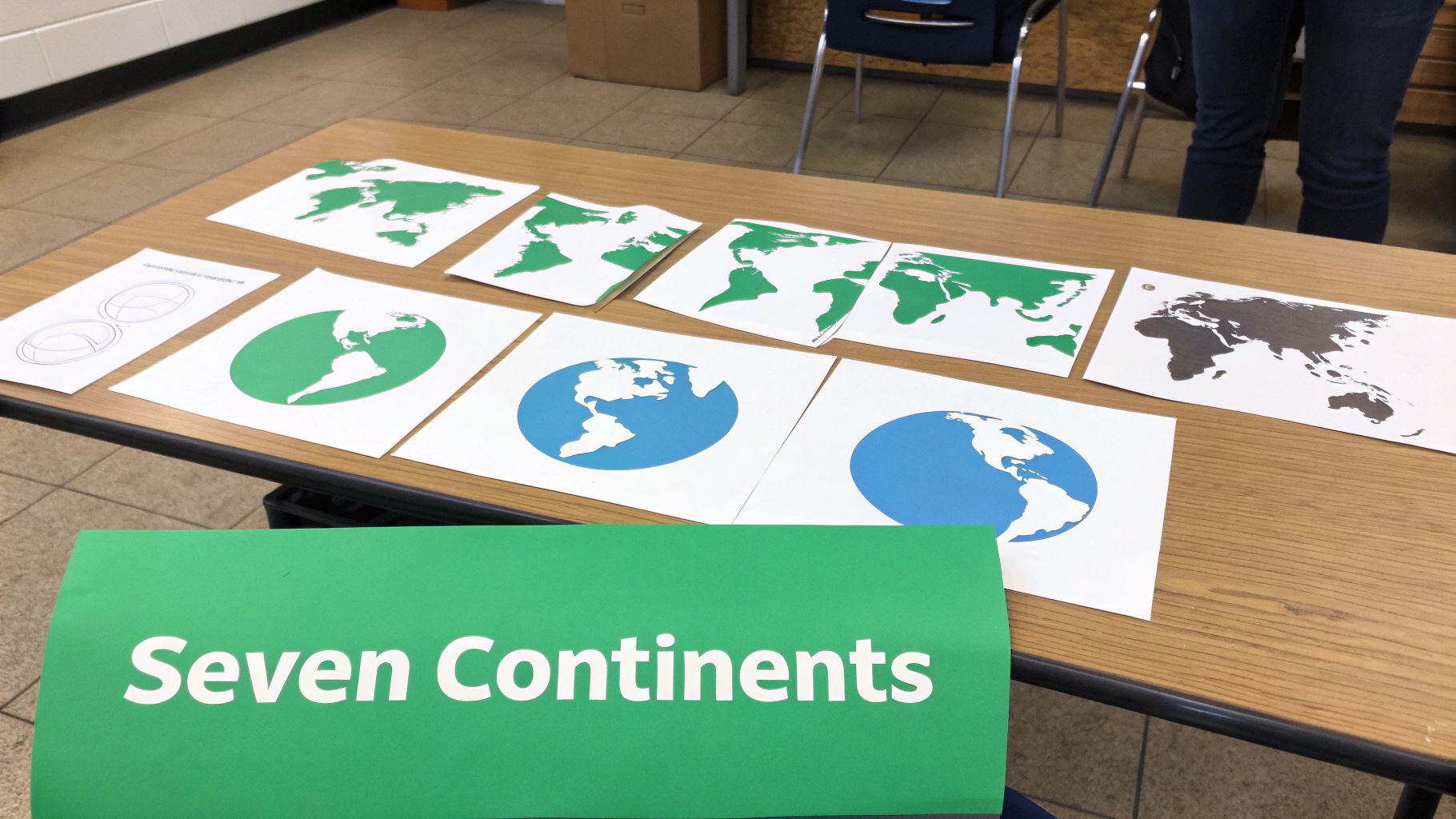
Before you can start labeling continents with confidence, you have to actually know them. Think of each one like a character with its own distinct personality and features—it’s a much better approach than just trying to memorize a list of names.
A great way to start is by organizing them from largest to smallest. This simple trick gives you an immediate mental framework, a sense of scale and order that makes everything else click into place.
For instance, the continent of Asia is the largest by a long shot, covering a massive 44.58 million square kilometers. That makes it more than five times the size of Australia, the smallest continent. This size difference is just one example of their unique traits. Africa has a relatively smooth, regular coastline, while Europe's is incredibly jagged and indented, giving it the longest coastline in relation to its area.
To help you get a handle on this, here's a quick reference table.
The Seven Continents at a Glance
This table breaks down the seven continents by size and highlights a key feature for each one, which is super helpful for quick identification.
| Continent Name | Size Rank (Largest to Smallest) | Key Geographic Feature |
|---|---|---|
| Asia | 1 | The absolute giant of the group. |
| Africa | 2 | Distinctive rounded shape, south of Europe. |
| North America | 3 | Wide at the top, tapering to a point. |
| South America | 4 | Often described as looking like an ice cream cone. |
| Antarctica | 5 | The isolated ice cap at the South Pole. |
| Europe | 6 | Jagged, peninsula-rich western coastline of Eurasia. |
| Australia | 7 | The "island continent," located southeast of Asia. |
Having this basic info in your back pocket makes the next steps much easier.
The Big Three Landmasses
Let's kick things off with the heavyweights. If you can lock these three down, you're well on your way because they anchor your entire mental map of the world.
- Asia: The undisputed giant. Its sheer size is its most memorable feature. It connects to both Europe and Africa, forming the largest continuous landmass on the planet.
- Africa: You can spot this one by its distinct, rounded shape with a bulge in the northwest. It sits directly south of Europe.
- North America: Often pictured as a rough triangle—wide at the top and tapering toward the bottom where it connects to South America via a narrow land bridge.
Once you can reliably spot these three, you've already accounted for a huge portion of Earth's land. That initial win builds momentum and makes placing the rest of the continents a breeze. For a deeper dive into their stats and stories, check out our full guide on what are the seven continents.
A simple trick I've always used is to see Africa and South America as puzzle pieces. Notice how the eastern bulge of South America looks like it could slot right into the western coast of Africa. This visual clue is a great reminder of their past connection in the supercontinent Pangaea.
The Remaining Four Continents
With the biggest landmasses identified, the other four will fall into place much more easily. Each one has a special characteristic that makes it stand out.
- South America: Think of an ice cream cone. Its shape is incredibly distinct, making it one of the easiest to pinpoint once you know what you're looking for.
- Antarctica: This one’s easy. It’s the isolated continent at the very bottom of the map, completely covered in ice. Its location is its key identifier.
- Europe: While it's technically connected to Asia, it’s defined by its jagged, peninsula-rich coastline. If you get stuck, look for the boot-shaped Italian Peninsula jutting into the Mediterranean Sea.
- Australia: The island continent. It's the only one that is also a single country, sitting by itself completely surrounded by water, southeast of Asia.
By associating each continent with a key visual—Asia's size, Africa's shape, Europe's coastline—you transform a boring memory task into an engaging exercise in recognition. This approach makes it so much easier to label the continents and oceans on any map you come across.
Navigating the Five Major Oceans
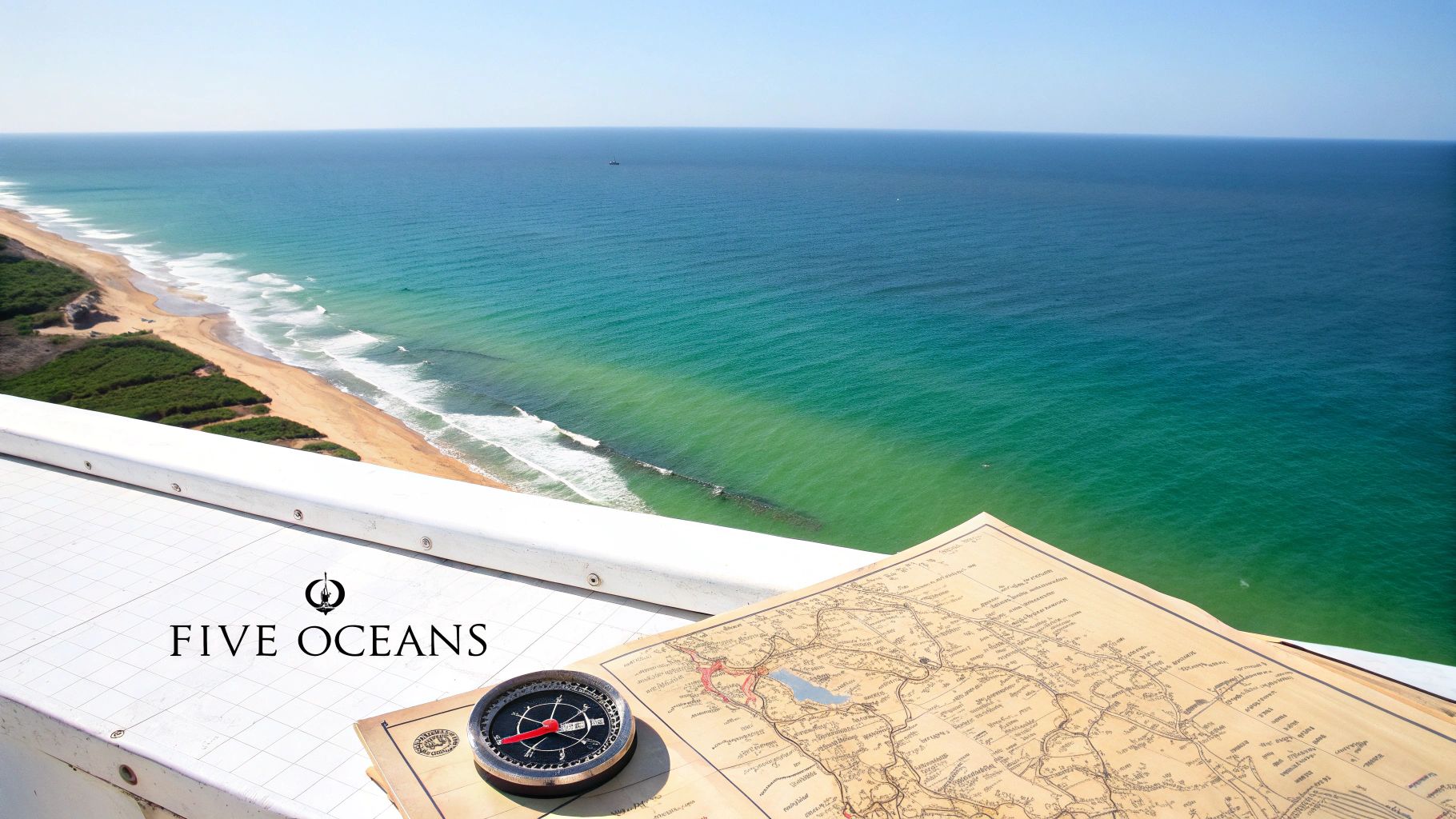
Alright, now that you can pinpoint the major landmasses, let's chart the vast waters connecting them.
Here's a pro tip: when you label the continents and the oceans, think about how they interact. Instead of seeing them as separate items on a list, see the oceans as the massive, blue spaces between the continents. This one shift in perspective makes everything click into place.
Our planet is a water world—roughly 70.8% of the Earth's surface is covered by one enormous, interconnected global ocean. This body of saltwater holds about 97% of our planet's water and is traditionally divided into five major oceans. Fun fact: the Southern Ocean was only officially recognized in the year 2000!
Locating the Pacific and Atlantic
Let's start with the big ones. The Pacific and Atlantic are the easiest to place simply because of their sheer size. They're the obvious anchors on any world map.
The Pacific Ocean is the heavyweight champion—the largest and deepest of them all. It's that massive expanse of water you see between Asia and Australia on one side and the Americas on the other. An easy way to lock it in? It’s the ocean that borders the entire west coast of both North and South America.
The Atlantic Ocean is the body of water that neatly separates the Americas from Europe and Africa. Think of it as the "middle" ocean on most maps. When you label the Atlantic, you're essentially drawing the line between the Old World and the New.
The Indian, Southern, and Arctic Oceans
With the two giants placed, the other three fall into place much more easily based on their unique positions.
- Indian Ocean: This one is neatly tucked below Asia, bordered by Africa to the west and Australia to the east. It's the only ocean named after a country, which makes it a bit special.
- Southern Ocean: This is the "newest" officially named ocean, and it completely encircles Antarctica. Find the icy continent at the bottom of your map, and the water surrounding it is the Southern Ocean. Easy.
- Arctic Ocean: Head to the very top of the world. The smallest and shallowest ocean, the Arctic surrounds the North Pole, making it the polar opposite of the Southern Ocean.
My favorite way to teach this is to work from the outside in. Start with the massive Pacific and the central Atlantic. Then, find the Indian Ocean nestled below Asia. Finally, cap your map with the Arctic at the top and the Southern at the bottom.
This systematic approach turns map labeling from a guessing game into a simple, logical exercise.
For a more detailed look into these vast bodies of water, be sure to check out our complete guide on the oceans and seas of the world.
Memory Tricks That Actually Work
Let's be honest, staring at a list of names and trying to brute-force them into your brain is a terrible way to learn. A much smarter approach for labeling the continents and the oceans is to tie those names and locations to something your brain can actually grab onto. This is where a few clever memory tricks, called mnemonics, can be a total game-changer.
One of the most common mnemonics for the continents just uses the first letter of each one. You've probably heard a version of it, but a popular one is: Eat An Apple As A Snack. That gives you Europe, Asia, Africa, Australia, Antarctica, South America, and North America.
Now, the order doesn't line up perfectly with a world map, but that's not really the point. The goal here is to give you a mental checklist. When you're filling out a map, you can run through the phrase and make sure you haven't missed one.
Turn Shapes into Stories
Another fantastic method is to use visual association. Our brains are just wired to remember pictures and stories way better than abstract words. So instead of seeing a random blob on the map, try to see it as something else. Give it a personality.
For example, a lot of people think South America looks like a giant ice cream cone. Once you see it, you can't unsee it, and suddenly it's easy to remember. Italy is another classic—everyone knows it as "the boot" kicking a little rock, which is the island of Sicily. The trick is to come up with your own associations for each continent.
Making these connections personal is what makes them stick. The weirder or more creative your mental image, the more likely you are to remember it. This kind of active learning is a cornerstone of solid study habits. If you want to get better at this, our guide on how to study geography has a lot more strategies like this.
And if you really want to lock in that knowledge, it helps to understand the science behind how to retain information better. When you pair these proven learning methods with fun geography tricks, the information really starts to solidify.
How Our World Map Got Its Shape
Embedded content
The map you're learning to label is really just a snapshot of our planet in motion. It’s easy to think of the continents as fixed, but they've been on an incredible journey for billions of years. The powerful forces of continental drift and shifting tectonic plates are constantly reshaping Earth’s surface under our feet.
Believe it or not, about 300 million years ago, all the continents we know today were smashed together into a single, massive supercontinent called Pangaea. This giant landmass was surrounded by one enormous global ocean known as Panthalassic. Over eons, tectonic forces cracked Pangaea apart, sending the pieces drifting toward their current locations. You can dive deeper into this incredible geologic story from the ocean's perspective on ocean.si.edu.
From One Landmass to Seven Continents
Once you know this, you start seeing clues everywhere on the map. It's why the eastern coastline of South America looks like a puzzle piece that could slot perfectly into the western coast of Africa—because it once did!
Understanding this deep history gives a richer appreciation for geography. It transforms the task to label the continents and the oceans from a static exercise into a dynamic puzzle, millions of years in the making.
This context is what helps make the features of our world so much more memorable.
Untangling Common Geography Questions
When you’re first trying to nail down all the continents and oceans, a few questions always pop up. It happens to everyone. Let's get these sorted out so you can practice with total confidence.
The biggest hurdle I see people face is how to actually practice. Just staring at a map won’t cut it—that’s passive learning, and it’s not very sticky. You need to get your brain working.
The secret is active recall. Grab a blank map and try to label everything from memory. Then, pull out the answer key and see how you did. Doing this over and over is way more effective than just reading a labeled map.
Clearing Up the Tricky Bits
A couple of geographical facts tend to trip people up. Once you understand the "why" behind them, they’re much easier to remember.
So, is Australia a continent or an island? The fun answer is: it’s both! It qualifies as a continent because it’s a massive landmass sitting on its own tectonic plate. But since it's completely surrounded by water, it's also technically the world's largest island. This gives it the unique distinction of being the only country that is also its own continent.
Why don’t older maps show the Southern Ocean? Great question! The Southern Ocean is the new kid on the block. For centuries, geographers just considered the waters around Antarctica to be the southern ends of the Atlantic, Pacific, and Indian Oceans. It wasn't until 2000 that the International Hydrographic Organization officially recognized it as a distinct ocean, defined by the powerful Antarctic Circumpolar Current. That’s why you won't see it on vintage maps.
Getting these little details straight helps build a much clearer picture of the world in your mind, making every practice session that much more effective.
Ready to turn your geography knowledge into a global adventure? With EarthChasers, you can explore the world in a fun, interactive 3D game. Test your skills, compete on leaderboards, and discover new wonders. Start your journey today at https://earthchasers.com.