What is Environmental Geography? Discover Key Concepts & Careers
Learn what is environmental geography, its core concepts, real-world applications, and career opportunities in this essential field. Explore more now!
Ever wondered how the city you live in affects the climate around it? Or how a distant river system determines the food on your plate? That's the core of environmental geography. It's the study of the dynamic, two-way street connecting human societies and the natural world.
This field acts as a critical bridge, exploring how our actions—from building skyscrapers to farming fields—shape ecosystems. But it also looks at the flip side: how environmental forces like weather patterns and natural disasters influence our lives and decisions.
Defining the Bridge Between People and Planet
Think of it as a constant conversation between humanity and the Earth. Environmental geography is the science of deciphering that dialogue.
It doesn't just look at a forest; it asks, "How does clearing these trees impact the local community's water supply and economic future?" It doesn't just map a river; it analyzes how building a dam upstream changes agriculture and settlements for hundreds of miles downstream.
This discipline digs deep, moving beyond simple observation to unravel the complex web of cause and effect. It’s all about getting to the "where" and "why" behind our planet's biggest challenges.
The Human Side of the Equation
A huge piece of the puzzle is us. Environmental geographers spend a lot of time studying human systems to understand how our societies are organized and how our activities leave a footprint on the planet.
This includes things like:
- Urbanization: How do sprawling cities consume resources, generate waste, and alter local climates and wildlife habitats?
- Agriculture: What impact do different farming methods have on soil health, water quality, and long-term land stability?
- Industrialization: What are the real links between manufacturing, pollution, and the health of nearby communities and ecosystems?
- Policy and Economics: How do government rules and economic incentives push environmental decisions in one direction or another?
The Natural World's Response
On the other side of the bridge are Earth's physical systems. Environmental geography examines these natural processes—not in a vacuum, but in direct relation to what we do.
This perspective is essential for understanding everything from global climate shifts to the tiny dynamics of a single watershed. Geographers explore the incredible variety of our planet, often inspired by its sheer beauty and the need to protect the natural wonders of the world.
To get a clearer picture, let's break down the core components these geographers study.
Core Components of Environmental Geography
This table shows the two main systems—human and physical—that environmental geographers look at and how they interact.
| System Type | Examples | Interaction Focus |
|---|---|---|
| Human Systems | Cities, farms, industries, economic policies, transportation networks. | How human activities extract resources, produce waste, and modify landscapes. |
| Physical Systems | Climate patterns, water cycles, soil composition, ecosystems, landforms. | How natural processes respond to human pressures and influence human settlement and behavior. |
By connecting the dots between these systems, environmental geography gives us the tools to find smarter, more sustainable solutions.
By connecting human choices with environmental outcomes, this field provides a crucial framework for finding sustainable solutions. It's about recognizing that we are not separate from nature but are deeply intertwined with it.
Ultimately, environmental geography is about revealing hidden connections. It links a political decision made in a capital city to the rising sea levels affecting a coastal village. It connects the shopping habits in one country to the resource extraction in another.
This integrated approach is exactly what we need to navigate the complex environmental issues of our time, blending hard data with a deep understanding of human behavior to forge a more balanced path forward.
To really get what environmental geography is all about, we have to rewind the clock. This field didn't just pop up with the latest climate change headlines. It’s a discipline with a long history, built over centuries of observation, exploration, and a slow, dawning realization of just how much we affect our planet.
The story of environmental geography is really the story of humanity learning to connect the dots between our actions and the Earth's health.
The first seeds were planted by thinkers and naturalists who started looking at the world with a more critical eye. Take someone like Alexander von Humboldt back in the early 19th century. He didn't just travel around making lists of plants and animals. He saw how climate, altitude, and landforms created interconnected ecosystems. He was one of the first to suggest that human activities, like chopping down forests, could mess with the climate on a bigger scale.
These early insights paved the way for a more organized study of how people and their environment interact.
The Rise of Conservation and Concern
Then came the Industrial Revolution, which threw gasoline on the fire. As factories choked the skies with smoke and cities swelled, the environmental damage became too big to ignore. This period sparked the very first conservation movements, led by people who saw forests disappearing, rivers turning toxic, and wildlife vanishing before their eyes.
Thinkers like George Perkins Marsh laid it all out in his 1864 book, Man and Nature. He made one of the first solid arguments that societies were actively wrecking their own environments. Marsh even suggested that ancient civilizations collapsed partly because they mismanaged their natural resources—a pretty wild idea at the time.
This growing alarm wasn't just talk. It led to real-world action:
- National Parks: The creation of Yellowstone National Park in 1872 was a game-changer. Land was set aside not for what it could produce, but simply for its natural beauty and intrinsic value.
- Forest Management: Early forestry services were born from the understanding that we couldn't just keep cutting down trees forever. We had to manage them if we wanted them to last.
- Soil Conservation: Nothing teaches a lesson like a catastrophe. The Dust Bowl of the 1930s was a brutal wake-up call about the dangers of bad farming, forcing new policies to protect vital topsoil.
These events made it crystal clear: we needed a field of study that could analyze these problems based on where and why they were happening. Environmental geography stepped in to fill that role.
The big idea that started to take hold was that human well-being and a healthy environment aren't two separate things. They're two sides of the same coin, woven together across time and space.
Modern Environmentalism and a New Discipline
The mid-20th century was another major turning point. A post-war economic boom brought new levels of consumption and, with it, new problems like chemical pollution and massive amounts of waste. But this time, public awareness exploded, thanks to a few powerful voices who brought these issues into everyone's living rooms.
Rachel Carson’s 1962 blockbuster, Silent Spring, was a key catalyst. It sold over 500,000 copies internationally and opened the public's eyes to the hidden dangers of pesticides. The book sparked a firestorm of research and legislation that became central to modern environmental geography.
This new awareness led to a wave of official government action. For instance, the landmark U.S. National Environmental Policy Act (NEPA) of 1970 forced federal agencies to actually study the environmental impact of their projects before starting them. This wasn't just an American idea; it inspired over 100 countries to adopt similar review processes. You can learn more about the history of these crucial movements on libguides.lindahall.org.
From those early naturalists to modern-day activists, environmental geography has evolved into the critical field we know today. It carries the torch for those who first dared to ask tough questions about our role on this planet, giving us the tools we need to build a more sustainable future.
Exploring the Core Concepts and Subfields
To really wrap your head around what is environmental geography, you have to unpack its core ideas and dive into its surprisingly diverse specializations. Think of it like a giant puzzle. The core concepts are your corner pieces—they give the whole thing structure. The subfields are all the different sections that fill in the complete picture, each telling a unique story about our planet.
At its heart, the field is built on a few foundational ideas that geographers use to make sense of the tangled relationship between people and their environment. These aren't just stuffy academic terms; they're practical lenses for seeing the world.
One of the big ones is sustainability. In simple terms, sustainability is all about meeting our needs today without messing things up for future generations. It’s a balancing act—making sure our economic, social, and environmental systems can all thrive together for the long haul.
Another key concept is resilience. Imagine an ecosystem is like a sturdy rubber band. It can stretch and adapt when it faces a disturbance, like a wildfire or a drought. Resilience is its power to bounce back to its original shape. But if the stress is too much or lasts too long, that rubber band can snap, leading to permanent, often disastrous, changes. The same idea applies to human communities facing environmental shocks.
This visual shows how the core principles of ecology, mapping, and sustainability form the foundation of environmental geography.
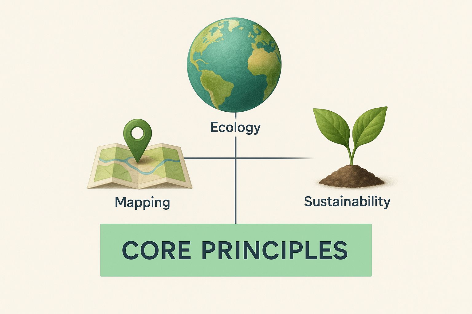
As the infographic shows, this discipline is built by blending hard science with a deep understanding of society's role in the natural world.
A Diverse Family of Subfields
Environmental geography isn’t one single subject. It's more like a big family with many specialized members, each focusing on a different piece of the human-environment puzzle. This specialization is what allows geographers to tackle very specific problems with focused expertise.
The field really started to take shape during the environmental movements of the 1960s and 1970s. It spun out of a broader look at environmental history—how humans and nature have interacted over centuries. By mixing insights from geography, biology, and sociology, it carved out a unique space for analyzing how we impact the planet, and how the planet impacts us. You can explore more about the origins of environmental studies on ebsco.com.
Let’s get to know some of the most prominent subfields.
Hazards Geography: This area zeroes in on the messy intersection of natural disasters and human communities. A hazards geographer doesn't just study an earthquake; they figure out why an earthquake of the same magnitude flattens one city while another recovers quickly. They map risk zones, pick apart building codes, and analyze social factors that make certain groups more vulnerable.
Political Ecology: This subfield investigates how power—political, economic, and social—shapes environmental issues. It asks tough questions like, "Who actually benefits from deforestation?" or "Why are polluting factories so often located in low-income neighborhoods?" It draws a straight line from environmental problems to issues of power and inequality.
Water Resource Management: Specialists here tackle one of our planet’s most critical resources. They study everything from the physical flow of river basins to the thorny politics of water rights. Their work is absolutely vital for ensuring communities have clean water, managing flood risks, and solving conflicts over shared rivers and lakes.
These subfields show that environmental geography isn’t about knowing a little bit about everything. It's about applying a specific, powerful lens to solve real-world problems.
Understanding the Differences and Connections
While these subfields have their own focus, they’re constantly overlapping and informing one another. A political ecologist studying land rights might team up with a water resource manager to see how those rights affect irrigation. A hazards geographer might work with a city planner to design communities that can better withstand climate change.
It's also interesting to see how environmental geography connects to other branches of the discipline. For example, it shares a focus on human-environment interaction with its sister field, cultural geography, but with a much stronger emphasis on physical systems and sustainability. You can see the contrast by exploring our guide on what is cultural geography.
To make these distinctions even clearer, let's break down how these specializations differ in their approach.
Comparing Key Subfields in Environmental Geography
This table gives a quick snapshot of the major specializations within environmental geography, showing what they focus on and the kinds of questions they seek to answer.
| Subfield | Primary Focus | Example Research Question |
|---|---|---|
| Hazards Geography | The intersection of natural events and human vulnerability. | Why are coastal communities in Southeast Asia more vulnerable to tsunamis than those in other regions? |
| Political Ecology | The role of power, politics, and economics in environmental issues. | How do international trade agreements impact deforestation rates in the Amazon rainforest? |
| Water Resource Management | The sustainable use and distribution of water resources. | What are the most equitable ways to allocate water from the Colorado River among competing states? |
Each subfield uses the same core tools of environmental geography—like spatial analysis and systems thinking—but points them at very different problems. This diversity is the field's greatest strength, allowing it to address the vast and varied environmental challenges we face today. By understanding these different branches, we get a much clearer map of what environmental geography is all about.
Inside the Environmental Geographer's Toolkit
So, how do environmental geographers actually do their work? It's not just about theories and textbooks. To solve complex environmental puzzles, they need a diverse set of tools, blending old-school fieldwork with powerful modern technology.
Think of an environmental geographer as an investigator at the scene of a complicated environmental issue. They have to gather evidence from all angles, analyze clues others might miss, and piece together the story of what's happening, where it's happening, and—most importantly—why.
At the heart of this modern toolkit is Geographic Information Systems (GIS). Don't let the name intimidate you. The simplest way to think about GIS is as a system for creating smart, layered digital maps.
Imagine you have a map of a city. One layer shows the road network. Another shows population density. A third shows air pollution levels, and a fourth highlights parks and green spaces. By stacking these digital layers on top of each other, a geographer can spot relationships that are otherwise invisible. They can instantly see which neighborhoods have the worst air quality but the fewest parks, giving city planners the hard evidence they need to make a change. Professionals use industry-standard software like ArcGIS Pro to turn this raw location data into powerful, actionable stories.
Gathering Data from Every Angle
Of course, a tool like GIS is only as good as the information you feed it. Geographers use a wide range of methods to collect the rich, detailed data they need. It’s a mix of boots-on-the-ground work and high-tech observation.
Their methods usually fall into a few key areas:
- Fieldwork: This is the classic, get-your-hands-dirty approach. It means going directly to the source to collect water samples from a stream, survey residents about how they perceive a local environmental risk, or map the changing shoreline of a coastal wetland.
- Remote Sensing: Using satellites and drones, geographers can gather information from a distance. This is how they monitor massive-scale changes like deforestation in the Amazon, track the retreat of polar ice caps, or even assess the health of crops across huge farming regions.
- Quantitative Data Analysis: This is all about the numbers. Geographers dig into statistics on everything from rainfall patterns and temperature records to population growth and resource consumption. Analyzing this data helps them identify trends and build models to see what might happen next.
- Qualitative Data Collection: Not everything can be counted. This method is about understanding the human side of the story. It involves conducting interviews, digging through historical documents, or running community focus groups to understand people’s values, beliefs, and experiences with their environment.
By weaving together these different streams of data, environmental geographers get the full picture. They can connect the hard numbers from a satellite image with the personal stories of the people living in that exact landscape.
Modeling the Future
One of the most powerful things geographers do with all this data is environmental modeling. Using sophisticated computer software, they create simulations to forecast how environmental systems might behave in the future.
For instance, a model could project how a coastal city will be impacted by different sea-level rise scenarios over the next 50 years. City planners can use these models to test out different defense strategies—like building a seawall versus restoring a protective mangrove forest—to see which one offers the most effective protection. This proactive approach helps us prepare for tomorrow's challenges instead of just reacting to them.
This toolkit—from GIS and remote sensing to fieldwork and computer modeling—is what makes modern environmental geography so effective. It gives experts the ability to diagnose complex problems, from a local pollution hotspot to global climate trends, and develop solutions backed by solid evidence.
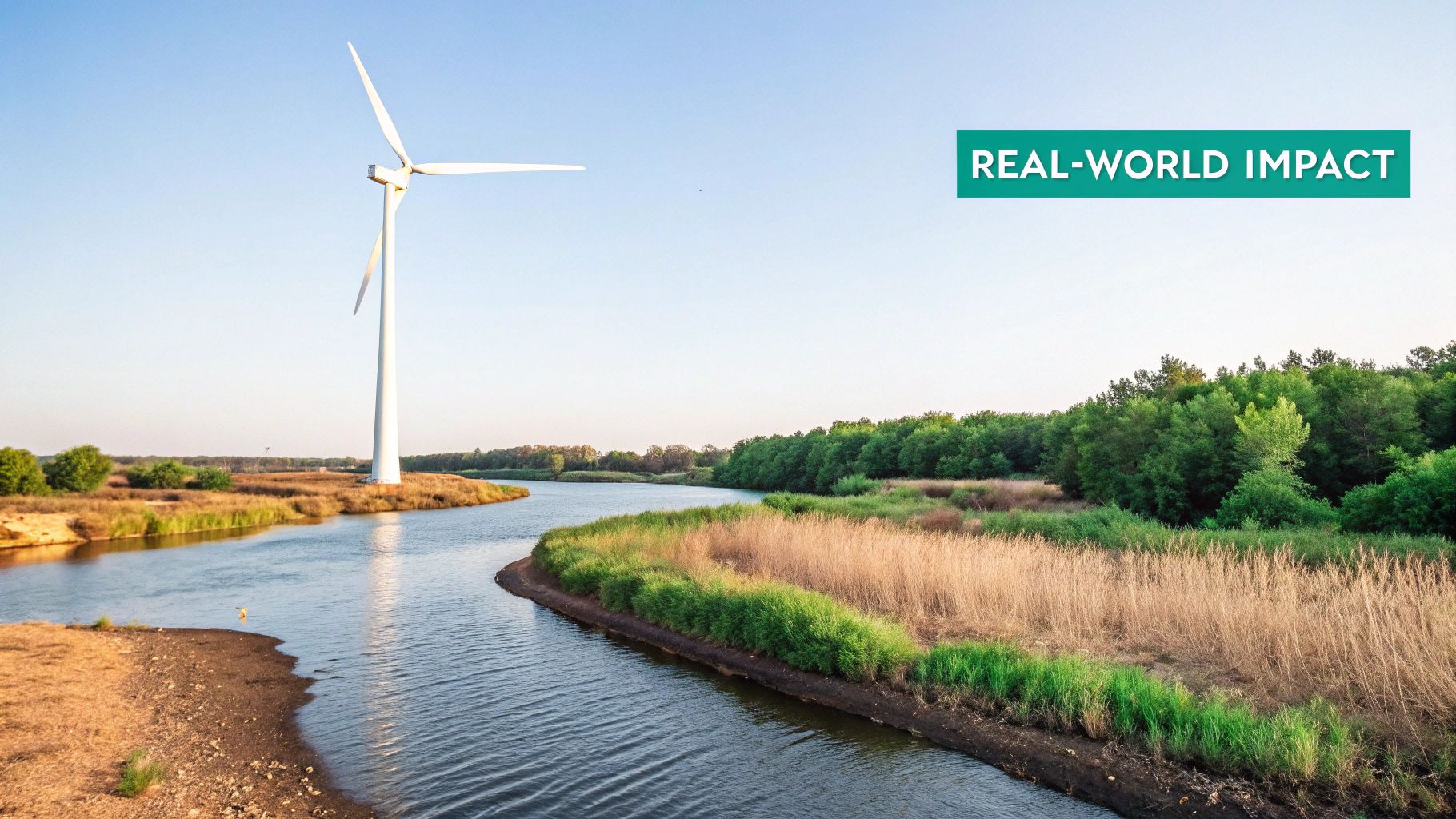
Seeing Environmental Geography in Action
Theory is one thing, but the real magic happens when you see environmental geography solving actual problems out in the world. This is where concepts like "sustainability" and "spatial analysis" stop being buzzwords and start making a tangible difference.
By looking at problems through a geographic lens, specialists can create solutions that are not just effective, but are fine-tuned to the unique character of a specific place. Let's look at a few mini-stories that show how environmental geographers are shaping a more resilient world.
Greening the Concrete Jungle
Ever notice how cities feel way hotter than the surrounding countryside? That’s the urban heat island effect. Dark surfaces like asphalt and concrete soak up the sun's heat, cranking up temperatures and creating health risks, especially during heatwaves.
An environmental geographer doesn’t just see a hot city; they see a spatial problem.
Mapping the Hotspots: First, they use thermal satellite imagery to create heat maps. These maps almost always show the hottest areas are low-income neighborhoods with little green space. Suddenly, an environmental problem becomes a social equity issue.
Connecting the Dots: Using GIS, they layer this heat data with other info, like land cover (where’s all the concrete?), tree canopy, and demographic data. This creates a clear, visual link between a lack of green infrastructure and dangerously high temperatures.
Designing Smart Solutions: Armed with this data, they work with city planners on targeted fixes. Instead of a one-size-fits-all approach, they might recommend planting trees on specific streets, turning vacant lots into parks, or pushing for green roofs on buildings in the hottest zones.
By using geographic tools, they turn a massive city-wide challenge into a series of actionable, neighborhood-level projects that directly improve people’s lives.
Managing Forests for a Sustainable Future
Forests aren't just a bunch of trees. They're complex ecosystems that give us clean air, fresh water, and vital resources. But reckless logging can lead to deforestation and habitat loss. Environmental geographers are crucial for striking a balance between our needs and the planet's health.
They might start by using remote sensing to spot areas at high risk of deforestation. Then, they'll do fieldwork to check on soil health and biodiversity. All this data feeds into a sustainable forest management plan. This is more than just planting a few saplings; it’s a geographically-informed strategy that could include:
- Selective Logging Corridors: Designating specific areas for timber harvesting in rotation, giving other parts of the forest time to recover.
- Buffer Zones: Creating protected areas around rivers and streams to prevent erosion and keep our water clean.
- Community Involvement: Working with local communities who rely on the forest to find alternative income sources that don’t involve clear-cutting.
The key idea is seeing the forest not just as a resource to be used, but as a dynamic spatial system. A change in one spot can create ripple effects across the entire landscape.
Protecting Communities from Natural Hazards
When a hurricane hits or a wildfire spreads, the damage is never uniform. Some communities are hit hard, while others are spared. A hazards geographer figures out why.
Imagine they’re tackling flood risk in a coastal town. Here's how they'd approach it:
- Model the Risk: First, they create detailed maps showing which areas would flood during different types of storms.
- Assess Vulnerability: Then, they layer those risk maps with social data to pinpoint vulnerable groups, like the elderly or people without transportation, who might need extra help evacuating.
- Evaluate Infrastructure: They also analyze the location of critical infrastructure—hospitals, power stations, shelters—to see if they’re sitting in high-risk zones.
This spatial analysis helps emergency managers create smarter evacuation routes, place resources where they're needed most, and develop land-use policies that keep people out of harm's way. It also ties into a deeper knowledge of aquatic systems, which you can dive into with our guide on the ocean and seas of the world.
These applications feel modern, but the interplay between people and their environment is ancient. Environmental geography helps us understand how the environment has shaped economic and social progress throughout history. Take agriculture, for instance, which began around 10,000 years ago. The Fertile Crescent in the Middle East, with its unique biodiversity and climate, was a perfect incubator for productive farming, which in turn fueled the population growth and complex societies we see today. You can discover more insights about environment and development on psu.pb.unizin.org.
From ancient farmlands to modern megacities, these examples prove environmental geography is anything but abstract. It’s a hands-on field dedicated to understanding and improving the most important relationship of all: the one between people and our planet.
Your Questions About Environmental Geography Answered
As you dive into the fascinating world of environmental geography, some questions are bound to surface. You're not alone. Let's tackle the most common ones to give you a clearer picture of this vital field.
We'll dig into what makes environmental geography unique, where it can take you professionally, and how it’s helping solve some of the planet’s biggest challenges.
What Is the Difference Between Environmental Geography and Environmental Science?
This is probably the most frequent question, and for good reason—the two fields sound similar and often work together. The real difference comes down to the lens they use to see the world.
Think of it this way: an environmental scientist is like a biologist or chemist examining a single tree. They're focused on the "what" and "how." They'll analyze the tree's health, its cellular structure, and the chemical processes happening in its leaves.
An environmental geographer, on the other hand, is like a forest ecologist studying the entire ecosystem. They ask "where" and "why." Where did this tree grow and why here? How do local soil conditions, human activity, and the surrounding climate affect the health of the entire forest?
Environmental geography always uses a spatial lens. It blends physical science with social science to understand why human-environment interactions look different from one place to the next.
What Career Paths Can I Pursue With This Degree?
An environmental geography degree is surprisingly versatile. It gives you a powerful mix of spatial analysis, systems thinking, and a deep understanding of human-environment dynamics—skills that are in high demand anywhere development and conservation need to find a balance.
Graduates are perfectly suited for roles where location and environmental impact are two sides of the same coin. Some common paths include:
- Urban and Regional Planner: Shaping sustainable cities, designing green spaces, and creating zoning laws that help communities thrive.
- GIS Analyst: Using powerful mapping software to analyze spatial data for government agencies, tech companies, or environmental consulting firms.
- Corporate Sustainability Manager: Helping businesses shrink their environmental footprint, manage resources smarter, and navigate environmental regulations.
- Environmental Consultant: Advising organizations on the environmental impact of their projects, from new construction to resource extraction.
- Policy Advisor: Working with governments or non-profits to research and shape the laws that protect our planet.
The job market for these skills is looking bright. The U.S. Bureau of Labor Statistics projects strong growth in related fields, and GIS professionals, for example, can earn a median salary of over $100,000.
How Does This Field Help Us Address Climate Change?
Environmental geography is absolutely essential in the fight against climate change. It’s the discipline that connects a massive, global problem to its real-world, local impacts. After all, climate change doesn't happen the same way everywhere.
Geographers are the ones who figure out the "where" and "why" of climate vulnerability.
They build the models that predict which coastal communities are most at risk from sea-level rise. They use spatial analysis to pinpoint the best spots for wind and solar farms. And they investigate the socioeconomic drivers of emissions, connecting consumption patterns in one part of the world to deforestation in another.
A huge piece of this puzzle is climate justice. Geographers play a key role in making sure our responses are fair, highlighting how climate change disproportionately harms marginalized communities and working to design solutions that protect everyone, not just the privileged.
Is Environmental Geography Only About Problems?
Not at all. While fixing problems like pollution and habitat loss is a huge part of the work, the field is just as much about fostering a positive, healthy relationship between people and the planet.
It’s about understanding how a stunning mountain range can shape a region's culture and identity. It’s about learning from the traditional ecological knowledge of indigenous communities to guide modern sustainability. And it’s about proving how a well-designed city park can boost our mental and physical health.
Ultimately, environmental geography is as much about finding better ways to live with nature as it is about fixing what’s broken. It celebrates the deep, undeniable connections we have to our world and seeks to make them stronger for generations to come.
Ready to see the world in a new way? EarthChasers brings geography to life through an interactive 3D game. Explore diverse landscapes, discover new cultures, and challenge your knowledge in a fun and engaging adventure. Start your journey and become a global explorer today at https://earthchasers.com.