What Is Physical Geography Explained
What is physical geography? Discover the science of Earth's landscapes, climates, and natural systems and see how it helps solve real-world problems.
Physical geography is the science of why our planet looks and acts the way it does. It's not about memorizing maps or country names; it’s about understanding the living, breathing story behind Earth’s most powerful systems—from the slow-motion collision of continents that builds mountains to the atmospheric forces that whip up a hurricane.
Decoding Earth's Natural Blueprint
Ever wondered why the Sahara is a desert and not a jungle? Or how a river, over millions of years, can carve a canyon through solid rock? These are the kinds of questions that drive physical geographers. At its heart, this field is an investigation into the planet’s natural features and the processes that create them.
Think of Earth as a massive, intricate machine with countless interconnected parts. Physical geography is the instruction manual that explains how each part works, how it influences the others, and how the whole system functions. It gives us the foundation to understand the world around us on a much deeper level.
The Science of Systems and Processes
Physical geography isn’t just a static collection of facts. It’s the study of active, ongoing processes—the cause-and-effect relationships that govern our environment.
Geographers in this field tackle fundamental questions like:
- How do tectonic plate movements build mountains and trigger earthquakes?
- What forces drive the ocean currents and global wind patterns that shape our weather?
- Why do different climates support such unique ecosystems and forms of life?
- How does the water cycle sustain our planet and sculpt its landscapes?
Answering these questions allows us to build a coherent picture of our planet as one unified system. This perspective is vital. It’s how we can predict that melting glaciers in the Arctic will have dramatic effects on coastal cities thousands of miles away.
Physical geography offers more than just an explanation of the natural world; it provides the essential framework for addressing some of the most critical challenges of our time, including climate change, natural disaster mitigation, and sustainable resource management.
The Core Components of Physical Geography
To make sense of such a complex system, physical geographers break it down into four interconnected "spheres." This table gives a quick snapshot of what each one covers.
| Component (Sphere) | What It Studies | Example Phenomena |
|---|---|---|
| Geosphere | The solid Earth: rocks, minerals, landforms, and tectonics | Mountain formation, volcanic eruptions, erosion |
| Hydrosphere | All water on Earth: oceans, rivers, glaciers, and groundwater | Ocean currents, the water cycle, flooding |
| Atmosphere | The layer of gases surrounding the planet | Weather patterns, climate, hurricanes, wind |
| Biosphere | All living organisms and their environments | Ecosystems, biomes, soil formation, life cycles |
These spheres aren't isolated; they are constantly interacting in a dynamic dance that shapes our world.
More Than Just Landscapes
It's a common misconception that physical geography is only about landforms—mountains, valleys, and coastlines. While that's a huge piece of the puzzle (geomorphology, to be specific), the discipline is much broader. It’s all about the interplay between Earth’s major systems.
Take a volcanic eruption, for instance. A physical geographer sees far more than just a mountain spewing lava. They see an event that links all the different spheres: the molten rock (geosphere) releases gases that alter air quality (atmosphere), which in turn can affect rainfall patterns (hydrosphere) and devastate plant and animal life (biosphere).
This holistic view is what makes the field so powerful. It’s the key to understanding our planet’s past, present, and future, making physical geography immediately relevant to every single one of us.
Understanding Earth’s Four Interconnected Spheres
To really get physical geography, you have to stop seeing our planet as a pile of separate parts. Instead, think of it as a single, complex system where everything is connected. It’s a bit like a symphony orchestra—the strings, brass, and percussion all have their own roles, but they work together to create one dynamic piece of music.
In physical geography, our "sections" are the four great spheres. They're in a constant state of give-and-take, shaping and reshaping the world. A single event in one sphere can send ripples through all the others, showing just how tangled up the forces that define our planet truly are. Getting a feel for this interplay is the first step to seeing the whole picture.
The Lithosphere: The Solid Foundation
First up is the lithosphere, which is basically all the solid, rocky stuff. This covers everything from the massive continental plates and the deep ocean floor to the mountains, valleys, and soils that make up the landscapes we see every day. It's the stage where most of Earth's drama happens.
But this stage is anything but static. Tectonic plates are always on the move, grinding against each other to build colossal mountain ranges over millions of years or triggering sudden, violent earthquakes in a matter of seconds. At the same time, much slower forces like weathering and erosion are constantly at work, carving out canyons and slowly wearing down the highest peaks.
The Hydrosphere: The Water World
Next is the hydrosphere, which is just a way of saying all the water on Earth, in all its forms. We’re talking about the vast oceans, rivers, lakes, groundwater, and the massive ice caps. It even includes the moisture floating around in the air as clouds and vapor. Water is the planet's lifeblood, endlessly cycling and connecting every environment.
The hydrosphere plays a huge role in keeping our climate in check, carving out landforms through erosion, and, of course, making life possible. Giant ocean currents act like global conveyor belts, moving heat around the planet, while rivers carry sediment that builds up fertile deltas where civilizations have thrived for centuries.
The sheer power of the lithosphere and hydrosphere is hard to wrap your head around. The planet’s highest point, Mount Everest, soars 8,848 meters high, pushed up by the incredible force of colliding tectonic plates. At the other extreme, the Mariana Trench plunges a staggering 10,994 meters below sea level. While oceans cover 71% of the planet, it’s the cryosphere—the frozen part—that holds about 69% of the world's freshwater in glaciers, a massive reserve that's now shrinking as the climate warms.
The Atmosphere: The Protective Blanket
Wrapping the entire planet is the atmosphere, the thin, fragile layer of gases we call air. This sphere is what makes life possible, giving us the oxygen we need to breathe and shielding us from the sun’s most harmful radiation. It's also where all our weather comes from.
The atmosphere is a surprisingly chaotic and energetic place. Differences in temperature and pressure create the winds and storms we experience daily, while the larger circulation of air masses sets our long-term climate patterns. Events on the ground, like a massive volcanic eruption, can shoot ash and gas straight into the atmosphere, impacting global temperatures for years.
The Biosphere: The Sphere of Life
Finally, we have the biosphere, which includes every single living thing on Earth. This means everything from the tiniest microbes in the dirt to the blue whales roaming the ocean. Life isn't just a passenger on this planet; it’s woven through the other three spheres and is an active force in shaping them.
For example, huge forests can influence local weather and water cycles, while tiny marine organisms build enormous coral reefs that protect entire coastlines. The fascinating patterns of where life exists are the focus of biogeography, a field that explains why certain plants and animals call specific places home. You can dive deeper into these global ecosystems in our guide to the biomes of the world.
Each sphere has its own job, but it’s their constant interaction that creates the world we know and love. A change in the atmosphere (like a warming climate) melts glaciers (hydrosphere), which in turn raises sea levels and erodes coastlines (lithosphere), ultimately changing coastal ecosystems (biosphere). This web of connections is what physical geography is all about.
Exploring the Major Branches of Physical Geography
Physical geography is a vast and captivating field, way too broad to be a single subject. It's better to think of it as a family of related sciences, each giving us a unique lens to view and understand our planet. Imagine a team of specialized detectives investigating a complex case; each expert brings a different skill set to help piece together the full story of how Earth works.
Embedded content
Exploring these major branches shows just how deep physical geography goes. From the slow, powerful grind of continents to the fleeting patterns of weather, each sub-discipline deciphers a different part of our world’s intricate natural blueprint. Together, they create a complete picture of the forces shaping everything we see and experience.
Geomorphology The Study of Landforms
At its core, geomorphology tells the story of Earth’s surface. Geomorphologists read landscapes like history books, deciphering the tales told by mountains, canyons, rivers, and coastlines. They investigate the processes—both dramatic and subtle—that build up and wear down the planet’s crust, or lithosphere.
Imagine standing at the edge of the Grand Canyon. A geomorphologist sees more than just a beautiful view; they see a chronicle of millions of years. They see the relentless work of the Colorado River carving through layers of ancient rock—a process known as fluvial erosion. They also spot evidence of weathering, where wind and rain have slowly broken down the canyon walls to shape its iconic features.
This branch connects directly to our lives by helping us understand and prepare for geological hazards.
- Landslide Prediction: By studying slope stability and soil types, geomorphologists can pinpoint areas at high risk for landslides, helping to protect communities.
- Coastal Management: They analyze how waves, tides, and currents shape our coastlines, which informs decisions on where to build and how to defend against erosion.
A key part of studying Earth's crust involves understanding metamorphic rock and the geological forces that transform it. This knowledge is fundamental to geomorphology, explaining the very materials that landscapes are built from.
Climatology and Meteorology Air in Motion
While people often use the terms interchangeably, climatology and meteorology are two distinct but related fields focused on our atmosphere. Meteorology is the study of short-term atmospheric conditions—what we simply call weather. It's the science behind your daily forecast, predicting rain, sun, or snow for the next few hours or days.
Climatology, on the other hand, takes the long-term view. It analyzes weather patterns over decades, centuries, and even millennia to define a region's climate. A climatologist might study 30 years of temperature and precipitation data to figure out why the Amazon is a rainforest while the Sahara is a desert. They look at the big picture, examining factors like ocean currents, solar radiation, and atmospheric composition that create our planet's climate zones.
This concept map shows how these branches connect to Earth's fundamental systems.
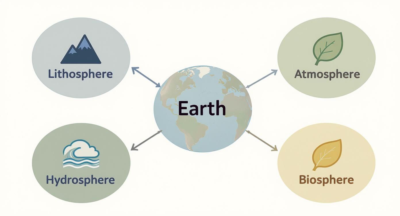
The visualization really highlights how the lithosphere, hydrosphere, atmosphere, and biosphere aren't isolated. They are deeply interconnected systems that physical geographers spend their time studying.
Biogeography The Geography of Life
Why do kangaroos only live in Australia? And why are polar bears found in the Arctic but not the Antarctic? These are the kinds of questions at the heart of biogeography, the branch that explores the distribution of plants and animals across the planet. It’s a fascinating blend of biology and geography, bridging the gap between life (the biosphere) and the other Earth systems.
Biogeographers study how physical barriers like mountains and oceans have isolated species, leading them down unique evolutionary paths. They also examine how climate, soil, and water create distinct habitats, or biomes, that support specific communities of life. For instance, the cold, dry conditions of the tundra support hardy mosses and lichens, while the warm, wet climate of a tropical rainforest allows for an explosion of biodiversity.
Biogeography is more than just an academic pursuit; it's a critical tool for conservation. By understanding the specific environmental needs of a species, conservationists can better protect its habitat and predict how it might be affected by climate change or human development.
Hydrology The Science of Water
Finally, hydrology is the study of Earth’s water, or the hydrosphere. This field tracks the incredible journey of water as it moves through the hydrologic cycle—evaporating from oceans, forming clouds, falling as rain or snow, and flowing across and under the land back to the sea.
Hydrologists are essential for managing one of our most precious resources. Their work includes:
- Water Supply Management: They assess how much freshwater is available in rivers, lakes, and underground to ensure cities and farms have the water they need.
- Flood Forecasting: By monitoring rainfall and river levels, hydrologists can predict when and where floods are likely to occur, giving communities critical time to prepare.
- Water Quality Protection: They study how pollutants move through water systems, helping to identify sources of contamination and keep our drinking water safe.
From the grand shapes of continents to the intricate web of life, each branch of physical geography offers a specialized perspective. Together, they give us the knowledge we need to understand our planet not as a collection of static features, but as a living, dynamic system of interconnected forces.
The Tools and Methods Geographers Use
So, how do physical geographers actually figure all this stuff out? It’s not just about staring at maps. Think of them as environmental detectives, blending old-school fieldwork with some seriously powerful modern tech to gather clues about how our planet works. The toolkit has evolved in a huge way, shifting from compasses and paper charts to digital instruments that show us the Earth in breathtaking detail.
At the end of the day, their job is to observe, measure, and analyze the world around us. Whether that means taking soil samples on a remote hillside or poring over satellite images of a melting glacier, the goal is always the same: collect data that tells a story. This data is the raw material that all geographic understanding is built on.
The Power of Spatial Data
Modern physical geography is all about collecting and interpreting spatial information. This has pushed the development of some incredibly sophisticated techniques for mapping and analyzing the Earth’s surface.
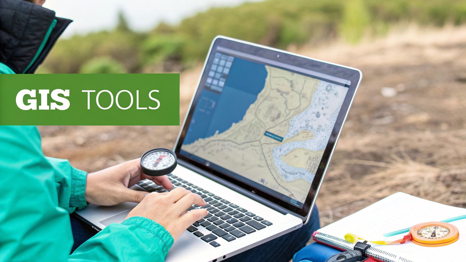
Geographic Information Systems (GIS): The easiest way to think about GIS is as a set of smart maps. Instead of a single flat picture, GIS lets geographers stack different layers of data—like elevation, land use, and rainfall patterns—right on top of each other. By seeing how these layers interact, they can spot hidden connections. For example, how does the steepness of a slope (elevation layer) affect the risk of a landslide after heavy rain (rainfall layer)? It’s a game-changing tool for everything from disaster response to city planning. If you want to dive deeper, we have a whole guide on what Geographic Information Systems are.
Global Positioning System (GPS): We all know GPS for getting around town, but for geographers, it’s an essential fieldwork tool. It provides the hyper-accurate location data needed to map landforms, track the shifting course of a river, or tag the exact coordinates of an environmental sample. GPS makes sure every piece of data is locked to a precise point on the globe.
These tools are all part of the wider field of geomatics, which pulls together data collection, mapping, and analysis to build a clearer picture of our world.
Eyes in the Sky: Remote Sensing
One of the biggest leaps forward for physical geography has been remote sensing. Put simply, it’s the science of gathering information about the Earth from a distance, usually with sensors on satellites or aircraft. It’s like giving our planet a regular check-up from space.
Remote sensing acts as Earth's early-warning system. It allows scientists to monitor vast and inaccessible areas—like the Amazon rainforest or the Antarctic ice sheets—in near real-time, providing critical data on environmental changes that affect us all.
Satellites carry specialized sensors that can "see" things the human eye can't. They measure the temperature of the ocean's surface, check the health of forests by analyzing the light they reflect back, and even detect tiny shifts in the ground that might warn of a volcanic eruption.
This constant flood of data gives geographers the power to monitor huge processes like deforestation, urban sprawl, and the melting of polar ice with incredible precision. By pairing these high-tech tools with boots-on-the-ground fieldwork, geographers are able to piece together the complex, dynamic story of our ever-changing world.
How Physical Geography Solves Real World Problems
This is where the rubber meets the road. All the theory about Earth’s systems transforms into real, tangible action that affects our daily lives. Physical geography isn't just an academic discipline stuck in a textbook; it's an active, problem-solving science at work all around us, every single day.
From predicting the path of a hurricane to designing cities that are cooler and more livable, its applications are incredibly diverse. When geographers apply their knowledge to the real world, they save lives, protect precious resources, and help build a more resilient future.
Let's look at a few powerful examples.
Predicting and Mitigating Natural Hazards
One of the most immediate ways physical geography helps society is by forecasting and managing natural disasters. Scientists use their deep understanding of Earth’s processes to figure out where and when a disaster might hit, giving communities crucial time to prepare.
Take landslides in mountainous regions. A geomorphologist—a specialist who studies how landscapes are formed—sees more than just a steep hill. They analyze the slope's angle, the specific types of soil and rock, and local rainfall patterns to create incredibly detailed hazard maps. These maps aren't just for show; they guide city planners and engineers on where it's safe to build homes, roads, and hospitals, steering development away from the most dangerous zones.
This same practical approach applies to all kinds of hazards:
- Volcanic Eruptions: Geographers watch for ground swelling, track gas emissions, and monitor tiny earthquakes to predict when a volcano might erupt.
- Flooding: Hydrologists analyze river levels and watershed data to issue flood warnings that get people to safety before the water rises.
- Coastal Storms: By modeling storm surges, climatologists and oceanographers help coastal towns create effective evacuation plans.
Managing Critical Water Resources
Water is everything. Yet managing it is a massive challenge, especially with growing populations and more frequent droughts. This is where hydrologists and climatologists become essential, combining their expertise to make sure our farms and cities have the water they need to function.
Imagine a region in a prolonged drought. Hydrologists get to work assessing every part of the water supply. They measure groundwater levels, analyze the mountain snowpack (a critical source of meltwater), and calculate how much water is flowing in the rivers. This hard data allows water managers to make tough but necessary decisions, like implementing conservation rules or fairly dividing water between cities and agriculture.
By understanding the entire water cycle—from rain clouds to underground aquifers—physical geographers provide the scientific backbone for sustainable water policies that can support communities, even when resources are scarce.
Designing Smarter Sustainable Cities
Urbanization is one of the biggest stories of our time. By 2025, over 60% of the world's population is expected to live in cities. This explosive growth, especially in megacities like Mumbai, completely reshapes the landscape, affecting local climates and natural systems.
This is where understanding urban microclimates becomes so important. Cities often create a "heat island" effect, where concrete and asphalt trap and radiate heat, making urban cores significantly hotter than the surrounding countryside.
Physical geographers work directly with city planners to fight back. They might recommend practical, science-backed solutions like:
- Planting more trees for shade and natural cooling.
- Installing green roofs and parks to absorb less heat.
- Using reflective materials for roads and buildings to bounce sunlight away.
These aren't just cosmetic changes. They make cities more comfortable, slash energy bills for air conditioning, and improve air quality for everyone. This blend of natural processes and human environments is a fascinating field, and you can dive deeper in our guide on what is environmental geography.
From preventing landslides to building greener cities, it's clear that physical geography isn't just about understanding our world—it’s about actively making it a better, safer place to live.
Why This Science Matters More Than Ever
In an age of rapid environmental change, knowing physical geography has shifted from a classroom subject to a critical life skill. This isn't just about understanding maps anymore. It’s about having the owner's manual for our planet so we can make sense of the powerful forces shaping our world.
The insights from this field are on the front lines of our biggest challenges. Physical geography is the science that explains the mechanics of a wildfire, predicts the path of a hurricane, and helps us manage precious resources for a growing population.
A Critical Skill for a Changing Planet
Geographic literacy isn't optional—it's essential for everyone, from homeowners to world leaders. Without a real grasp of how Earth’s systems connect, our big decisions are just educated guesses. With it, we can start building a more resilient and sustainable society.
- For citizens, it empowers smarter choices about where to live, how to vote on environmental issues, and the best ways to prepare for natural hazards.
- For policymakers, it provides the hard data needed to draft effective environmental laws and build infrastructure that can actually withstand future conditions.
- For business leaders, it uncovers real-world risks and opportunities tied to supply chains, resource scarcity, and the local impacts of climate change.
This is where understanding physical geography moves from theory to reality. It bridges the gap between scientific principles and the tangible world we live in every day.
Facing the Future with Geographic Insight
The consequences of ignoring these foundational principles are all around us. Climate change is redrawing our world, and the numbers are startling. Since 1997, Antarctica has lost approximately 7.5 trillion tons of ice. Under current warming trends, two-thirds of the world’s glaciers could be gone by 2100.
This isn't just an abstract environmental problem. The resulting sea-level rise could flood coastal areas where 340–480 million people currently live, potentially triggering massive migrations within this century. You can learn more about these major environmental shifts on Earth.org.
We are all living on a complex, interconnected planet. Physical geography gives us the tools not just to see our world, but to truly understand its intricate web of connections—and our own powerful role within it. It’s a roadmap to a more informed, responsible, and sustainable future for all of us.
Got Questions? We've Got Answers.
Still curious about what physical geography is all about? Let's clear up some of the most common questions people have when they first dive into this incredible science.
What’s the Main Goal of Physical Geography?
The big idea is to understand the natural processes and patterns that have sculpted our planet. It’s all about answering the "why" behind the "what"—why do mountains exist where they do, how do ocean currents and atmospheric winds work together, and how are these powerful systems changing over time?
How Is Physical Geography Different from Human Geography?
Think of it like two sides of the same coin. Physical geography is all about the natural world—the landforms, climate, water systems, and ecosystems that make up the stage. On the other hand, human geography focuses on the actors on that stage: people, their cultures, cities, and how they interact with their environment.
They might be separate branches, but they're deeply connected. You can’t really understand the rise of a coastal city (human geography) without looking at its natural harbor and local climate (physical geography).
Is Physical Geography Considered a STEM Field?
Without a doubt. Physical geography is a core Earth science, built on the foundations of the scientific method. It pulls heavily from physics, chemistry, biology, and geology to explain how the world works.
Modern geographers are in the trenches with advanced tools like GIS, remote sensing, and complex computer models to analyze data. It's a serious STEM discipline.
Do I Need to Be a Science Whiz to Study It?
Not at all. While it's definitely a science, the fundamental ideas are surprisingly accessible. The best part is that it uses real-world examples you see every day to explain big concepts.
A basic grasp of physical geography helps you understand everything from your local weather forecast to global news about natural disasters and climate change. It gives you a user's manual for how our planet works, which is useful for everyone, not just scientists.
Ready to see these concepts in action? With EarthChasers, you can stop reading and start exploring. Discover breathtaking landscapes, learn about the forces that shape them, and challenge your friends to see who knows our planet best.
Start your adventure and watch physical geography come to life!