What Is Topography in Geography A Complete Guide
What is topography in geography? Explore how elevation, landforms, and digital mapping shape our world in this complete, easy-to-understand guide.
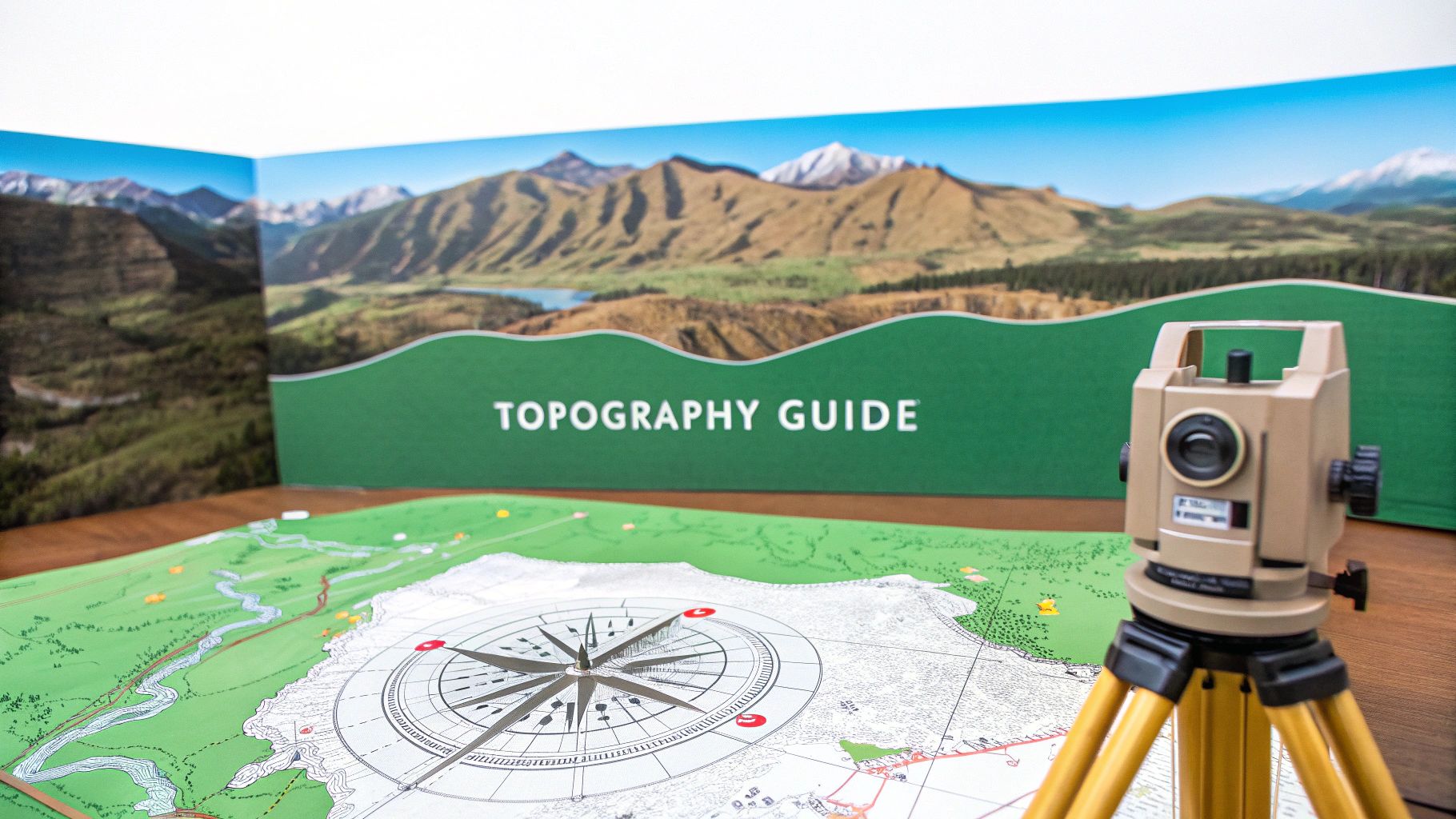
When you hear the word "topography," what comes to mind? For most people, it's those cool-looking maps with wavy lines all over them. And they're not wrong! At its core, topography is the detailed study of Earth's surface features—or its terrain.
It’s the science that answers the question, "what does the landscape actually look like?" by mapping out everything from mountains and valleys to rivers and roads.
What Is Topography? A Quick Overview
Imagine trying to explain the Grand Canyon to someone who has never seen it. You wouldn't just say it's "a big hole." You’d talk about its staggering depth, the sheer cliffs, the layers of colored rock, and the tiny-looking river carving its way through the bottom.
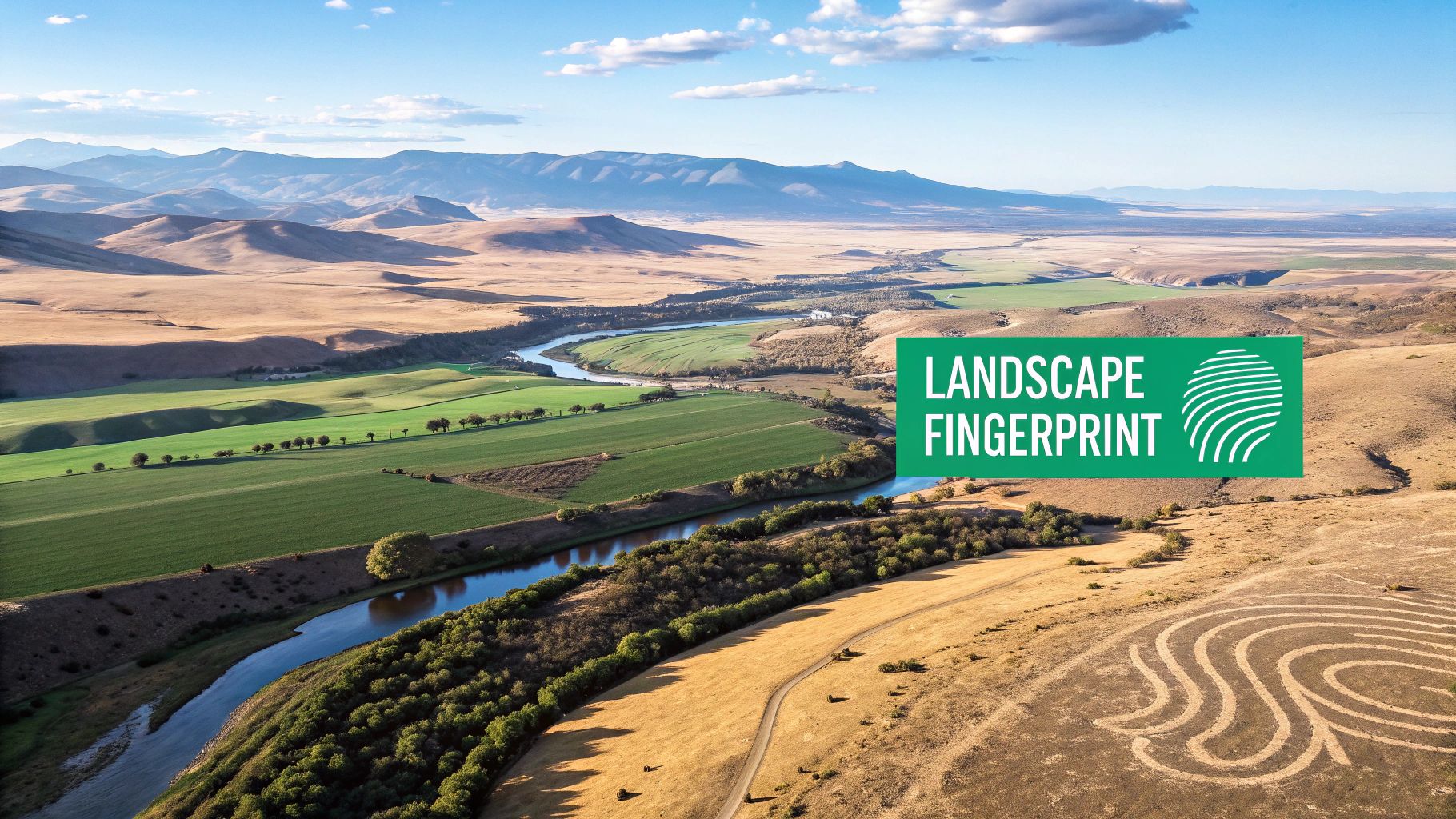
That's exactly what topography does. It captures the three-dimensional character of a place—its ups, downs, and everything in between—and translates it onto a two-dimensional surface like a map. It’s the unique fingerprint of a landscape, telling a story written over millions of years by geology, water, and weather.
This "fingerprint" is defined by a few key components that work together to give every place on Earth its distinct shape.
The Building Blocks of Terrain
To really get what topography is all about, you need to know its three core elements. Each one gives us a different piece of the puzzle.
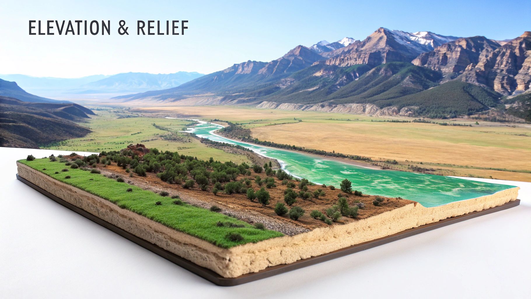
Elevation: This is the simplest one. It's just the height of a specific point above a set baseline, which is almost always sea level. A mountain peak has a high elevation, while a beach obviously has a very low one.
Relief: This isn't about feeling better; it’s about the difference in elevation within an area. A flat prairie has very low relief, while a rugged, jagged mountain range has incredibly high relief. It’s what makes a landscape feel dramatic or subtle.
Landforms: These are the specific, named shapes of the land. Think mountains, valleys, plateaus, canyons, and hills. These are the features you can point to and name, all sculpted by powerful geological forces.
Think of these three elements as the alphabet of a landscape. Once you can read them, you can start to understand the story the land is telling you.
To make this even clearer, here’s a quick breakdown of how these components come together.
Core Components of Topography at a Glance
This table offers a quick reference for the fundamental elements that define any landscape's topography.
| Component | What It Represents | Real-World Example |
|---|---|---|
| Elevation | A point's height above sea level. | The peak of Mount Everest is at 29,032 feet. |
| Relief | The difference between the highest and lowest points in an area. | The Great Plains (low relief) vs. the Rocky Mountains (high relief). |
| Landforms | Recognizable physical features of the Earth's surface. | A volcano, a river delta, or a sand dune. |
By combining these three components, we get a complete picture of the terrain, which is crucial for everything from hiking and urban planning to understanding ecosystems.
Breaking Down Elevation, Relief, and Landforms
To really get what topography is all about, you need to understand its three core pillars. These elements are the building blocks that shape every single landscape on Earth, from the flattest plains you can imagine to the most jagged, sky-piercing peaks.
First up is elevation. Simply put, it's the height of any given point, usually measured from sea level. But elevation is so much more than just a number—it dictates everything from the local climate and temperature to what kinds of trees and plants can survive there. If you're curious, you can check the specific altitude of any spot with a good online elevation finder tool.
Next, we have relief. Think of relief as the "texture" of the land's surface. It’s the difference between the highest and lowest points in a given area. A landscape with wide-open, rolling fields has low relief, while a dramatic region carved with steep mountains and deep canyons has high relief.
The Major Shapes of the Earth
Finally, we get to landforms—the actual physical features that give a landscape its character. These are the mountains, valleys, plateaus, and plains we can see and recognize. Each one tells a story about the immense geological forces that shaped it.
Mountains, like the Himalayas, are usually the result of tectonic plates crashing into each other, pushing the Earth's crust skyward over millions of years.
Valleys are often carved out by the relentless, erosive power of rivers and glaciers grinding away at the rock over millennia.
Plains, like the Great Plains of North America, are vast, low-relief areas that frequently become the world’s most fertile farmlands.
Topography is more than just a map; it's a dynamic story of geological forces and natural processes. Understanding elevation, relief, and landforms allows us to read this story and appreciate the complexity of our planet's surface.
For a great real-world look at how these concepts come together, you can explore guides on specific examples of complex landforms such as Little Cottonwood Canyon, where the dramatic elevation changes and high relief create a truly stunning landscape.
How We Map the Earth's Terrain
Mapping the Earth's terrain has come a long way from the days of surveyors trekking through the wilderness with basic tools. Early mapmakers laid the groundwork for topography by painstakingly measuring elevation changes step by step, a process that was slow, grueling, and limited in scope.
The real breakthrough came with technologies that gave us a bird's-eye view, like satellite imaging and LiDAR (Light Detection and Ranging). LiDAR, in particular, is a game-changer. It works by shooting laser beams at the ground and measuring how long they take to bounce back, creating incredibly precise 3D models of the surface.
From Data Points to Digital Worlds
All this information—billions of individual measurements—gets compiled into what we call Digital Elevation Models (DEMs). A DEM is essentially a 3D digital blueprint of a terrain's surface. It’s the foundational data that powers everything from the mountains you fly over in Google Earth to the complex models used by city planners and scientists.
A DEM transforms millions of individual elevation points into a seamless, interactive model of the landscape. It's the technology that allows us to not just look at a flat map but to truly explore the terrain's shape and structure.
This tech has even peeled back the curtain on the hidden world beneath our oceans. Global mapping of the ocean floor jumped from a mere 6% in 2018 to nearly 25% by 2023. On land, the picture is even more complete, with modern datasets providing elevation models for over 99% of the planet's landmass.
Of course, having these advanced maps is one thing; knowing how to read them is another. If you're ready to dive into the practical side, our guide on how to read topographic maps is the perfect next step. To see how modern tech puts this all into practice, check out this great resource on mapping with drones.
Why Topography Matters in Everyday Life
Topography isn't just some abstract concept for geographers and map-makers. Its principles shape critical decisions that affect our daily lives, often in ways we don’t even see. The physical layout of the land—the "lay of the land"—dictates where we build our homes, how we grow our food, and even how nations defend their borders.
Think about the last road you drove on. Civil engineers don't just pave a straight line from A to B. They lean heavily on topographic maps to design safe, efficient routes. They analyze every slope, hill, and valley to avoid steep grades, unstable ground, and flood-prone areas, making sure the road doesn't wash out during the first big storm.
Farmers have understood this for centuries. They instinctively use their knowledge of the landscape to plant crops on slopes that get the best sunlight, and they manage irrigation so water flows gently without eroding precious topsoil. It’s an age-old practice, now supercharged with precise digital elevation data.
From Farming to Flood Prevention
Once you start looking, you'll see the influence of topography everywhere. Understanding the terrain is fundamental for planning, building, and surviving.
Urban Planning: City planners use topographic data to decide where to build. It helps them ensure proper drainage and avoid putting new developments in high-risk zones for landslides. Building in a low-lying valley without a solid flood plan is just asking for disaster.
Natural Disaster Management: Topography is absolutely key to predicting and preparing for natural hazards. Geologists analyze steep slopes to flag potential landslide zones, while hydrologists map river valleys to forecast where floodwaters will go, giving people time to evacuate.
Resource Exploration: The shape of the land often gives clues about what's underneath. Companies searching for minerals or oil use topographic maps to identify geological formations where those resources are likely to be hiding.
The timeline below shows just how far we've come in mapping our world, moving from painstaking manual surveys to incredibly advanced digital methods.
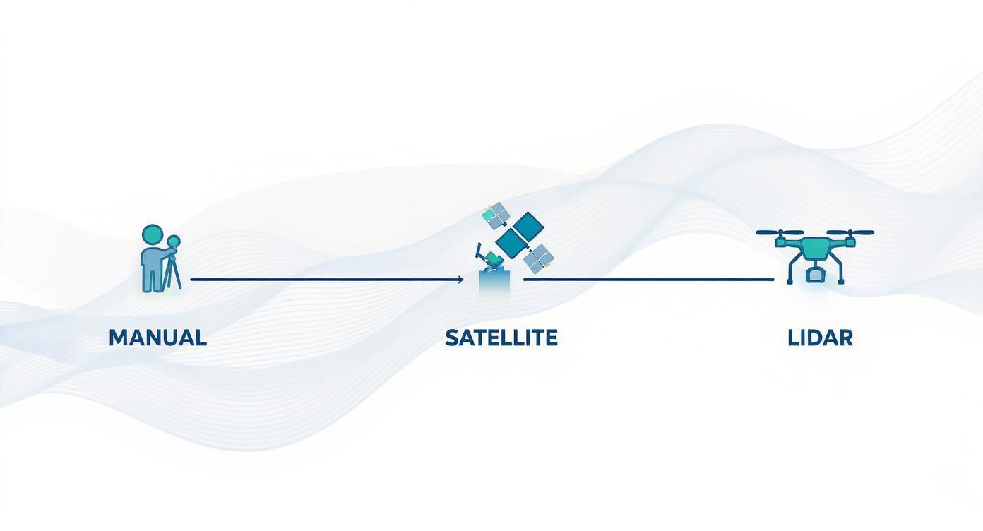
This evolution represents a massive leap, from slow, localized mapping to rapid, highly detailed global data collection using satellites and LiDAR-equipped drones.
In the world of EarthChasers, getting a handle on these real-world applications is your secret weapon. Navigating a tough in-game quest often means you have to think like an engineer or a farmer—using the landscape to your advantage to find the quickest path or spot a hidden objective.
The Power of High-Resolution Digital Elevation Models
Forget the old-school paper maps with their wavy contour lines. Modern topography has gone digital, and the results are absolutely stunning. Today, we work with Digital Elevation Models (DEMs), which are essentially hyper-detailed 3D maps of the Earth's surface.
Embedded content
Think of it like upgrading from a grainy, black-and-white photo to a crystal-clear 4K video of the landscape. This level of detail is all about resolution. When you hear that a DEM has a "2-meter resolution," it means every single pixel in that model represents a 2x2 meter square of actual ground. This precision lets us spot subtle dips, ridges, and slopes that were totally invisible before.
A Flood of Precise Data
We are in the middle of a global mission to map our planet like never before. Massive projects like EarthDEM are piecing together a high-resolution 3D view of the entire globe, giving scientists an incredible tool to track even the smallest changes in the landscape.
High-resolution DEMs turn topography into a powerful, data-driven science. They provide the raw information needed to model complex environmental systems, from predicting landslide risks to managing precious water resources with pinpoint accuracy.
The sheer scale of this is mind-boggling. The EarthDEM project recently dropped a data release covering over half of Earth's non-polar land—a staggering 210 terabytes worth of information. Meanwhile, the USGS 3D Elevation Program (3DEP) is constantly expanding its coverage in the United States, adding hundreds of thousands of square kilometers of fresh data. You can see how this data is being updated by checking out the high-resolution world elevation layers on esri.com.
Turning Data into Actionable Insights
So, what do we do with all this amazing data? This is where it gets really interesting. This wealth of information is the bedrock for modern environmental science, allowing researchers to:
- Model Soil Erosion: Figure out exactly which slopes are most vulnerable to erosion after a heavy rain, helping farmers protect their topsoil.
- Manage Water Resources: Map out every creek and valley in a watershed to see exactly how water flows. This is crucial for predicting floods and protecting our drinking water.
- Track Landscape Changes: Monitor the aftermath of a volcanic eruption or watch how a glacier is melting over time, giving us hard data to study climate change.
This data is crunched using powerful software that can turn raw numbers into predictive models. To get a better sense of the tech that makes this possible, take a look at our guide on what are geographic information systems.
Using Topography for Environmental Insights
These days, topography is about so much more than just drawing the contours of mountains and valleys. It’s about turning raw elevation data into powerful environmental intelligence—the kind of information that helps us protect our planet. Geographers and scientists now run sophisticated algorithms on massive datasets, transforming a sea of numbers into insights we can actually act on.
This computational approach lets us model complex natural processes with stunning accuracy. One of the most critical applications? Predicting soil erosion, a huge threat to agriculture all over the world. To get ahead of it, scientists need to calculate exactly how the shape of the land will affect the flow of water and how much soil it will carry away.
From Data to Predictions
A key metric they use is the LS-factor, a value that combines slope length and steepness to quantify erosion risk. This isn't just a simple measurement you can take with a protractor; it involves some pretty complex calculations on high-resolution datasets.
Topography today is less about just making maps and more about creating predictive models. By understanding the precise shape of the terrain, we can forecast how landscapes will respond to environmental pressures like heavy rainfall or deforestation.
These models are absolutely essential for everything from sustainable farming and watershed management to modeling climate change. They help farmers put smarter soil conservation strategies in place and guide officials in protecting vital water sources from runoff and pollution.
For example, topography is a core component in calculating global soil erosion patterns. The slope length and steepness factors are often calculated using SRTM 3-arcsecond spatial resolution data, which gives a solid picture of how terrain influences the process. When combined with even higher-resolution data, these datasets can cover over 99 percent of the world's landmass, allowing for incredibly detailed analysis on a planetary scale. It's a great example of how modern topography uses advanced computational power to pull vital characteristics from the land itself. You can learn more about how scientists calculate global soil erosion using topographic data in recent studies.
Tying It All Together
Still have a few questions about topography? Let's clear up some common points to make sure these concepts are crystal clear.
What's the Real Difference Between Topography and Topology?
It's easy to get these two mixed up because they sound so similar, but they're worlds apart.
Think of it this way: Topography is about the physical shape of the land. It’s the nitty-gritty of mountains, valleys, and slopes—things you can measure and climb. Topology, on the other hand, is about connections and relationships. It doesn’t care about hills; it just cares how Point A is connected to Point B, like a subway map showing stations linked by lines.
How Do Those Wavy Lines on a Map Work?
Those lines are called contour lines, and they're the secret language of a topographic map. Each line connects points that sit at the same exact elevation.
- Lines packed tightly together? You're looking at a steep climb.
- Lines spread far apart? That’s a gentle slope or flat ground.
Once you get the hang of reading them, you can see a 3D landscape pop right off a 2D page.
A great way to think about contour lines is to imagine a mountain being sliced into horizontal layers, like a cake. Each line on the map is the edge of one of those slices.
Can Topography Actually Change?
Absolutely. While the massive shifts from plate tectonics take millions of years, landscapes can change surprisingly fast. A sudden landslide can carve a new path down a mountain, a volcanic eruption can build a new cone overnight, and a major flood can reroute a river entirely.
And it’s not just nature. Human activities like mining, building dams, or large-scale construction projects are constantly reshaping the Earth’s surface on a massive scale.
Ready to see how all this plays out in the real world? In the EarthChasers game, a sharp eye for topography is your secret weapon for nailing challenges and finding those hidden spots. Jump in and start your adventure today!