Your Ultimate Guide to Mastering Any Map Quiz North Africa
Ace your map quiz North Africa with this guide. Learn countries, capitals, and proven study techniques that make geography engaging, memorable, and easy.
Trying to master a North Africa map quiz can feel a little like you've been handed a puzzle with a bunch of sand-colored pieces. It's tough to know where to begin. The secret? Anchor your knowledge to the biggest, most obvious features first—the countries and the giant geographical landmarks that define them. This turns a jumble of abstract shapes into a connected, memorable landscape right from the start.
Your North Africa Map Quiz Starter Kit
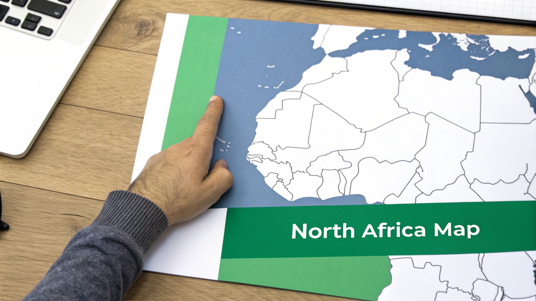
Before you get lost in the details of every city and river, let's build a solid foundation. Think of it as putting up the frame of a house before you start decorating. Instead of trying to cram every fact in at once, we'll focus on the essentials that form the backbone of any North Africa map quiz.
The trick is to forge a strong link between each country and its most unmissable geographic signature. These massive features act like landmarks on your mental map, making it so much easier to place everything else correctly.
The Core Countries And Their Geographic Anchors
Your journey starts with mastering the locations of the main countries that define this incredible region. Most quizzes will hit you with this core group, so you need to be able to spot them in your sleep.
- Morocco: It’s the region's northwestern anchor, easy to spot with its coasts on both the Atlantic and Mediterranean, plus the rugged Atlas Mountains running through it.
- Algeria: Africa's largest country, it absolutely dominates the central Maghreb. Think vast Saharan interior.
- Tunisia: A small but significant country tucked between Algeria and Libya, with a long and historically important Mediterranean coastline.
- Libya: Another coastal nation, defined by its long Mediterranean shore and massive desert territory stretching south.
- Egypt: The northeastern giant. It’s impossible to miss, thanks to the life-giving Nile River and its famous delta.
- Sudan: Sitting directly south of Egypt, it shares the Nile and marks the transition from pure desert to more sub-Saharan landscapes.
- Western Sahara: You'll almost always see this territory on quizzes. It's located right on the Atlantic coast, just south of Morocco.
When you connect a country to a dominant feature—like Egypt with the Nile or Morocco with the Atlas Mountains—you're creating powerful visual and conceptual hooks. This method blows rote memorization out of the water.
To help you get started, here's a quick cheat sheet connecting the dots between these core countries, their capitals, and a key landmark.
North African Countries And Capitals At A Glance
| Country | Capital City | Key Geographic Feature |
|---|---|---|
| Morocco | Rabat | Atlas Mountains |
| Algeria | Algiers | Sahara Desert Dominance |
| Tunisia | Tunis | Mediterranean Coastline |
| Libya | Tripoli | Expansive Libyan Desert |
| Egypt | Cairo | The Nile River & Delta |
| Sudan | Khartoum | Confluence of the Nile |
| Western Sahara | Laayoune (El Aaiún) | Atlantic Coastal Plain |
This table is your jumping-off point. Use it to build those initial connections before you dive deeper into the region's rich geography.
Building Your Foundational Map
Once you have these core locations locked in, you'll start to see North Africa not as a random collection of borders, but as an interconnected geographical story. The Sahara Desert is no longer just a big empty space; it's the defining feature that separates the coastal nations from the heart of the continent. The Mediterranean Sea becomes the shared northern highway that has shaped the history and culture of Morocco, Algeria, Tunisia, Libya, and Egypt for millennia.
This foundational knowledge is your most powerful tool. After you've built this mental map, adding capitals, major cities, and smaller features becomes a simple process of layering details onto a structure you already get.
For some hands-on practice, nothing beats a physical map. You can find some great resources and learn more about how to use them with this guide to a printable Africa map. It’s a game-changer.
Connecting People, Places, and History
A map is so much more than a collection of lines, dots, and colors. It's a living storybook of human history. To truly conquer any map quiz North Africa throws at you, you have to look beyond the borders and understand the people who have shaped this land for thousands of years. This context is what turns abstract shapes into meaningful places.
When you connect geography to human migration, locations suddenly become infinitely more memorable. Instead of just seeing Morocco's outline, you can picture it as the historic heartland of the Amazigh people, a culture deeply intertwined with the soaring Atlas Mountains. This story-driven approach gives you the crucial 'why' behind the 'where,' making the information really stick.
The Ancient Roots and Cultural Layers
North Africa’s cultural landscape is a rich tapestry woven from two main threads: the indigenous Imazighen (often called Berbers) and the waves of Arab migrations that started in the 7th century. The Imazighen are the region's original inhabitants, with roots that stretch back thousands of years.
Their languages and traditions laid down a foundational cultural layer, one that remains particularly strong in the mountainous and rural parts of the Maghreb (Morocco, Algeria, and Tunisia). Then, the arrival of Arab groups brought the Arabic language and Islam, which profoundly shaped the coastal cities and major trade routes.
Understanding this dynamic is a game-changer. When you see a location on the map, ask yourself: Was this a historic Amazigh stronghold, a major Arab trading hub, or a place where both cultures mixed? That one question adds a powerful layer of context that helps you lock in the location.
This historical interplay explains the incredible cultural diversity you see today. For example, while Arabic is the official language in Algeria, millions also speak Tamazight languages—a living testament to this deep-seated dual heritage.
How History Draws the Map for You
When you start to see the history on the map, geographic recall becomes almost effortless. It creates a logic that’s far easier to follow than just memorizing random placements.
- The Maghreb: This term, meaning "the west" in Arabic, is a logical grouping for Morocco, Algeria, and Tunisia. Thinking of them as a historical and cultural unit helps you remember their proximity on the quiz.
- Egypt's Nile Valley: For millennia, civilization has been packed tightly along the Nile. This makes it simple to remember that Egypt's population centers and most famous ancient sites all follow this single, life-giving river.
- Coastal Connections: The Mediterranean coast was a highway for Phoenicians, Romans, Arabs, and Europeans. This shared history links the northern cities of Tunisia, Algeria, and Libya, making their relative positions on the map feel much more intuitive.
Recent genetic studies have backed up this deep history, revealing that the ancestral lines of the Imazighen and Arabs diverged over 20,000 years ago. This created a unique demographic mosaic that continues to define the region's identity. You can discover more about North Africa's demographic history and see how it shaped modern populations. Suddenly, every quiz question becomes a piece of a much larger, more fascinating story.
Decoding the Most Common Quiz Questions
To crush your North Africa map quiz, you have to get inside the head of the person who made it. It’s rarely just about pointing to countries on a map. Most quizzes are cleverly designed to test your spatial thinking from several different angles.
Once you know the common question formats, you can stop studying blindly and start preparing with a real strategy. Most quizzes will hit you with three main types of challenges: locating countries and capitals, identifying physical features, and figuring out which countries share borders. Let's break down how to handle each one.
Country and Capital Placement
This is the bread and butter of any geography quiz. You’ll see a highlighted country and have to name it, or you'll be asked to click on its capital city. A classic rookie mistake is mixing up the coastal capitals like Algiers, Tunis, and Tripoli—they can start to blur together.
Here’s a simple trick: take a mental road trip along the coast. Start at Rabat on Morocco's Atlantic shore and drive east along the Mediterranean. As you pass each capital, name it out loud: Algiers, Tunis, Tripoli. Your trip ends in Cairo, which is a bit inland but sits right on the iconic Nile Delta.
Identifying Physical Features
These questions shift your focus from the political map to the physical one. Instead of borders, you’ll be asked to find the major landmarks that give North Africa its unique character.
- Atlas Mountains: This is your anchor. The mountain range is what separates the coastal areas of Morocco and Algeria from the endless Sahara.
- Nile River and Delta: You can't miss it. This is the lifeblood of Egypt, flowing north and fanning out into the Mediterranean Sea.
- The Sahara Desert: A question will almost certainly ask you to identify the massive desert that dominates pretty much everything.
The real secret here is to see how the physical and political maps connect. The Atlas Mountains create the environment for the Maghreb countries. The Nile defines Egypt. If you link the feature to the country, you'll never forget either one.
Naming Bordering Countries
The last common question format tests how well you understand the regional puzzle. You might get a question like, "Which of these countries does not border Algeria?" This requires a more sophisticated mental map of how all the pieces fit together.
Mnemonics can be a lifesaver here. For example, mentally bundle the core Maghreb countries (Morocco, Algeria, and Tunisia) into a single, connected bloc. Thinking of them as a unit makes it way easier to remember that they all touch.
While we're focused on North Africa, getting familiar with different quiz styles in general is always a good idea. For a broader perspective, you can check out these pop quiz examples from a bootcamp setting to see how questions can be structured for learning. Once you’ve dissected these patterns, you can walk into any quiz feeling prepared and confident.
Study Smarter, Not Harder, with Proven Techniques
Embedded content
Let's be honest: just staring at a map of North Africa, hoping the names and borders will magically sink in, is a recipe for frustration. It’s one of the least effective ways to prepare for a map quiz on North Africa. The real secret is to stop passively observing and start actively learning. It’s time to use strategies that actually build strong, lasting connections in your brain.
Forget trying to swallow the whole region in one bite. A much better approach is a technique called chunking, which just means breaking a big area into smaller, more manageable pieces. For North Africa, you could group Morocco, Algeria, and Tunisia together as the Maghreb. Learning that one cluster is far less intimidating than trying to memorize seven separate countries all at once.
Master with Visual and Kinesthetic Learning
Another game-changer is visual association. Our brains are wired to remember images way better than abstract words or lines on a map. So, get creative. Try linking a country’s shape to an object you already know.
- Does Tunisia’s outline remind you of a seahorse?
- Does the curve of Morocco’s Atlantic coast look like a fisherman's hook?
These simple mental pictures act as powerful memory triggers when you’re staring at a blank quiz map.
To really lock it in, get your hands involved. Download a blank map of North Africa and physically trace the borders with your finger or a pen. Label the countries, the capitals, and major features like the Atlas Mountains and the Nile River. This hands-on, kinesthetic approach—learning by doing—activates muscle memory and builds a much deeper feel for how everything fits together.
Spaced repetition is the ultimate hack for long-term memory. Instead of cramming for hours, review the map for short bursts over several days. This technique forces your brain to recall information just as it’s about to forget it, locking it in for good.
The diagram below breaks down the main types of questions you can expect, which helps you focus your study time where it counts.
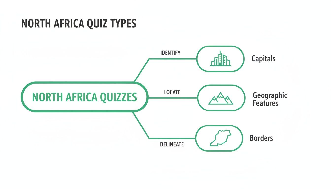
As you can see, quizzes test your knowledge of capitals, physical features, and borders—reinforcing why a multi-layered study plan works so well.
Tools That Reinforce Your Knowledge
Find the perfect study method for your learning style with this comparison of proven geography memorization techniques.
Effective Geography Study Technique Comparison
| Technique | How It Works | Best For |
|---|---|---|
| Chunking | Grouping countries into smaller regions (e.g., The Maghreb) to learn them as a set. | Learners who feel overwhelmed by large amounts of information. |
| Visual Association | Connecting a country’s shape or location to a familiar image or object. | Visual learners who remember pictures better than words. |
| Kinesthetic Learning | Physically tracing maps and writing labels to build muscle memory. | Hands-on learners who learn best by doing. |
| Spaced Repetition | Reviewing information at increasing intervals to move it into long-term memory. | Anyone looking for an efficient, science-backed way to memorize facts. |
Ultimately, mixing and matching these methods will give you the best results. What works for remembering capitals might be different from what helps you nail down river systems.
To make this even easier, technology can be your best friend. Digital flashcard apps that use spaced repetition systems (SRS) are perfect for drilling countries and capitals. This method systematically shows you flashcards at just the right intervals, maximizing your memory retention without wasting time on the stuff you already know cold.
To truly master any quiz, incorporating general effective exam study techniques is also a huge help. When you combine these broader strategies with geography-specific methods, you've got a killer plan. For an even deeper dive into memory tricks built just for geography, check out our guide on the best way to learn geography. By actively engaging with the map this way, you won't just be ready—you'll be confident.
Bringing The Map To Life with Interactive Tools
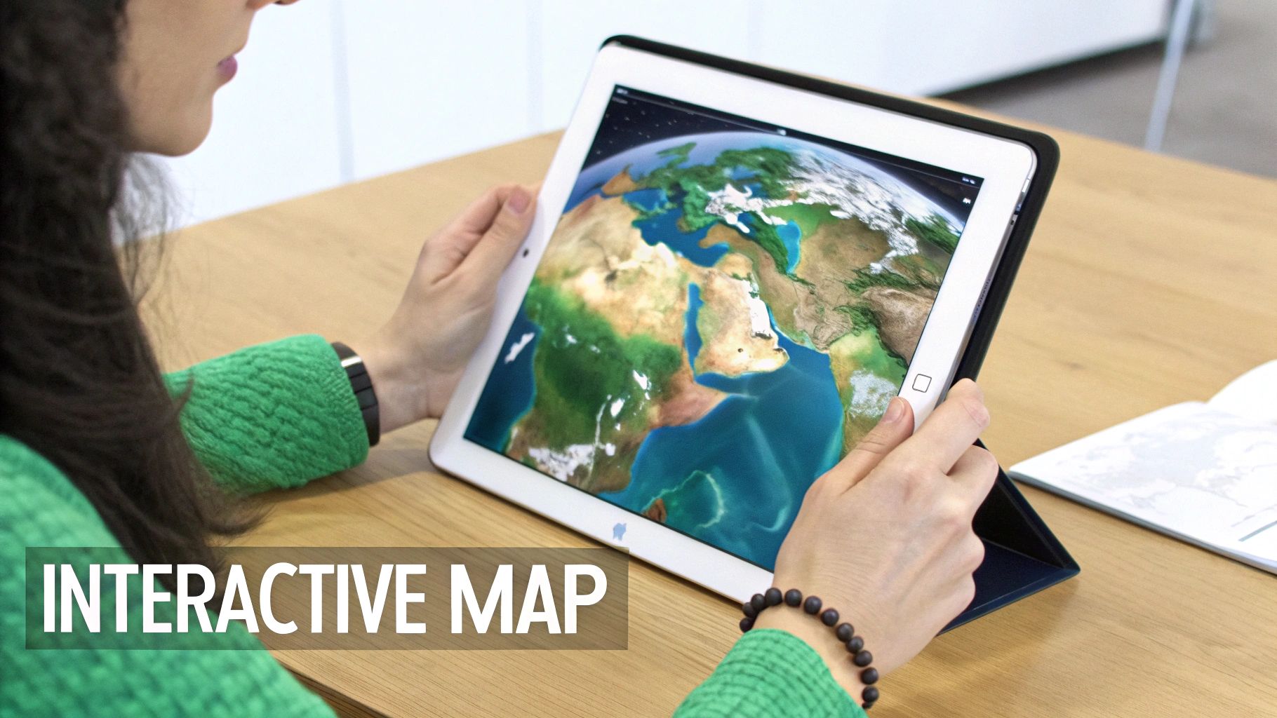
Let's be honest: staring at a flat, lifeless map is a surefire way to get bored. So why do it? Let's ditch the passive memorization and dive into a dynamic, three-dimensional world instead. The right tools can turn geography from a chore into a genuinely engaging experience, and a great starting point for any map quiz North Africa prep is an interactive online quiz.
These digital drills give you instant feedback, immediately showing you what you got wrong and why. That rapid-fire loop of question-and-answer makes your study time incredibly efficient—way more effective than just glaring at a textbook, hoping the names will stick.
Beyond 2D Learning with Immersive Platforms
While online quizzes are a solid first step, immersive 3D platforms are where the real magic happens. This is next-level stuff. Tools like EarthChasers let you stop just pointing at a spot on a map and start actually experiencing it. Imagine flying over the rugged peaks of the Atlas Mountains yourself, or tracing the entire path of the Nile River from its headwaters all the way to the Mediterranean Sea.
This gamified approach takes abstract geographical facts and makes them tangible and, most importantly, memorable. You build a powerful spatial awareness that a 2D map just can't deliver. Once you've seen the sheer scale of the Sahara from above, the mental connections you make are so much stronger. Recalling locations during a quiz starts to feel like second nature.
This interactive exploration is more than just fun; it’s a powerful mnemonic device. When you've 'flown' the coastline from Morocco to Egypt, the sequence of countries becomes a story in your mind, not just a list to be memorized.
Making Geography Relevant and Actionable
Interactive maps also pull back the curtain on the deeper stories shaping the region. North Africa has seen staggering urbanization, turning rural landscapes into megacities that are now major players in global trade and energy markets. Think about this: between 1950 and 2000, the population of the MENA region quadrupled, but its urban growth was even more explosive. You can dig deeper into how North Africa is grappling with these demographic shifts and see the real-world impact.
The best part is that modern tools cater to every learning style. Whether you love fast-paced quizzes, deep-dive exploration, or even building your own challenges, there’s an option for you. And for those who really want to take charge of their learning, it's surprisingly easy to create a map quiz laser-focused on your specific study goals. This hands-on approach ensures you’re not just learning geography—you’re interacting with it.
Why Knowing North Africa's Geography Matters
Let's be honest, acing a map quiz on North Africa feels great. But the real payoff goes way beyond a good grade—it’s about gaining a key that unlocks a deeper understanding of our world. This isn't just a static collection of countries on a page; it's a dynamic, humming hub of global activity.
Knowing this geography gives you the context behind the headlines. Suddenly, news about international trade, European politics, and even environmental shifts starts to click into place.
For instance, when you can instantly picture the Suez Canal on a map, you understand why it's a massive deal. It's not just a strip of water; it's a critical chokepoint for roughly 12% of all global trade. Likewise, when you see Libya or Algeria, you can immediately connect them to Europe's energy security as major natural gas suppliers. This is how a simple academic exercise transforms into a practical tool for becoming a smarter, more informed global citizen.
A Region Shaping Our Future
North Africa is also a demographic powerhouse with an incredible story of growth. The region's population has absolutely exploded over the last 70 years, turning it from a relatively sparse area into a major global force.
Think about this: in 1955, Northern Africa was home to just 56.6 million people. By 2025, that number rocketed to nearly 280 million. That's an almost five-fold increase in just seven decades. You can dig deeper and explore North Africa's population trends to see the full picture of this massive shift.
This young, booming population is already making waves, influencing international economies and migration patterns. What happens here will be a key focus for decades to come.
Understanding the map of North Africa is like having a key to deciphering global events. It connects the dots between a location, its resources, its people, and its impact on the rest of the world.
Ultimately, every country, sea, and mountain range you learn for your quiz has a real story behind it. By mastering this map, you’re doing more than just memorizing names and borders—you're gaining a genuine appreciation for a truly pivotal part of our planet. That’s a powerful motivation, and it’s the final piece of the puzzle you need to conquer that map once and for all.
Common Sticking Points on a North Africa Map Quiz
As you start prepping for a North Africa map quiz, a few questions always seem to trip people up. Let's clear the air and get you focused on what actually matters, so you can walk in feeling confident.
First up: how many countries are we even talking about? Your core list will almost always be the six main nations: Morocco, Algeria, Tunisia, Libya, Egypt, and Sudan. But don't forget Western Sahara—its disputed status makes it a classic "gotcha" question on political maps.
Getting Your Study Strategy Right
So, what's the best way to practice? I've found the most effective method is a one-two punch of active recall and hands-on mapping. Use some digital flashcards to drill countries and capitals, but then print out a blank map and physically trace the borders. That muscle memory really helps it stick.
Knowing the nuances of disputed territories is often what separates a good score from a great one. Don't skip over places like Western Sahara; their inclusion is a frequent test of detailed geographic knowledge.
Another common question is about Sudan. It's huge, it’s tied to the Nile, and it acts as a bridge to Sub-Saharan Africa. Because of that, you can bet it will be on the quiz. Make sure it’s a solid part of your study plan.
Tackling Tricky Country Pairs
Finally, which countries give people the most trouble? It almost always comes down to two pairs: Morocco and Algeria, and Tunisia and Libya. They’re neighbors, and it's easy to flip them in your mind.
- Morocco vs. Algeria: Just remember Morocco is the one way out west, touching both the Atlantic and the Mediterranean. Algeria is the massive country right next to it, taking up a huge chunk of the central Maghreb.
- Tunisia vs. Libya: Think of Tunisia as the small country getting squeezed between Algeria and the much larger Libya. A little visual trick is to see Tunisia’s shape as a small wedge pointing up into the Mediterranean.
Ready to transform your map skills from flat memorization to an immersive 3D adventure? EarthChasers offers a dynamic way to explore the world, making geography fun and unforgettable. Start your journey and master any map quiz at https://earthchasers.com.