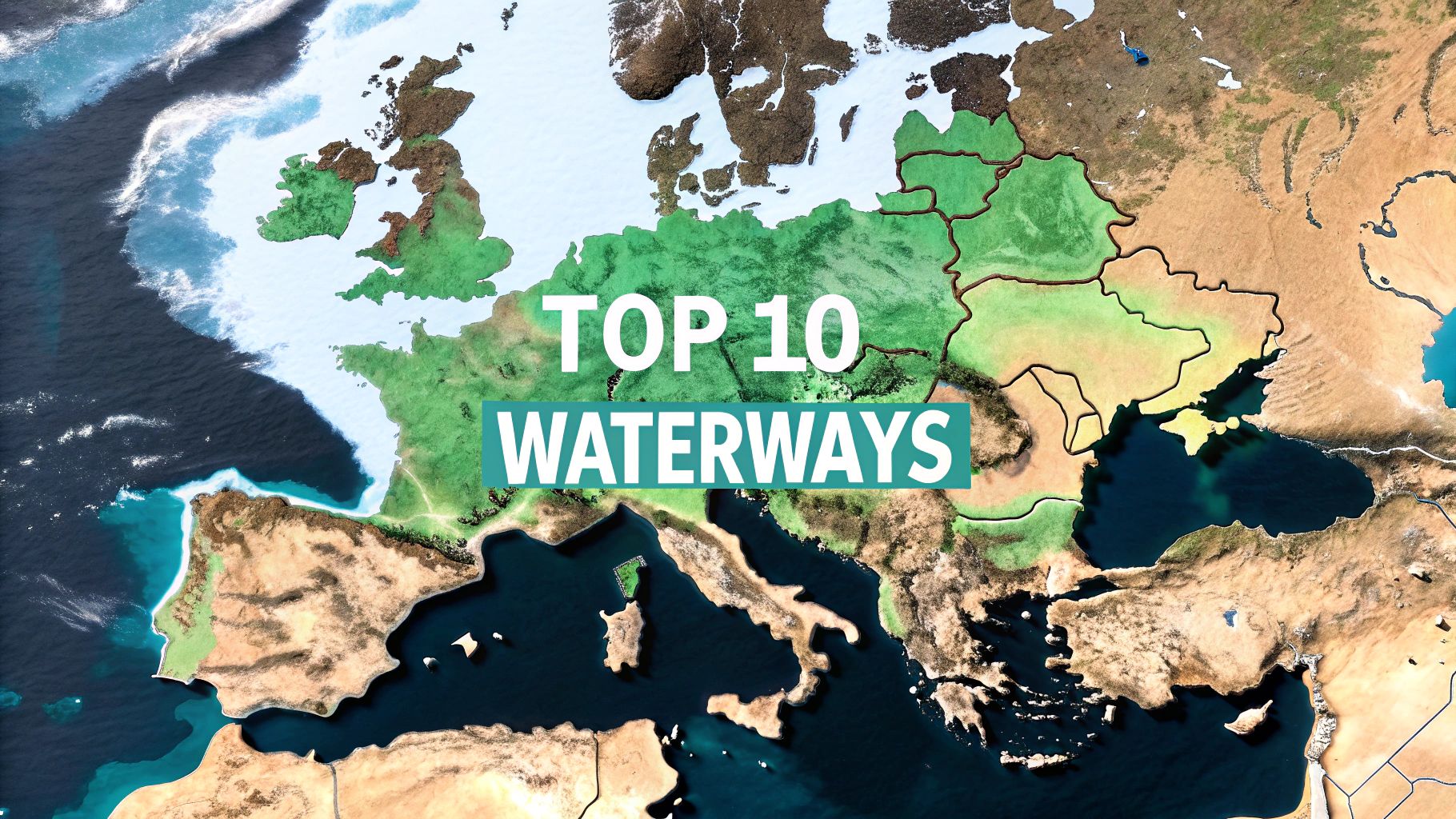
Bodies of Water in Europe: Top 10 Guides for Explorers
Explore bodies of water in europe: discover 10 must-see aquatic wonders from the Danube to the Mediterranean.
Europe's history, culture, and economy have been profoundly shaped by its vast network of rivers, seas, lakes, and straits. These are not merely geographical features or simple lines on a map; they are the continent's lifeblood, having served as cradles of civilization, crucial arteries of commerce, and strategic geopolitical assets for millennia. Understanding the most significant bodies of water in Europe is fundamental to grasping the continent's development, from ancient trade routes to modern industrial hubs. This guide offers a comprehensive exploration of these vital waterways.
From the sun-drenched, ancient shores of the Mediterranean Sea to the bustling industrial corridors of the Rhine River, each body of water tells a unique story. We will dive deep into a curated list of Europe's most influential aquatic landmarks. This roundup provides a clear overview of their location, key statistics like size and depth, and the countries they border. More importantly, it highlights their cultural and ecological significance, offering a richer context beyond basic facts.
This article is designed for geography enthusiasts, gamers, and trivia buffs alike. For users of discovery platforms like EarthChasers, we will provide actionable insights to transform this knowledge into an interactive adventure. You will find specific travel hooks, notable landmarks to visit, and even creative gameplay challenge ideas. We also suggest map markers to help you chart your own virtual or real-world explorations, allowing you to trace these historic routes and uncover the stories held within Europe's waters. Get ready to navigate the continent's most essential aquatic systems.
1. Mediterranean Sea
The Mediterranean Sea is arguably one of the most historically significant bodies of water in Europe and the world. Encircled by Southern Europe, North Africa, and the Middle East, this vast sea connects to the Atlantic Ocean via the narrow Strait of Gibraltar. Its name, derived from the Latin mediterraneus meaning "inland" or "in the middle of the earth," reflects its central role in the development of numerous ancient civilizations.
With a surface area of approximately 2.5 million square kilometers (965,000 square miles), the Mediterranean has been a cradle of civilization. Empires rose and fell on its shores, from the Phoenicians who established vast trade networks to the Roman Empire, which famously called it Mare Nostrum ("Our Sea"). Its strategic importance continues today, amplified by the Suez Canal which provides a direct shipping route between Europe and Asia.
Key Facts & Location
- Bordering Continents: Europe, Africa, Asia
- Bordering European Countries: Spain, France, Monaco, Italy, Slovenia, Croatia, Bosnia and Herzegovina, Montenegro, Albania, Greece, and Cyprus.
- Key Connections: Strait of Gibraltar (to the Atlantic Ocean), Suez Canal (to the Red Sea), Dardanelles (to the Sea of Marmara and the Black Sea).
- Average Depth: 1,500 meters (4,900 feet)
- Maximum Depth: 5,267 meters (17,280 feet) in the Calypso Deep.
EarthChasers Gameplay & Travel Hooks
For travelers and gamers, the Mediterranean is a treasure trove of challenges and landmarks. From the volcanic islands of Santorini and Sicily to the ancient ruins of Carthage and Rome, the region offers countless points of interest. Its diverse coastline, featuring the fjords of Croatia and the sandy beaches of Spain, presents unique navigational challenges.
Challenge Idea: A "Mare Nostrum Conquest" mission where players must visit and document a key historical port in every bordering European country, facing challenges like navigating treacherous straits or solving historical puzzles related to ancient trade routes.
Suggested Map Markers:
- Strait of Gibraltar: A critical chokepoint between continents.
- Suez Canal: The vital man-made waterway linking to Asia.
- Calypso Deep: Mark the sea's deepest point for a deep-dive challenge.
- Ancient Ruins of Delos, Greece: A UNESCO World Heritage site and mythological birthplace.
The Mediterranean is a fundamental part of a larger global system of oceans and seas. You can explore its connection to other major bodies of water in our detailed guide. Learn more about the oceans and seas of the world on earthchasers.com.
2. Danube River
Flowing through more countries than any other river on the planet, the Danube is a lifeline of Central and Southeastern Europe. As the continent's second-longest river, it travels approximately 2,857 kilometers (1,775 miles) from its source in Germany's Black Forest eastward to the Black Sea. This mighty river has been a crucial artery for trade, culture, and conflict for millennia, shaping the destinies of empires and the stunning capitals that line its banks, including Vienna, Budapest, and Belgrade.
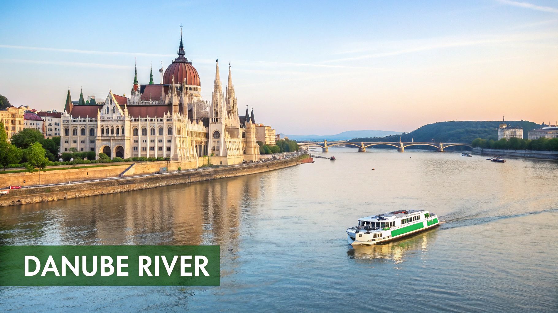
From the dramatic Iron Gates gorge forming the natural border between Serbia and Romania to the sprawling, biodiverse Danube Delta, the river's landscape is as varied as the cultures it connects. Its economic importance as a major transportation corridor is matched by its ecological significance, supporting vast wetlands and diverse ecosystems. This blend of history, commerce, and nature makes the Danube one of the most vital bodies of water in Europe.
Key Facts & Location
- Flows Through: Germany, Austria, Slovakia, Hungary, Croatia, Serbia, Bulgaria, Romania, Moldova, and Ukraine.
- Source: Black Forest, Germany.
- Mouth: Black Sea, via the Danube Delta in Romania and Ukraine.
- Length: Approximately 2,857 kilometers (1,775 miles).
- Key Features: Iron Gates Gorge, Danube Delta (UNESCO World Heritage site), Wachau Valley.
EarthChasers Gameplay & Travel Hooks
For travelers and gamers, the Danube River offers a journey through the heart of European history. Cruising its length reveals a succession of iconic landmarks, from medieval castles to grand imperial palaces. The river presents diverse navigational scenarios, from the busy industrial ports near major cities to the wild, reed-filled channels of the Danube Delta, home to over 300 bird species.
Challenge Idea: A "Danube Diplomat" mission where players must transport valuable cargo from the Black Forest to the Black Sea, navigating through all ten countries. Challenges include passing through the Iron Gates, avoiding industrial pollution zones, and completing cultural mini-games in capital cities like Vienna and Budapest.
Suggested Map Markers:
- Iron Gates Gorge: A dramatic and challenging navigational passage.
- Budapest Parliament Building: An iconic architectural landmark on the riverbank.
- Danube Delta: A vast, complex wetland for ecological exploration challenges.
- Wachau Valley, Austria: A scenic and historic wine-growing region.
The Danube is a quintessential example of how rivers connect and define regions. Discover more about the Danube River and other major waterways in our comprehensive guide. Learn more about the bodies of water in Europe on earthchasers.com.
3. Rhine River
The Rhine River is a vital artery of Western Europe, functioning as both a major economic powerhouse and a cultural landscape rich with history. Flowing approximately 1,233 kilometers (766 miles) from its source in the Swiss Alps to its delta in the North Sea, this legendary river winds its way through six countries. It has been a critical navigation route since the Roman Empire, shaping trade, industry, and the borders of nations for centuries.
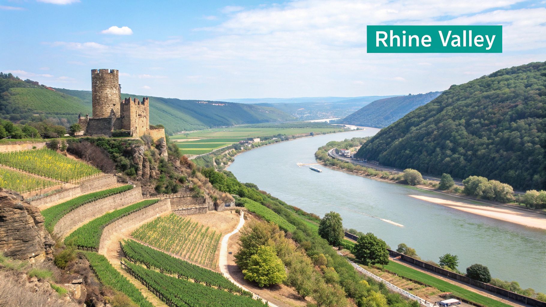
From the dramatic cliffs of the Rhine Gorge, a UNESCO World Heritage site dotted with medieval castles, to the bustling industrial port of Rotterdam, the Rhine presents a journey through Europe's diverse heritage. Its banks are home to world-renowned wine regions, major cities like Strasbourg, the seat of the European Parliament, and vast industrial centers, making it one of the most significant bodies of water in Europe for both commerce and tourism.
Key Facts & Location
- Source: Swiss Alps, Switzerland
- Mouth: North Sea, Netherlands
- Bordering/Flowing Through Countries: Switzerland, Liechtenstein, Austria, Germany, France, Netherlands
- Length: Approximately 1,233 kilometers (766 miles)
- Major Cities on the Rhine: Basel, Strasbourg, Mannheim, Cologne, Düsseldorf, Rotterdam
EarthChasers Gameplay & Travel Hooks
For travelers and gamers, the Rhine offers a dynamic blend of natural beauty and industrial might. The upper and middle sections are perfect for scenic exploration, discovering historic castles and vineyards, while the lower Rhine presents logistical challenges navigating one of the world's busiest commercial waterways. Seasonal water level fluctuations can also impact navigation, adding a realistic element to any travel or gameplay plan.
Challenge Idea: A "Rhine Trader" mission where players must transport valuable cargo from Basel to the Port of Rotterdam. The challenge involves navigating locks, managing fluctuating water levels, and avoiding congestion in industrial zones like Cologne, testing both piloting and strategic planning skills.
Suggested Map Markers:
- Rhine Gorge (Upper Middle Rhine Valley): Mark this UNESCO site for its high density of castles and legends.
- Strasbourg, France: A key political landmark as the seat of the European Parliament.
- Port of Rotterdam: Europe's largest seaport, offering complex industrial navigation challenges.
- Lorelei Rock: A famous slate rock on the riverbank tied to folklore and maritime myth.
The Rhine River is a key component of Europe's interconnected waterway system. You can explore its role alongside other major rivers in our dedicated guide. Learn more about the rivers of the world on earthchasers.com.
4. Baltic Sea
The Baltic Sea is a major arm of the Atlantic Ocean, enclosed by the Scandinavian Peninsula, the mainland of Europe, and the Danish islands. It is one of the largest brackish inland seas in the world, characterized by its low salinity due to high freshwater runoff from surrounding land and its limited connection to the saltier North Sea. This unique environment has shaped the history, culture, and economies of the nine nations along its coast.
With a surface area of approximately 377,000 square kilometers (146,000 square miles), the Baltic has been a vital hub for trade since the Hanseatic League dominated its waters in the Middle Ages. Its strategic importance persists, with major ports like Gdańsk and Copenhagen facilitating trade and travel. Today, it is also a popular tourist destination, particularly the vast archipelagos of Sweden and Finland, though it faces significant environmental challenges, including "dead zones" caused by nutrient runoff.
Key Facts & Location
- Bordering Continents: Europe
- Bordering European Countries: Denmark, Estonia, Finland, Germany, Latvia, Lithuania, Poland, Russia, and Sweden.
- Key Connections: The Danish Straits (including the Øresund, the Great Belt, and the Little Belt) connect it to the Kattegat and the North Sea.
- Average Depth: 55 meters (180 feet)
- Maximum Depth: 459 meters (1,506 feet) in the Landsort Deep.
EarthChasers Gameplay & Travel Hooks
For travelers and gamers, the Baltic Sea offers a distinct set of challenges and landmarks defined by its shallow, icy waters and rich maritime history. Navigating the thousands of islands in the Finnish and Swedish archipelagos requires precision, while its historical ports offer a glimpse into centuries of trade and conflict. The sea ice that forms from December to March presents a significant seasonal obstacle.
Challenge Idea: A "Hanseatic Trader" mission where players must transport fragile goods between key historical ports like Gdańsk, Lübeck, and Visby. Success depends on navigating treacherous winter ice flows and avoiding modern shipping lanes, all while managing resources against the clock.
Suggested Map Markers:
- Øresund Bridge: The iconic combined railway and motorway bridge linking Copenhagen, Denmark, and Malmö, Sweden.
- Landsort Deep: Mark the sea's deepest point for a specialized submersible challenge.
- Suomenlinna, Finland: A UNESCO World Heritage sea fortress built across six islands off Helsinki.
- Gdańsk Port, Poland: A historically crucial port and the birthplace of major political movements.
5. North Sea
The North Sea is a dynamic and economically vital marginal sea of the Atlantic Ocean, situated between Great Britain, Scandinavia, Germany, the Netherlands, Belgium, and France. Known for its often-turbulent weather and strong tides, it is one of the busiest maritime areas in the world and a cornerstone of the Northern European economy, rich in fossil fuels, fisheries, and renewable energy resources.
Covering an area of around 570,000 square kilometers (220,000 square miles), the North Sea has shaped the history and culture of the nations lining its shores. From the Viking age of exploration to modern-day energy extraction, it has been a theater of trade, conflict, and innovation. Its shallow waters, particularly over areas like the Dogger Bank, have made it a productive fishing ground, which famously led to disputes like the "Cod Wars" in the 20th century.
Key Facts & Location
- Bordering Continents: Europe
- Bordering European Countries: United Kingdom, France, Belgium, Netherlands, Germany, Denmark, Norway, and Sweden.
- Key Connections: English Channel (to the Atlantic Ocean), Norwegian Sea (to the Atlantic and Arctic Oceans), Skagerrak and Kattegat (to the Baltic Sea).
- Average Depth: 95 meters (312 feet)
- Maximum Depth: 700 meters (2,300 feet) in the Norwegian Trench.
EarthChasers Gameplay & Travel Hooks
For gamers and travelers, the North Sea presents a formidable environment defined by industrial might and raw nature. Navigating its busy shipping lanes while contending with extreme weather offers a significant challenge. The landscape is dotted with massive oil rigs and the ever-growing presence of offshore wind farms, such as the massive Dogger Bank development, creating a unique, modern maritime vista.
Challenge Idea: An "Energy Tycoon" mission where players must safely navigate a supply vessel between major port cities like Amsterdam and Aberdeen, delivering critical supplies to offshore oil platforms and wind farms while battling simulated storm conditions and avoiding restricted zones.
Suggested Map Markers:
- Brent Oil Field: A historically significant oil field representing the region's energy sector.
- Dogger Bank: The vast shallow area, home to major fisheries and wind farm projects.
- Norwegian Trench: The sea's deepest point, a key feature for geological exploration.
- Port of Rotterdam, Netherlands: Europe's largest seaport, a hub of global trade.
The North Sea is a critical part of the larger system of European bodies of water. You can explore its connection to the Atlantic and Baltic in our detailed guide. Learn more about the oceans and seas of the world on earthchasers.com.
6. Lake Baikal (Eastern Europe/Asia Border)
Straddling the border between Europe and Asia, Lake Baikal is a natural wonder of superlative status. Located in the mountainous Russian region of Siberia, it is the world's oldest and deepest freshwater lake, holding more water than all of the North American Great Lakes combined. Its age, estimated at 25-30 million years, and isolation have resulted in one of the world's richest and most unusual freshwater ecosystems.
This colossal lake, often called the "Galapagos of Russia," contains approximately 23% of the planet's unfrozen fresh surface water. Its waters are renowned for their exceptional clarity, allowing visibility to depths of over 40 meters. The lake and its surrounding areas are home to thousands of species of plants and animals, many of which are found nowhere else on Earth, making it one of the most significant bodies of water in Europe and Asia for biodiversity.
Key Facts & Location
- Bordering Continents: Europe, Asia
- Bordering European Countries: Russia
- Key Connections: Fed by over 330 inflowing rivers, with its only outlet being the Angara River.
- Average Depth: 744 meters (2,442 feet)
- Maximum Depth: 1,642 meters (5,387 feet) at Olkhon Crevice.
EarthChasers Gameplay & Travel Hooks
For gamers and explorers, Lake Baikal offers a stark, beautiful, and challenging environment. Its unique fauna, like the endemic Baikal seal (the only exclusively freshwater seal), provides rare discovery opportunities. The famed Trans-Siberian Railway runs along its southern shore, offering a landmark journey with breathtaking views. Winter transforms the lake into a vast expanse of turquoise ice, creating otherworldly landscapes perfect for traversal challenges.
Challenge Idea: A "Siberian Survivor" mission where players must track the elusive Baikal seal across the frozen lake in winter, managing resources and surviving extreme temperatures while documenting the unique ice formations like "hummocks" and "sokui."
Suggested Map Markers:
- Olkhon Island: The largest island in the lake and a center of local shamanism.
- Listvyanka: A key settlement and starting point for Baikal exploration.
- Olkhon Crevice: Mark the lake's deepest point for a bathyscaphe mission.
- Circum-Baikal Railway: A historic section of the Trans-Siberian with stunning views.
7. Thames River
The Thames River is arguably the most famous river in England and one of the most historically significant bodies of water in Europe. Flowing for approximately 346 kilometers (215 miles) through southern England, it empties into the North Sea. The river's journey through the heart of London cemented the city's status as a global hub for trade, culture, and power, with its banks lined with centuries of history.
While relatively short compared to other major European rivers, its impact is immense. The Thames was London's primary artery for centuries, a bustling highway of commerce and a source of inspiration for artists and writers. After suffering from severe pollution during the Industrial Revolution, it has become a remarkable environmental success story, with species like sea trout and salmon returning to its waters.
Key Facts & Location
- Location: Southern England, United Kingdom
- Source: Thames Head, Gloucestershire
- Mouth: Thames Estuary, into the North Sea
- Length: 346 kilometers (215 miles)
- Key Cities on its Banks: London, Oxford, Reading, Windsor
- Major Tributaries: River Lea, River Medway, River Cherwell
EarthChasers Gameplay & Travel Hooks
For travelers and gamers, the Thames offers a dense, landmark-rich environment perfect for urban exploration. Its path through London is a living museum, featuring everything from ancient Roman docks to modern architectural marvels. The famous Thames Path National Trail provides a continuous walking route along the river, offering a unique perspective on the city and countryside.
Challenge Idea: A "Tide of History" mission where players must navigate a boat from the modern engineering feat of the Thames Barrier to the historic Tower Bridge, photographing key landmarks like the Houses of Parliament and Westminster Abbey in a specific sequence, all while managing the river's tidal changes.
Suggested Map Markers:
- Thames Barrier: A monumental modern flood defense system.
- Tower Bridge: London's iconic and operational bascule and suspension bridge.
- Houses of Parliament & Big Ben: The heart of British politics on the river's edge.
- Source of the Thames, Gloucestershire: A quiet stone marker for a discovery mission.
8. Lake Geneva (Lac Léman)
Lake Geneva, known as Lac Léman in French, is the largest Alpine lake and one of the most significant freshwater bodies of water in Europe. Cradled by the Alps, this crescent-shaped lake straddles the border between Switzerland and France, influencing the culture, economy, and landscape of both nations. It is a vital freshwater resource, supporting major cities like Geneva on its shores.
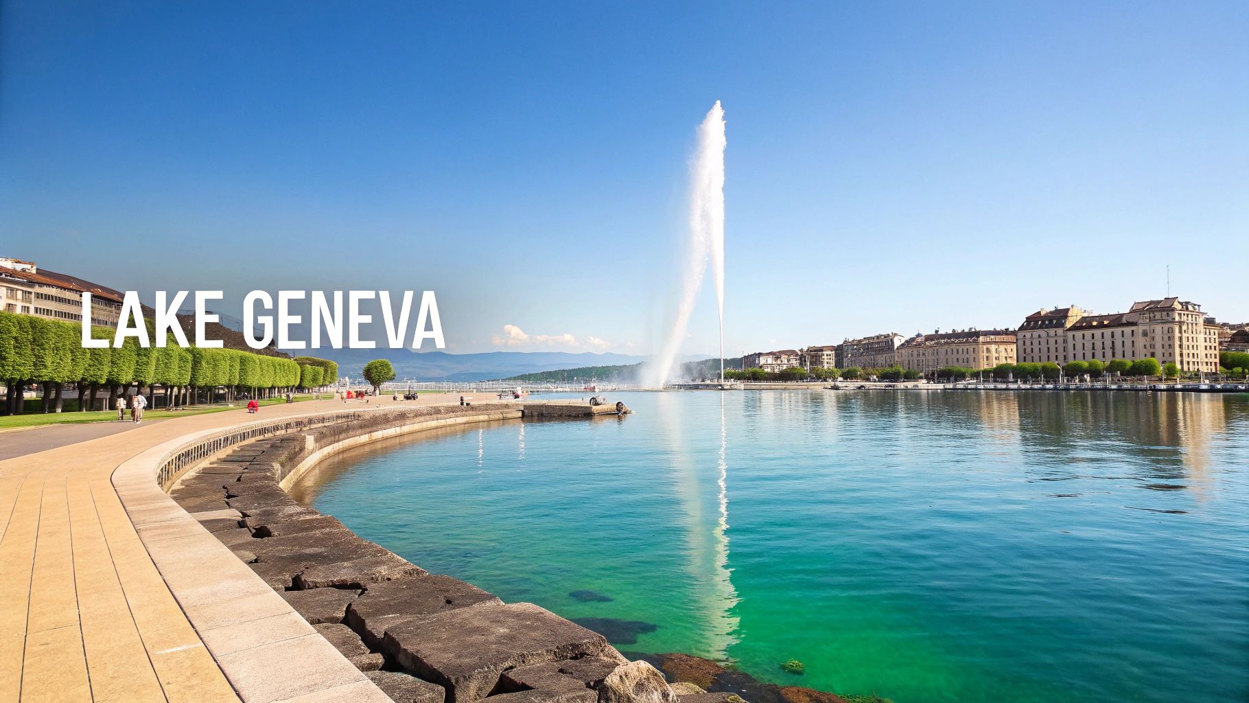
Formed by a retreating glacier, the lake is fed primarily by the Rhône River, which enters at its eastern end and exits through the city of Geneva at its western tip. The lake is renowned for its deep blue waters, the stunning backdrop of the Savoy and Vaud Alps, and landmarks like the Jet d'Eau in Geneva, a massive water fountain that has become a symbol of the city. Its shores are lined with historic castles, vibrant cities, and the famous Lavaux vineyard terraces, a UNESCO World Heritage site.
Key Facts & Location
- Type: Freshwater Glacial Lake
- Bordering Countries: Switzerland, France
- Key Cities on Shore: Geneva (Switzerland), Lausanne (Switzerland), Montreux (Switzerland), Évian-les-Bains (France).
- Surface Area: 580 square kilometers (224 square miles)
- Average Depth: 154 meters (505 feet)
- Maximum Depth: 310 meters (1,020 feet) in the "Petit Lac" section.
EarthChasers Gameplay & Travel Hooks
For travelers and gamers, Lake Geneva offers a sophisticated blend of natural beauty and international diplomacy. The region is perfect for missions involving high-stakes negotiations in Geneva, home to the United Nations and other international organizations, or exploring the cultural heritage of the Lavaux vineyards. The lake itself provides ample opportunities for sailing, swimming in designated areas, and scenic ferry travel between Swiss and French towns.
Challenge Idea: A "Diplomat's Passage" mission requiring players to transport a sensitive package from Montreux to the UN Headquarters in Geneva via ferry, navigating boat traffic and completing observational tasks at key landmarks along the way without raising suspicion.
Suggested Map Markers:
- Jet d'Eau, Geneva: A powerful landmark and potential mission starting point.
- Château de Chillon: A historic island castle near Montreux, perfect for an infiltration or recovery mission.
- Lavaux Vineyard Terraces: A UNESCO World Heritage site offering unique terrain and cultural exploration.
- Évian-les-Bains: The source of world-famous mineral water, a location for resource-gathering quests.
9. Strait of Gibraltar
The Strait of Gibraltar is a narrow and powerful channel that serves as the gateway between the Atlantic Ocean and the Mediterranean Sea. This critical chokepoint, separating the Iberian Peninsula in Europe from North Africa, is one of the busiest and most strategically significant shipping lanes in the world. Its geopolitical importance has been recognized for millennia, shaping the history of empires and modern international relations.
At its narrowest point, the Strait is just 14.3 kilometers (8.9 miles) wide, creating a dramatic and visually stunning passage. Its name is derived from the Rock of Gibraltar, a British Overseas Territory, which along with a corresponding peak in North Africa forms the mythical Pillars of Hercules. The constant flow of commercial vessels, military ships, and migrant crossings underscores its role as a vital intersection of continents and cultures. For those interested in the strategic Strait of Gibraltar and its surrounding beauty, you might find adventure in the Mediterranean Steps Nomads Adventure Gibraltar.
Key Facts & Location
- Connecting: Atlantic Ocean to the Mediterranean Sea.
- Separating Continents: Europe (Spain, Gibraltar) and Africa (Morocco, Ceuta).
- Key Geopolitical Points: The Rock of Gibraltar (UK), Tarifa (Spain), Tangier (Morocco).
- Narrowest Width: 14.3 kilometers (8.9 miles).
- Significance: A major global shipping route, a critical point for migration, and an area of immense biodiversity.
EarthChasers Gameplay & Travel Hooks
For gamers and travelers, the Strait of Gibraltar presents a high-stakes environment defined by strong currents, dense maritime traffic, and geopolitical tension. Navigating this passage requires precision and awareness, making it an ideal location for time-sensitive missions or stealth challenges. The dramatic cliffs and historical fortifications offer unique opportunities for exploration and discovery.
Challenge Idea: An "Pillars of Hercules" escort mission where players must guide a cargo vessel safely from the Atlantic to the Mediterranean, navigating through heavy fog, avoiding patrol boats from multiple nations, and contending with unpredictable currents.
Suggested Map Markers:
- The Rock of Gibraltar: A key strategic and historic landmark.
- Tarifa, Spain: Europe's southernmost point, known for strong winds.
- Pillars of Hercules: Mark both the European and African sides for a mythology-based quest.
- Tangier, Morocco: A major port city offering cross-continental travel.
Embedded content
The Strait of Gibraltar is a perfect example of how specific bodies of water in Europe influence global dynamics. You can explore how it connects the continents and oceans on our interactive map. Learn more about the world's continents and oceans.
10. Vistula River
The Vistula River, known in Polish as the Wisła, is Poland's longest and most important river, carving a path through the nation's heart. Stretching for 1,047 kilometers (651 miles), it flows from its source in the Carpathian Mountains of southern Poland, winding its way north through major cities before emptying into the Gdańsk Bay of the Baltic Sea. The Vistula has been a lifeline for Polish civilization, shaping its commerce, culture, and national identity for over a thousand years.
As the central artery of Poland, the river has been a witness to the country's entire history. It connected the southern cultural hub of Kraków with the powerful Hanseatic port of Gdańsk (Danzig) on the coast, facilitating the trade of grain and timber that defined the Polish-Lithuanian Commonwealth's economy. Its banks are home to some of Poland’s most significant landmarks, making it an indispensable part of any exploration of Central European bodies of water.
Key Facts & Location
- Source: Barania Góra, Silesian Beskids (Carpathian Mountains)
- Mouth: Gdańsk Bay, Baltic Sea
- Length: 1,047 kilometers (651 miles)
- Key Cities on its Banks: Kraków, Warsaw, Toruń, Gdańsk
- Primary Country: Poland (Its entire course is within Polish borders).
EarthChasers Gameplay & Travel Hooks
For travelers and gamers, the Vistula offers a journey through the core of Polish history and geography. From the royal castles of Kraków and Warsaw to the medieval gothic architecture of Toruń, its banks are lined with UNESCO World Heritage Sites. The Vistula Delta at its mouth provides a contrasting landscape of wetlands and unique ecosystems, presenting different navigational and exploration opportunities compared to the urban sections upstream.
Challenge Idea: A "Polish Crown" mission where players must navigate the river from Kraków to Gdańsk, collecting artifacts or information from key historical cities along the way. Challenges could include navigating seasonal spring floods or solving puzzles related to the grain trade routes.
Suggested Map Markers:
- Wawel Castle, Kraków: A historic royal residence overlooking the river.
- Warsaw Old Town: The rebuilt historic center on the Vistula's western bank.
- Toruń Medieval Town: The birthplace of Nicolaus Copernicus and a UNESCO site.
- Vistula Delta: A vast wetland area and ecological point of interest at the river's mouth.
Comparison of 10 Major European Bodies of Water
| Site | Management complexity 🔄 | Resource value / Requirements 📊 | Environmental status ⭐ | Ideal uses ⚡ | Key advantages 💡 |
|---|---|---|---|---|---|
| Mediterranean Sea | Very high — multi‑state governance, busy ports 🔄🔄🔄 | Major shipping, tourism, fisheries; supports ~150M people 📊 | ⭐⭐ — overfishing, pollution, warming | International shipping, tourism, regional trade ⚡ | Rich biodiversity, cultural/historical hub |
| Danube River | High — 10 riparian states, navigation & dams 🔄🔄🔄 | Freight corridor, hydropower, irrigation; Delta biodiversity 📊 | ⭐⭐⭐ — pollution & fragmentation, protected delta areas | Freight transport, hydropower, river cruises ⚡ | Regional cooperation, UNESCO delta, urban connections |
| Rhine River | High — intensive industrial use, cross‑border management 🔄🔄🔄 | Europe's busiest inland waterway; ports & energy 📊 | ⭐⭐⭐ — improved water quality; fragmentation remains | Commercial shipping, industry, tourism ⚡ | Direct link to Rotterdam, strong cargo capacity |
| Baltic Sea | Very high — enclosed basin, nine nations, seasonal ice 🔄🔄🔄 | Shipping, fisheries, growing wind energy, amber deposits 📊 | ⭐⭐ — eutrophication, dead zones, heavy traffic | Regional shipping, fisheries, summer tourism ⚡ | Unique brackish ecosystem, wind energy potential |
| North Sea | Very high — multinational energy & shipping sector 🔄🔄🔄 | Oil & gas legacy, offshore wind, major ports (Rotterdam, Hamburg) 📊 | ⭐⭐ — overfishing & pollution; renewable transition underway | Energy production, international shipping, fishing ⚡ | Large energy resources, world‑class ports |
| Lake Baikal | Moderate → High — remote, national jurisdiction, conservation needs 🔄🔄 | World's largest freshwater reserve (~23% surface freshwater), research value 📊 | ⭐⭐⭐ — exceptionally biodiverse but threatened by development | Scientific research, conservation tourism ⚡ | Unmatched endemic biodiversity, UNESCO site |
| Thames River | Moderate — urban infrastructure, flood defenses (Thames Barrier) 🔄🔄 | Urban economic corridor, recreation, cultural assets 📊 | ⭐⭐⭐ — major recovery since 1960s; urban pressures remain | Urban transport, tourism, recreation ⚡ | Iconic cultural sites, strong urban ecosystem recovery |
| Lake Geneva | Moderate — binational management (Switzerland/France) 🔄🔄 | Freshwater for 8M+, tourism, diplomatic hub (Geneva) 📊 | ⭐⭐⭐ — generally good; eutrophication concerns | Drinking water supply, diplomacy, recreation ⚡ | Scenic value, established international governance |
| Strait of Gibraltar | Very high — strategic chokepoint, geopolitical sensitivities 🔄🔄🔄🔄 | Critical shipping lane (~10% global trade); biodiversity corridor 📊 | ⭐⭐ — heavy traffic & pollution pressures; high strategic value | International shipping, naval control, short ferry routes ⚡ | Shortest Atlantic–Mediterranean link, major trade artery |
| Vistula River | Moderate — single‑country management (Poland), flood control 🔄🔄 | National transport, agriculture, urban supply (Warsaw) 📊 | ⭐⭐ — historical pollution improving; flood risks persist | Domestic freight, tourism, irrigation ⚡ | Cultural national importance, improved water quality |
Your European Waterways Adventure Awaits
Our journey across the continent has revealed that the diverse bodies of water in Europe are far more than just lines on a map. They are the continent's lifeblood, arteries of commerce, and cradles of civilization that have shaped everything from ancient empires to modern economies. We've seen how the mighty Danube River connects ten different nations, creating a cultural mosaic along its banks, and how the strategic Strait of Gibraltar has been a critical maritime gateway for millennia.
From the alpine purity of Lake Geneva to the industrial might of the Rhine, each river, sea, and lake tells a unique story. The Baltic Sea's brackish waters narrate a tale of trade leagues and delicate ecosystems, while the North Sea speaks of energy exploration and historical naval power. These are not static features; they are dynamic environments facing contemporary challenges like pollution, climate change, and geopolitical maneuvering, making their study more relevant than ever.
From Knowledge to Actionable Exploration
The true value of understanding these geographical landmarks lies in applying that knowledge. Recognizing the course of the Vistula River isn't just trivia; it's understanding Poland's historical heartland. Knowing the significance of the Thames is to grasp the very foundation of London's global influence. This article serves as your springboard, a detailed atlas from which you can launch your own deeper explorations.
The insights and map markers provided for each body of water are designed to be practical tools. They offer a framework for trivia masters, a strategic guide for gamers, and a virtual travel itinerary for geography enthusiasts. Consider these actionable next steps to continue your journey:
- Trace a Trade Route: Use a mapping tool to follow a historical trade route, like the Hanseatic League's path through the Baltic Sea, noting the key port cities and geographical challenges.
- Compare and Contrast: Pit two rivers against each other. How did the Rhine's role in industrialization differ from the Danube's role in connecting Eastern and Western Europe?
- Plan a Virtual Trip: Chart a course from the source of a river, like the Thames, to its mouth. Pinpoint the major cities, historical landmarks, and ecological zones you would encounter along the way.
- Engage with Marine Life: The exploration doesn't have to be purely academic. For those looking to engage directly with Europe's vast coastal waters, you can embark on unforgettable experiences like Dolphin watching in the Atlantic near Lagos, connecting classroom knowledge with real-world wonder.
Charting Your Own Course
Ultimately, the bodies of water in Europe represent a vast and interconnected network of history, ecology, and culture. Mastering this knowledge gives you a more profound understanding of how the continent functions, how its nations interact, and the environmental stakes at play. Whether your passion is history, gaming, or simply a love for the natural world, these waterways offer a lifetime of learning and discovery. The currents of the Rhine, the tides of the Mediterranean, and the depths of Lake Baikal are waiting. Your adventure has only just begun.
Ready to transform your geographical curiosity into an interactive challenge? With EarthChasers, you can build custom maps, challenge friends with location-based quizzes, and trace the very rivers and seas we've explored. Start your global adventure and master the world's geography at EarthChasers.