A Visual Guide to Major Rivers of the World Map
Explore our visual guide and interactive major rivers of the world map. Discover the longest rivers by continent, their history, and their cultural impact.

If you think about it, rivers are the arteries of our planet. They've been carving up landscapes and cradling entire civilizations for thousands of years. An interactive major rivers of the world map doesn't just show you where they are; it brings these incredible waterways to life, turning simple lines on a page into dynamic stories of culture, ecology, and history.
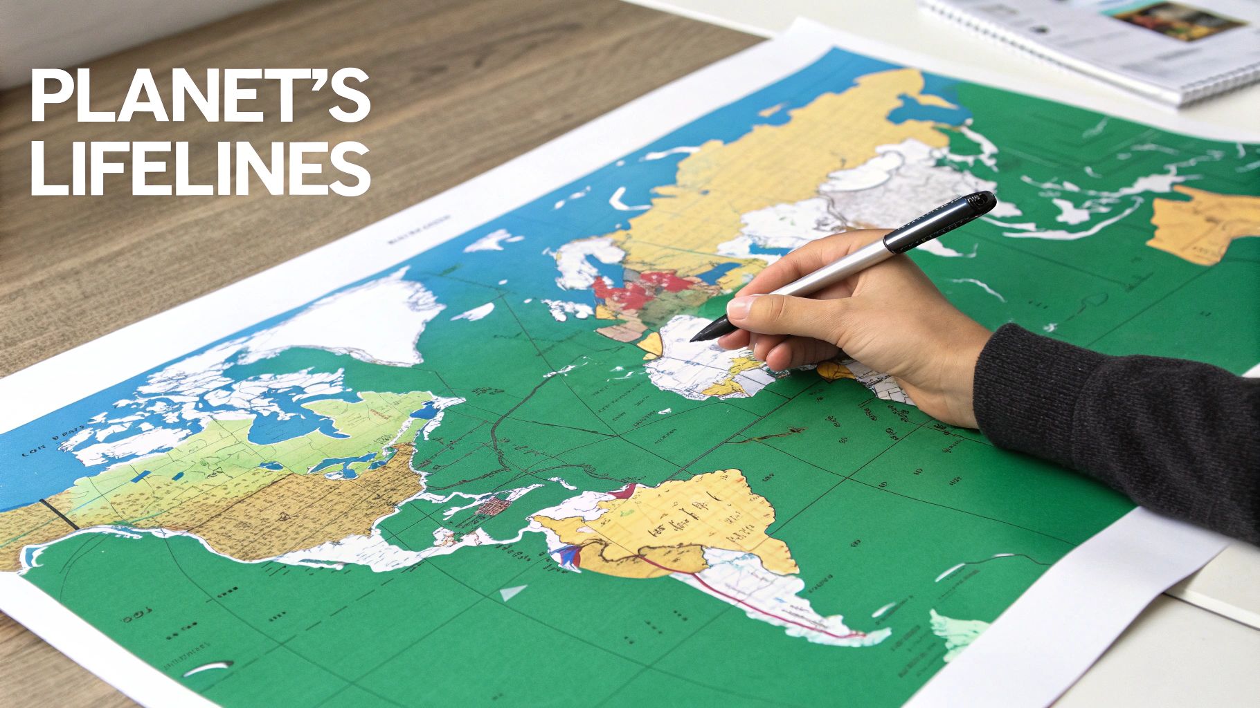
Charting the Planet's Lifelines
This guide is designed to go way beyond your old geography lessons. We’re going to use maps to really dig into how legendary rivers like the Nile, the Amazon, and the Yangtze have quite literally dictated the course of human history. These weren't just sources of fresh water—they were the original superhighways for trade, the bedrock of agriculture, and the spiritual centers for entire cultures.
Think of this as a visual journey. With each section, we’ll peel back another layer of the story, showing how these river systems continue to support billions of people and shape massive ecosystems. From the Fertile Crescent fed by the Tigris and Euphrates to the industrial heartlands powered by the Rhine, rivers tell the story of our progress and our profound dependence on the natural world.
Why a Map-Centered Approach Matters
Looking at these rivers on a map gives you a level of context that raw data just can’t touch. It lets you see the connections, understand the boundaries, and truly appreciate the immense scale of these natural wonders. A good map helps you grasp things instantly:
- Geographic Influence: You can actually see how mountain ranges give birth to mighty rivers and how those same rivers flow down to shape entire coastlines. While rivers are lifelines, their journeys end in the vast oceans and seas of the world.
- Human Settlement: Notice how almost every major city and ancient capital is clustered along riverbanks. It’s a powerful visual that highlights their non-negotiable role in our survival and growth.
- Ecological Reach: A map helps you visualize the sheer size of river basins, like the Amazon's, which covers an incredible 40% of South America and hosts biodiversity that’s off the charts.
Rivers are not just features on a map; they are the planet's circulatory system. They transport water, nutrients, and life across continents, connecting inland regions to the vast oceans and sustaining both natural habitats and human civilizations.
So, whether you're a student, an educator, or a geography buff playing games on EarthChasers, this guide will give you a much deeper appreciation for our planet's most important river systems. Let’s start charting these lifelines.
Mapping the World's River Giants
To really get a feel for our planet’s waterways, you have to start with the titans. A major rivers of the world map instantly pulls your eyes to three systems that have shaped continents for thousands of years: the Nile, the Amazon, and the Yangtze. These aren't just squiggles on a map; they're the planet's main arteries, and each has its own claim to fame.
Looking at these giants on a global scale gives you a clear sense of hierarchy. Before we zoom into specific continents, it’s crucial to know the "who's who" of world rivers. Each one tells a totally different story of geography, culture, and raw ecological power.
Understanding River Metrics
So, what makes a river a "giant"? It's not just one thing. While length is the first number people usually reach for, discharge—the sheer volume of water a river carries—is arguably just as important.
- Length: This is the total journey from the river's source all the way to its mouth. It’s a measure of its incredible trek across entire landscapes.
- Discharge: Measured in cubic meters per second, this number tells you about the raw power and volume of water flowing through the channel. A river with a high discharge has a massive impact on everything around it.
The classic debate between the Nile and the Amazon is the perfect example of this difference. One is the champion of length, while the other is the undisputed king of volume.
The Big Three Global Rivers
Let's meet the main characters on our world map—the rivers that stand out because of their immense scale and influence.
The Nile River
Often called the world's longest, the Nile is the legendary lifeblood of North Africa. It stretches for about 6,650 kilometers (4,130 miles), flowing north through 11 countries before it finally spills into the Mediterranean Sea. For millennia, its predictable floods made civilization possible, creating a ribbon of fertile green in a bone-dry desert that gave rise to the ancient Egyptians.
The Amazon River
While the Nile might wear the crown for length, the Amazon is in a league of its own when it comes to volume. It carries more water than the next seven largest rivers combined—a staggering display of nature’s power. Its massive basin covers about 40% of South America and supports the most biodiverse rainforest on the entire planet.
The Yangtze River
As Asia's longest river, the Yangtze is a modern-day powerhouse. It snakes through China, serving as a critical artery for trade, farming, and industry that supports nearly a third of the country's huge population. For thousands of years, it has been a cradle of Chinese civilization.
For a quick look at how these giants and a few others stack up, here’s a simple breakdown.
Top 5 Longest Rivers in the World
This table gives you a quick reference for the world's five longest rivers, showing just how far they travel across the globe.
| River Name | Approximate Length (km) | Approximate Length (miles) | Continent(s) |
|---|---|---|---|
| Nile | 6,650 | 4,130 | Africa |
| Amazon | 6,400 | 4,000 | South America |
| Yangtze | 6,300 | 3,917 | Asia |
| Mississippi | 6,275 | 3,902 | North America |
| Yenisei | 5,539 | 3,445 | Asia |
As you can see, these massive river systems are truly global, defining the landscapes of nearly every continent.
These rivers are so much more than just geographical features; they are the foundational pillars of history. The Nile enabled pharaohs, the Amazon hides undiscovered species, and the Yangtze fuels one of the world's largest economies. Their stories are humanity's story.
But a river's impact goes beyond just its main channel. To get the full picture, you also have to appreciate the dramatic features they create, like the incredible river-carved canyons and their geological significance. With this global context set, we're ready to start exploring these amazing waterways continent by continent.
Journey Through the Rivers of Africa and the Americas
Now that we’ve taken a bird's-eye view, let’s zoom in on our major rivers of the world map and get to know the unique personalities of the waterways in Africa and the Americas. These continents are home to rivers that aren’t just geographically massive; they're deeply woven into the fabric of culture, ecology, and history. Each one tells a story.
In Africa, the Nile gets all the attention, but there are other continental giants to discover. The Congo River, for instance, is the thundering heart of the world's second-largest rainforest. It's the second-largest river by discharge volume on the entire planet—a true force of nature that shapes the whole Central African ecosystem. Its incredible depth and power make it a critical resource for the region.
Fly a little west, and you’ll find the Niger River carving a curious boomerang-shaped path through West Africa, acting as a vital lifeline for countless communities engaged in agriculture and trade. Then there’s the Zambezi River to the south, famous not just for its length but for creating one of the planet’s most jaw-dropping natural wonders: the magnificent Victoria Falls, known locally as "The Smoke that Thunders."
Africa's Lifelines
These rivers are so much more than just water; they are corridors of life and commerce.
- The Congo River: A titan of discharge, its massive basin supports incredible biodiversity and millions of people. It's so deep in certain spots that it has created its own unique aquatic species found nowhere else on Earth.
- The Niger River: This river was central to trade empires for centuries. It connected the Sahara with the forested regions to the south, allowing goods and ideas to flow freely.
- The Zambezi River: Beyond the falls, the Zambezi is crucial for hydroelectric power. Dams like the Kariba provide electricity to several southern African nations.
This chart gives you a quick visual comparison of the world's most dominant rivers, measured by a few different metrics.
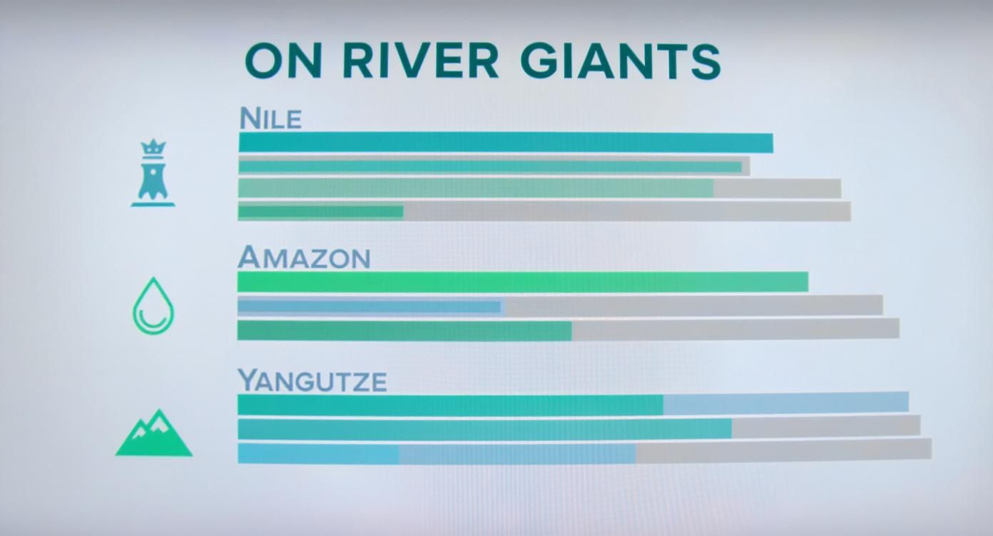
The visualization really drives home how "giant" can mean different things—from the Nile's legendary length to the Amazon's mind-boggling water volume.
Waterways of the Americas
Crossing the Atlantic, the Americas present river systems on a completely different scale. Two systems, in particular, command attention on any world river map because of their sheer size and economic might. For a closer look at the continent's layout, you can explore our detailed blank map of the Americas.
The Amazon River is practically a world of its own. It's the undisputed champion of water volume, pushing an incredible 209,000 cubic meters of water into the Atlantic every second. Stretching roughly 6,400 kilometers (4,000 miles), its basin covers about 40% of South America and sustains the planet's largest rainforest, home to an estimated 10% of all known species.
The Amazon isn't just a river; it's a colossal, living system. Its scale is so vast that it creates its own weather patterns and influences the global climate, making it a key player in the health of our planet.
Meanwhile, North America is dominated by the Mississippi-Missouri River system. This sprawling network has been the commercial backbone of the United States for centuries. It drains a massive chunk of the continent, serving as a vital highway for transporting agricultural goods from the heartland to ports on the Gulf of Mexico. Its story is one of exploration, settlement, and industrial growth—a river that truly shaped the economic destiny of a nation.
Discovering the Waterways of Asia and Europe
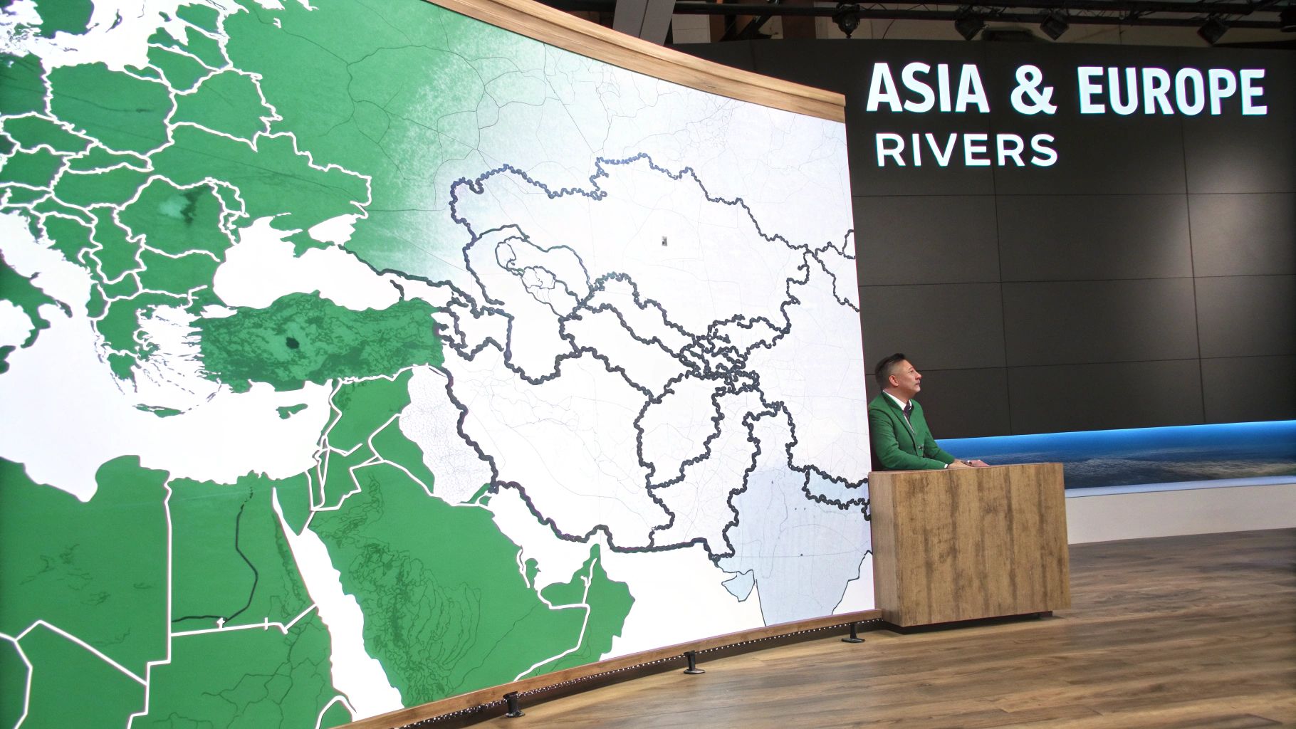
Our global tour now brings us to Asia and Europe, two continents whose histories have been carved by some of the planet’s most industrious rivers. These aren’t just lines on a major rivers of the world map; they are the ancient arteries of civilization.
From sacred spiritual sites to bustling commercial highways, these waterways tell the story of human culture, conflict, and connection.
Let’s start in Asia, a continent defined by rivers of almost unbelievable scale and profound cultural weight. These aren't just channels of water—they are the cradles of civilization that have supported billions of people for millennia, serving as sources of spiritual inspiration, agricultural life, and economic might.
The Powerhouses of Asia
In China, the Yangtze River is a colossal force of nature and human engineering. As the longest river in Asia and the third-longest in the world, it snakes its way for roughly 6,300 kilometers (3,917 miles) from the Tibetan Plateau to the East China Sea. The Yangtze's basin is a true economic engine, home to nearly 400 million people and generating about 40% of China's entire GDP. For a deeper look, check out this great resource on major rivers of the world from MapsForUPSC.
Flowing further south, the Mekong River tells a completely different story. It’s a lifeline that weaves through six countries—China, Myanmar, Laos, Thailand, Cambodia, and Vietnam—sustaining over 60 million people. The Mekong’s seasonal floods create one of the planet’s most productive inland fisheries, making it a critical source of food and cultural identity for the whole region.
And then there's the Ganges River in India, which holds a sacred place in the hearts of over a billion Hindus. It's more than a river; it's a living deity, a source of purification, and a central figure in countless rituals. Despite facing immense pollution challenges, its spiritual pull is as strong as ever, drawing millions of pilgrims to its banks every single year.
Asian rivers are living, breathing entities, deeply woven into the spiritual, cultural, and economic fabric of the continent. They are worshiped, relied upon, and engineered on a scale that is hard to comprehend.
Europe's Arteries of Connection
Shifting our focus to Europe, we find rivers that are less about sheer size and more about connection. These waterways have acted as natural borders, trade routes, and cultural melting pots, knitting together a continent of diverse nations. They are the arteries that fueled the Industrial Revolution and fostered centuries of shared history.
The Danube River is the quintessential European river. It famously flows through ten countries—more than any other on Earth—on its long journey from Germany’s Black Forest to the Black Sea. For centuries, it has been a conduit for trade, culture, and conflict, linking iconic capitals like Vienna, Budapest, and Belgrade.
To the west, the Rhine River has been a vital commercial highway since the days of the Roman Empire. Its path through the industrial heartlands of Germany and the Netherlands made it absolutely central to Europe’s economic rise. Today, the Rhine remains one of the busiest waterways in the world, a symbol of European cooperation and industrial power.
- Yangtze vs. Danube: The Yangtze is a story of national scale, powering a single, massive country. The Danube, in contrast, tells a tale of international connection, weaving through dozens of distinct cultures.
- Mekong vs. Rhine: The Mekong is a source of natural sustenance, defined by its incredible biodiversity and fisheries. The Rhine is a channel of industrial output, defined by its endless parade of cargo ships and commercial ports.
Bringing the World River Map to Life
Embedded content
A major rivers of the world map is so much more than a static image. Think of it as a dynamic playground for learning and exploration. For educators, students, and geography gamers alike, these maps are a launchpad for interactive projects that make geography stick.
The real key to deep understanding is turning geographic knowledge into practical action. Instead of just memorizing names and lengths, you can use a world river map as a tool for storytelling, strategic thinking, and creative discovery.
For Educators and Students
In the classroom, a river map is a powerful narrative device. It helps students connect historical events, ecological concepts, and cultural studies to tangible locations. Moving beyond passive reading makes lessons far more engaging and memorable.
Here are a few ideas to get you started:
- Mapping Historical Empires: Trace the expansion of the Roman Empire along the Danube or its settlements along the Rhine. Students can research how these rivers served as both natural borders and critical arteries for trade and military campaigns.
- Biodiversity Hotspot Project: Zero in on the Amazon or Congo river basins. Have students create presentations on the unique species found there, explaining how the river systems support such incredible biodiversity.
- Water Scarcity and Management: Compare the Nile's vital role in arid Egypt with the Mekong’s importance to agriculture in Southeast Asia. This sparks critical discussions on water rights, dam construction, and international cooperation.
A map is a story waiting to be told. By using rivers as the central characters, educators can illustrate how geography has directed the flow of human history, from the first civilizations to modern global trade.
For Geography Gamers
For players of games like GeoGuessr or our own EarthChasers, rivers are powerful strategic assets. They aren't just scenic features—they are key landmarks offering critical clues and navigational advantages. Learning to recognize major river systems can be the difference between a decent guess and a perfect score.
To really elevate your gameplay, you need to think like a geographer. Recognizing the distinct bend of the Niger River or the massive delta of the Ganges can instantly narrow your location from a whole continent down to a specific region.
Try these strategies in your next game:
- Use Rivers as Natural Borders: In EarthChasers, if you're dropped near a large river, try to identify it. If it’s the Rio Grande, you know you’re on the border between the United States and Mexico.
- Identify Regional Clues: A wide, muddy, brown river surrounded by dense, low-lying rainforest is a strong indicator of the Amazon basin. A river flowing through a deep, terraced canyon might point you toward the Yangtze in China.
- Create Your Own Challenges: Take it a step further by using our tools to build challenges for your friends. You can learn how to create custom maps featuring mystery river locations to truly test your identification skills.
Answering Your Questions About World Rivers
When you start digging into any major rivers of the world map, a few questions always seem to pop up. Why do different websites or books list different lengths for the same river? And what's the final word on which river is truly the longest? Let's clear up some of this geographical fog.
One of the biggest hurdles is simply how a river is measured. It's not as simple as laying down a ruler. Geographers have to trace a river from its mouth all the way back to its most distant source—which might just be a tiny, hard-to-find spring in the middle of nowhere. This process is complex, full of interpretation, and always open to new discoveries.
Modern tools like satellite imaging have given us a much clearer picture, often shaking up long-held rankings and forcing us to update our maps.
Why Is the Nile vs Amazon Debate So Common
The classic heavyweight title fight in geography is the Nile vs. the Amazon for the "world's longest river." For most of history, the Nile was the undisputed champ. But in the early 2000s, new studies suggested a different, more distant source for the Amazon, which, if correct, would stretch its total length just enough to steal the crown.
This back-and-forth highlights a key idea in geography: a river’s “source” isn’t always obvious. It might be a stream that only flows part of the year or a far-flung tributary, and pinning down the right one changes everything.
The debate is still very much alive, with credible sources backing both sides. This isn’t a failure of science; it’s a perfect example of how dynamic and wonderfully complex our planet is.
What Is the Deepest River in the World
While length gets all the glory, a river's depth tells an equally fascinating story. That title belongs to the mighty Congo River in Africa. In some spots, its channel plunges to an incredible depth of over 220 meters (720 feet).
That’s deep enough to have created underwater canyons. The Congo's current is so powerful that its lower reaches have carved out unique habitats, isolating fish populations on opposite banks and forcing them down separate evolutionary paths—all within the same river.
Answering these questions shows us that a river map is just the starting point. Behind every line is a story of scientific debate, natural wonder, and ongoing discovery, making every waterway a world of its own to explore.
Ready to test your newfound river knowledge? Jump into EarthChasers and explore the world’s waterways in a fully immersive 3D environment. Identify legendary rivers, navigate their paths, and compete with geography fans from around the globe. Start your adventure today at https://earthchasers.com.